Waitawheta Hut via Waiorongomai Valley, Kaimai Mamaku Forest Park
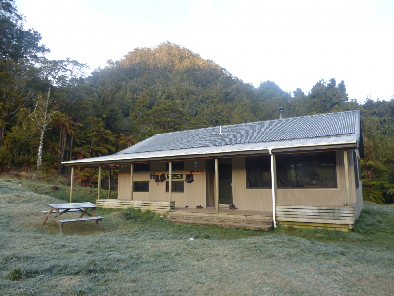
Waitawheta Hut is understandably the most popular overnight stop in the Kaimais. It provides a feeling of seclusion with views out to the surrounding forested hills, while being a mere three-hour stroll along its namesake river from Franklin Road to the north.
But it’s also accessible from the west, though with a bit more grunt. Numerous tracks from Waiorongomai Valley climb up and over the Kaimai Range, offering a wealth of mining relics in the process. Some are currently rough and energy sapping, but are set to become easier over the next six months, as volunteers hack better quality tracks along the ridge tops.
I was keen to try the Pylon Track – a backcountry trail freshly carved by members of Auckland and Howick Tramping Club.
From the car park, I briefly followed the Low Level Drive Track for two minutes before veering right along an unmarked path down to Waiorongomai Stream (this will be sign posted once volunteer work is complete). After a careful crossing, I followed a faint trail up the bank and past a derelict campsite, after which regular orange markers led me on.
The track’s never too steep and gets easier when you reach a spur. I made my way quickly to what was the confluence with the old Kauri Grove Track, which is being replaced by this new track to protect the kauri trees from dieback.
It was a steep slog to the range crest – this section hadn’t yet been reached by the volunteers though will soon be improved. I felt for the horses that long ago lugged nine-metre sections of pylon up here. The pylons were to transfer power from the Waikato River to the gold mine at Waihi and, when it came to building the track, avoiding sharp corners was clearly a higher priority than keeping the gradient friendly.
At the top is a clearing with several knolls offering grand views to the west, the Kaimai Range to the south and Te Aroha hill to the north.
When I reached the new Kaimai Ridgeway Track (formerly the North South Track), progress slowed. The volunteers plan to have cut a far better track here over the next six months, but when I tackled it, there were fallen trees, bogs and high grass to fight through – not to mention constant up and down. The ridge gets quite narrow in places, offering more views west and some towards Waihi Beach and Coromandel.
Reaching Waipapa Track was a wonderful moment – dense foliage abruptly replaced by a beautifully graded track gliding all the way down to Waitawheta Hut, a further two hours away.
There are numerous lookouts – the best being at the foot of some steps – bridges have been built over each of the several creeks crossed, and there are several enormous trees along the way.
The next day I headed straight back up Waipapa Track, ignoring the well-hidden left turn along the old North South Track, and continuing north past Pukekohatu and on to Waiorongomai Saddle where a sign stated it was just 75min to Te Aroha’s summit. But with the weather closing in, I headed straight down the steep and slippery Te Aroha Link Track. There are several options for continuing back to the car park. I stuck to the Piako County Tramline Track, passing through a tunnel just short enough to walk through without a headlamp, followed by a swingbridge over a ravine.
I then followed a sign towards ‘Winding Gear’ and ‘Mine Stope’ and saw the first of three ‘inclines’ – railed slopes on which minerals were transported using a pulley system; the weight of the full trucks going down would pull the empty ones up.
Descending so directly and rapidly was a novel experience and, after a little more flat, it wasn’t long before I reached Butlers Incline. This was a little more overgrown and steep. It was also considerably longer and my knees were feeling it by the time I reached the bottom and read the sign that requested trampers climb it, rather than descend, to reduce erosion.
Luckily each ‘incline’ has an alternative track down, but it’s worth hopping onto the tramline track as often as possible. It’s New Zealand’s oldest known railway with original rail still in place and there are relics scattered all along.
I gave Fern Spur Incline a miss and took the High Level Pack Track down to the car park instead, savouring one final view across the paddocks and down the western edge of the Kaimais.