Immerse yourself in nature on this peaceful, out-of-the-way trail in the eastern Hūnua Ranges.
The drive along the Kaiaua or Shorebird Coast is as much an attraction as this newly opened loop track, which, on a fine day, offers panoramic views of Tīkapa Moana Firth of Thames and the Coromandel Peninsula – and perhaps a glimpse of the blue-wattled kōkako.
Waharau Ridge Track has many selling points. Around 90 minutes’ drive from Auckland or Hamilton, it’s a half-day walk on a well-formed track and gravel road in a regional park that’s rather out on a limb, so you may well find you have the trail to yourself, even in summer. The surface and elevation make it an ideal choice for trampers or runners in training, and the mature forest with its abundant birdlife, especially in the upper reaches, will appeal to those seeking time in nature.
Leave your vehicle at the ‘tramper’s car park’ or nearby footwear cleaning station and toilets where this clockwise description of the track begins.
Once through the cleaning station, head up the gravel road that is flanked by sparse kānuka, which thickens and provides dappled shade on the climb. Follow sporadic red markers. All other tracks here are closed at the time of writing but will open progressively as they are upgraded to combat the spread of kauri dieback.
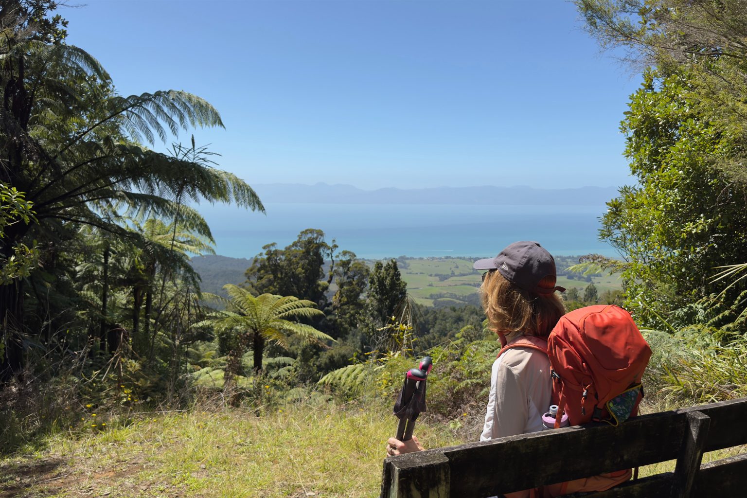
The road descends briefly and at 1.7km there is a small ford across an unnamed tributary that feeds the Waihīhī Stream. You may get wet feet depending on conditions. Once across, it’s a steady ascent through forest that grows denser the closer you are to the highest point (404m). As you near and traverse the undulating ridge, listen and watch for kōkako. Following several decades of intensive conservation work, there are currently about 500 adult birds in the Hūnua Ranges, and this is an area they frequent. A lookout at 4.65km makes a perfect lunch spot. On a clear day, gaze across the water to the Coromandel Peninsula.
At 6.14km, take the track hard to the right. Kohukohunui Track, straight ahead, leads to Adams Lookout and Campsite and is currently closed. For updates, check the open and closed track map on Auckland Council’s website.
The downhill section is darker, damper, and softer underfoot. Well contoured and with steps and boardwalks, it weaves quite steeply in parts through dense regenerating bush that includes rimu, kauri, tānekaha and tawai with varied ferns, mosses and lichens. Look out for small, flitting riroriro grey warbler and miromiro tomtit as well as pīwakawaka, tūī, kererū and korimako.
At 6.72km there’s another lookout. Carry on down the steps at 7.67km (don’t take the road on the right). At 8.26km you will reach an intersection and a short path to a viewpoint and a seat that overlooks farmland to forest and sea. You may see peacocks!
Return to the main track, and at 9.7km turn right to emerge at the tramper’s car park and start point.