Walk or cycle through the heart of Central Otago’s high country to a cute two-bunk basic hut. By Brian Dobbie
High above the Manuherikia Basin at the northern end of the Dunstan Mountains is an impressive upland area of rocky tors, open tussocklands, cushion fields and alpine tops. It’s the Lauder Basin Conservation Area, one of many substantial high country station areas that some years ago became public conservation land through tenure review. Cosy Lauder Basin Hut, smack bang in the middle of this area, is an obvious objective for trampers, cyclists and fit day walkers.Access is via a network of farm tracks from Lauder Station in the east or Cluden Station in the northwest. The Lauder Station route is easiest for those without a 4WD vehicle.
The first 6km follows an easement through Lauder Station. From the sign and car park near the end of Lauder Station Road, cross the locked gate and follow the farm road briefly up and then along the side of Woolshed Hill before dropping to an old vehicle bridge after 10min. Follow markers on fence posts through paddocks for 15min to pick up a vehicle track leading uphill to the north. (Note: this first section is not marked on topo maps.)
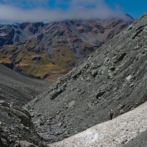
The track eases after an initial steep stretch, and after an hour you will reach the unmarked boundary of Lauder Basin Conservation Area at around 1100m.
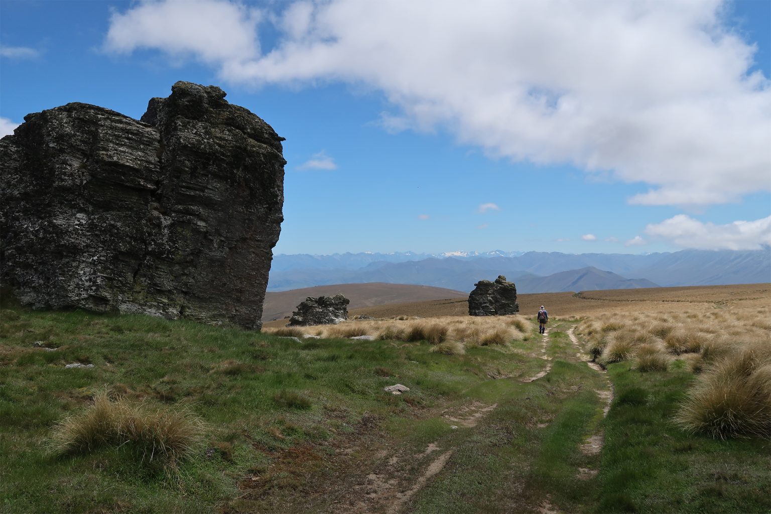
At a junction, 30min later, the road turns sharply right (north). For the next couple of hours it leads north to northeast, around Pt1628 and a trig at 1644m, past rocky tors and alpine plants. There are expansive views of the Manuherikia Basin, Dunstan Mountains and the distant peaks of Mt Aspiring National Park.
After Pt1555 the road curves down to the west through tussock, past a junction with the road from Cluden Station to the north, and drops 200m to Lauder Basin Hut, about 30min from the junction.
The hut is in a small valley, has mattresses, a toilet, water from the stream but no heating. On the return, if walking, take a direct route east-south-east up from the hut to pick up the road south of Pt1555, saving time and shaving about 2km off the distance.
You may encounter 4WD vehicles or cyclists during your trip.
The Lauder access easement is closed annually for lambing and calving from September 20 to the Thursday prior to Labour Weekend.

34 years of inspiring New Zealanders to explore the outdoors. Don’t miss out — subscribe today.

Questions? Contact us