
The northern Ruahine, accessed from the Napier-Taihape road, is an area steeped in colonial history. Much of the area was farmed in the late 1800s and evidence is still present in the form of huts and tracks.
The trip to Dianes begins on a silent track through sections of pine, which are the legacy of NZ Forest Service attempts to control erosion in the area. After a small climb to Komata Peak, the track then heads south with easy tramping along flat ground. It then drops steeply some 700m to the Taruarau River which marks the northern boundary of Ruahine Forest Park.
The Taruarau is waist-deep in normal flows but you could easily become stranded on either side if it’s been raining. Fortunately, there are campsites either side of the crossing and they make great destinations in their own right. After crossing the river, the track sidles above a small stream before unexpectedly popping into a large clearing containing the historic Shutes Hut. Unusually for the Ruahines, Shutes Hut is stone-built and for many years was the home of Alex Shute, a rabbiter, who helped construct the hut from local stone in 1920. Back then, this area was part of Big Hill Station and the marginal land around the hut was farmed, apparently holding around 1000 sheep. Today, all that remains of this venture are the hut, the pack track to Ruahine Hut and a few old totara strainer posts hidden in the bush.
Shutes Hut has recently been restored by DOC, but still retains the original open fireplace, stone walls, concrete floor and wooden bunks. It has a few other unusual features, including a large bound hut book dating to the late 1980s and an elaborate metal hut book container made for Lester Masters, a former Hawke’s Bay hunter who wrote many stories about the characters that hunted and farmed this land. It’s because of his book, Backcountry tales, that we know about Alex Shute, who apparently spent many months alone here and attempted to dissuade any visitors from lingering by pretending to be a bit unhinged. He was also partial to a beverage or two and named his dogs after various spirits, the most famous of which were Whiskey, Brandy and Gin.
Behind Shutes Hut, the track to Dianes Hut climbs a spur on a wide and pleasant track through regenerating forest. We heard many whitehead, tomtit, grey warbler and bellbird here.
With a steady gradient, the bush edge is soon reached. From here, the track is marked with cairns and the odd pole as it weaves through patches of scrub and open clay pans until the main Ruahine Range is reached. On clear days, expansive views over the Kaweka Range, Hawke’s Bay and the Central Plateau can be enjoyed from here.
Pleasant tops walking leads to the turn-off to Dianes Hut. Here, a worthwhile side trip can be made farther along the tops to Taruarau Biv (allow 30min each way).
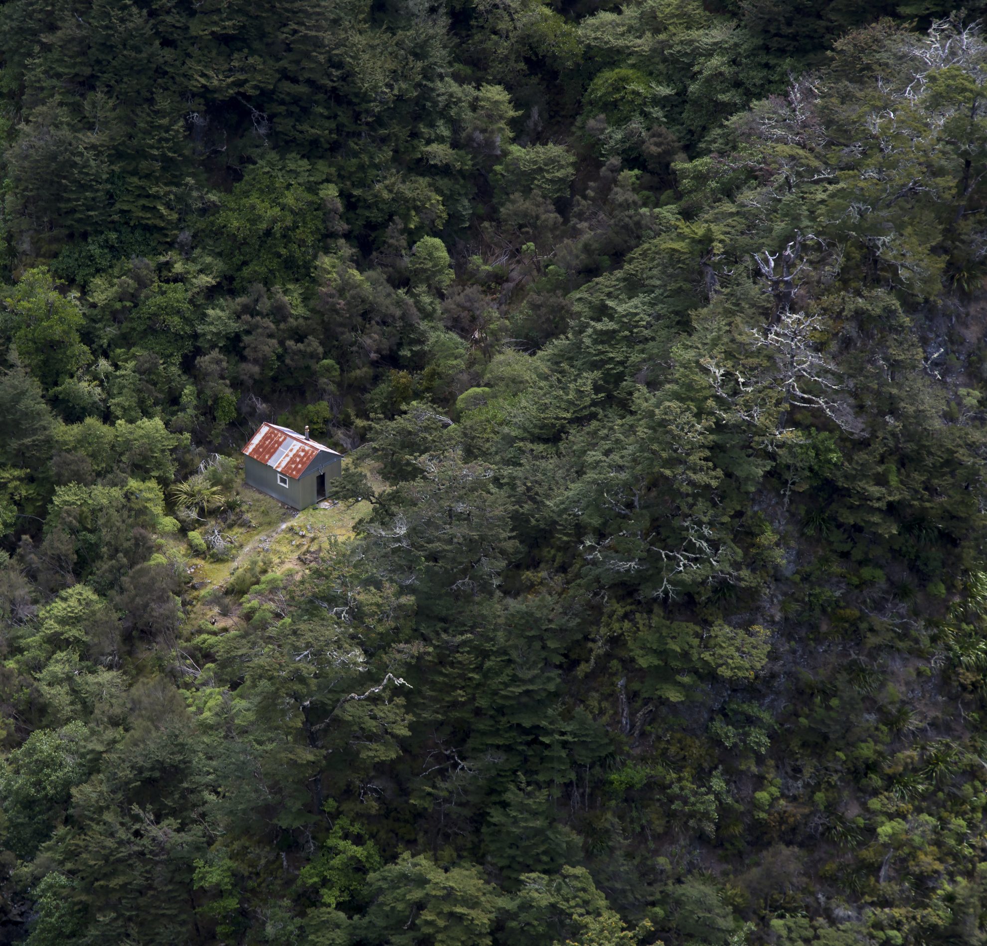
Dianes Hut is situated in a small clearing above the true left of the Koau Stream. It was built as a memorial for Diane Tressider, a hunter who frequented the area and died suddenly in 1978. The hut has a number of nice touches; the ceiling is higher than most DOC huts so you can sit up on the top bunks, and it is adorned with shelves, a dining table, concrete floor and a front door which appears to be taken from a golf club room.
If you are lucky, you may also be rewarded with seeing whio in the nearby Koau Stream.
– Jonathan Astin
34 years of inspiring New Zealanders to explore the outdoors. Don’t miss out — subscribe today.

Questions? Contact us


