Home / Trips / Canterbury

Canyon Creek Route, Ahuriri Conservation Park

Image of the January 2019 Wilderness Magazine Cover Read more from the
January 2019 Issue

With glaciated peaks, beech forest and braided rivers, Canyon Creek in the Ahuriri Conservation Park is a great location for a day walk, or a longer exploration.

From the road end, the track heads through grassland down the Ahuriri Valley with the peaks of the Barrier and Huxley ranges on either side and the braided Ahuriri River meandering down the centre. The track crosses a scree fan before branching west towards Canyon Creek. The steep forested canyon will soon become visible to the right of the creek. The trail continues towards the canyon and just before the forest edge there is a campsite with a long-drop toilet to the left of the track.

The track then crosses Little Canyon Creek before climbing steeply through beech forest to navigate around the precipitous canyon. After about 20 minutes of climbing there is a viewpoint into the rapids at the bottom of the canyon.

Canyon Creek is an idyllic, isolated alpine valley, headed by Mt Barth. Photo: George Driver

The trail then descends for half an hour before emerging into a hidden alpine valley – the 2000m peaks of the Huxley Range rising abruptly to the west and 1800m peaks in the east.

Cut off by the canyon, there is something extra alluring about this valley, and as we didn’t see another soul, it felt like our own secret alpine world.

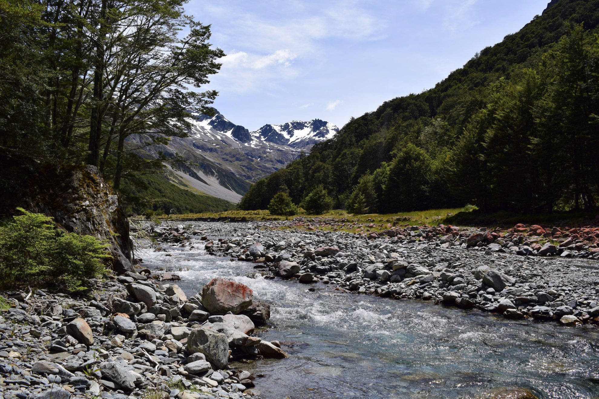
Following the braided stream, the views kept getting better and the glaciated peak of Mt Barth (2456m) can soon be seen at the head of the valley. The track follows the creek before winding through the beech forest on the river flats, with good camping spots. The forest becomes sparse further upstream, with fans of scree and landslides descending to the stream from the steep valley sides.

After three-and-a-half hours, the trail reaches a large bluff with waterfalls. Experienced trampers can continue above the bluff to the upper Canyon Creek basin, an incredible hanging valley under the Thurneysen Glacier and looming peak of Mt Barth. There is a rock bivvy in the valley on the true right of Canyon Creek.

Otherwise, retrace your steps back to the car park.

Distance
5.87km
Total Ascent
317m
Grade
Moderate
Time
7hr return
Access
From the Birchwood Road end – the road is suitable for cars until the conservation park boundary 21km down Birchwood Road. After that a high clearance 4WD vehicle is required to travel the 12km to the road end.
Map
BZ14

GPX File

Canyone Creek Route (gpx, 3 KB)

GPX File

Your device does not support GPX files. Please try a different device.