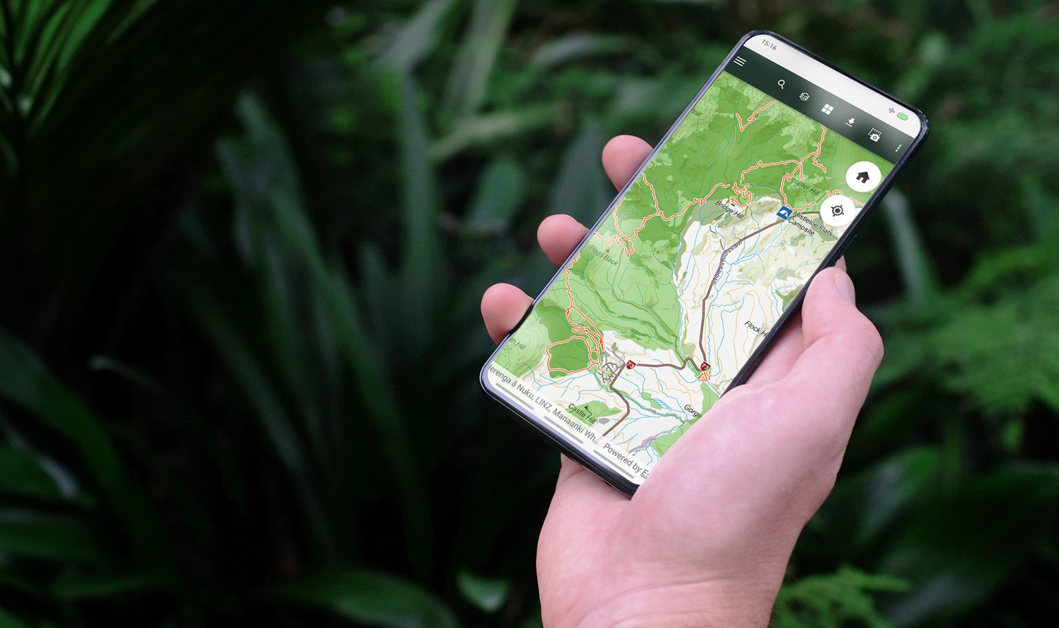
Herenga ā Nuku Aotearoa, the Outdoor Access Commission, has developed its mobile mapping app called Pocket Maps. The app allows you to find public access areas and conservation land anywhere in Aotearoa.
By searching an exact location by region and through the map layers, you can ‘understand what type of access land you are currently on or looking to walk, hunt, fish or mountain bike across’.
A new topographic basemap feature combines public access information with topographic maps.
The topographic basemap shows contours, rivers, roads, building outlines, lakes and New Zealand Geographic Board place names. It also features huts and campsites provided by DOC and the latest version of the Landcover Classification Database for visualising different landcover types.
The maps are split into regions and can be viewed online with a Wi-Fi connection or downloaded to be viewed offline.
34 years of inspiring New Zealanders to explore the outdoors. Don’t miss out — subscribe today.
Questions? Contact us