The track along Pinnacle Spur has to be one of the roughest in the Tararua. Photo: Sam Harrison

Gripping the bannister

January 2024

Read more from

January 2024

The famed Bannister Crossing involves steep ascents, slippery descents and harrowing traverses above incised gorges and along narrow ridges. Which is to say, it’s the perfect adventure tramp.

The sidle route along the Waingawa River’s true right, as it slithers through a deep and treacherous gorge separating Pukeamoamo Mitre from the rocky pinnacle of Bannister, has been called the worst track in the Tararua. To the north, the range is known for its narrow ridgeline and rocky steps. What better challenge to entice two yo-pros into the hills for a three-day mission?

As Mat and I strapped on gaiters at the Kiriwhakapapa Campsite, it began to rain. It was 7.30pm on a Friday, and we were headed to Blue Range Hut for the night. The initial five minutes were along an old bush tramway before we were confronted by our first challenge: the Blue Range. The climb was steep and slippery, undeniably Type II fun. But within an hour the turn-off to the hut emerged from the gloom and soon there was the welcome sight of Blue Range Hut. The hut is by far one of the quirkiest I’ve stayed in. It has been well looked after by Masterton Tramping Club, including being adorned with signs from the local hospital, one on the longdrop showing ‘social workers quarters’.

Next morning we set off towards Te Mara before marching along the undulating ridgeline in the direction of Cow Creek. Clouds hanging around the hilltops were gradually lifting. Rather than following the marked track down to Cow Creek, we headed towards Pt970 and Pt890. An old track once wove all the way along this route to Cow Saddle but is now barely distinguishable from the surrounding bush. 

The first 300m of the 700m climb are gruelling, relenting only when the dense band of sub-alpine scrub known, in the North Island, as the ‘leatherwood zone’ is reached. The track was well cut though.

At Pt1360, I watched as the cloud hanging over Pukeamoamo Mitre drifted our way, partially enveloping the landscape. To the right lay the broad Cattle Ridge, at left was the fractured ridge leading to Bannister. It didn’t look inviting, yet we headed that way.

The ridgeline sharpened, and the tussock gave way to exposed rock. Crossing Pt1385 there’s an excellent vantage over Bannister Basin, where a Department of Internal Affairs hut stood in the 1950s before the Forest Service took over wild animal control operations. The commute of deer cullers to Bannister Basin would have left something to be desired if our experience was anything to go by – although the views were fantastic. 

January 2024

Read more from

January 2024

Some parts of the route to Bannister are exposed and not for the faint-hearted! Photo: Sam Harrison

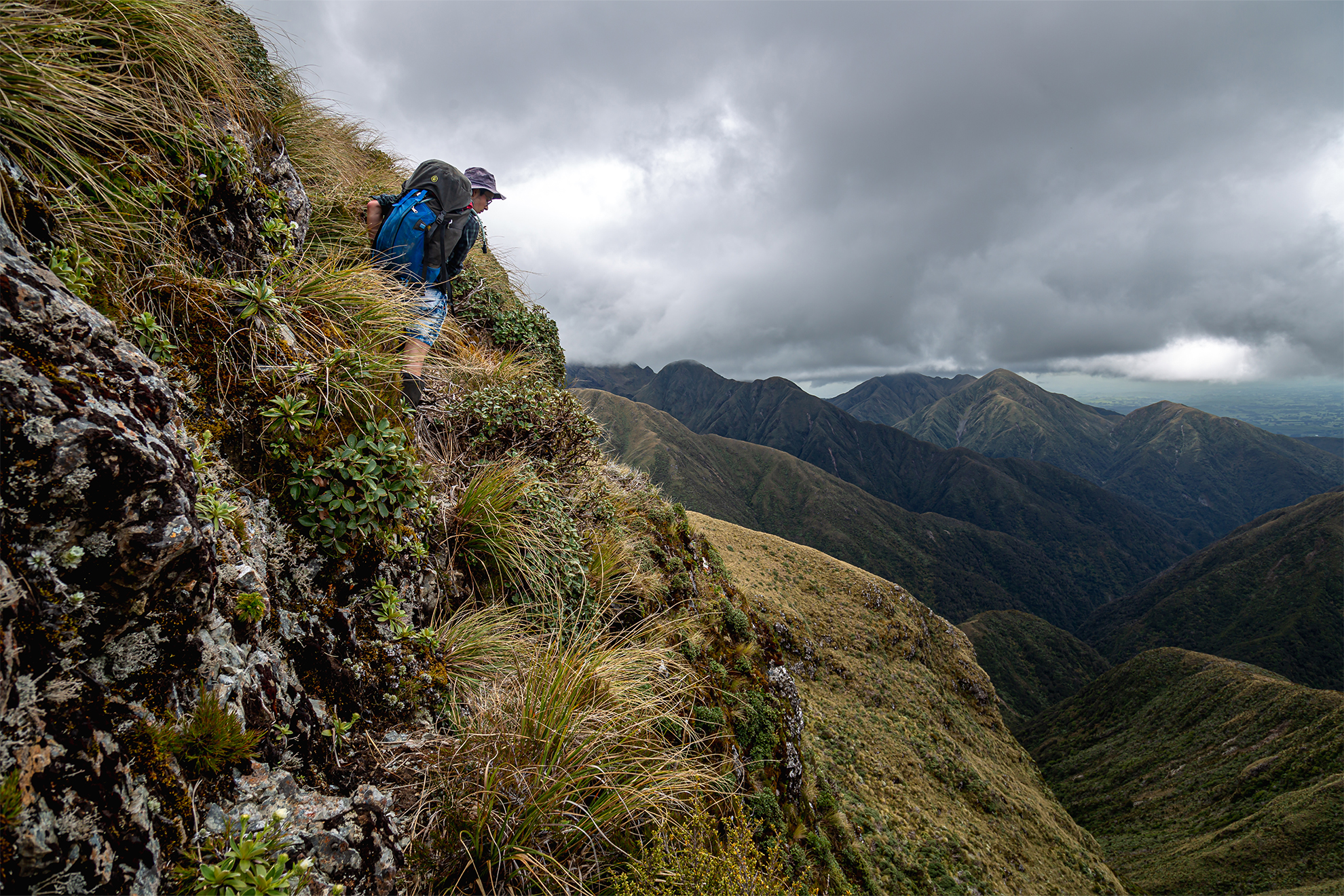
The ridge dropped to another saddle before rising towards the buttresses of Bannister. From a distance it looked impossible, and only when my face was inches from the rock and scrub was the way forward revealed.

Soon, we were confronted by a rock wall devoid of any comforting tussock. Other trip reports had mentioned this section as being particularly difficult, some recommending taking a rope for pack hauling. However, Mat scrambled up without a care, leaving me with no option but to tackle it too. It took a few abortive attempts, but by approaching from the right-hand side I managed to work up to the safety of the tussock above. “Phew,” I thought, “that’s the noteworthy s***-yourself section completed.”

The ridge from Pt1513 to Bannister was narrow and rocky, but the worst of the scrambling was done. However, the day was far from finished.

From here we dropped before climbing along the Twins. Older maps name the Twins as the Dromedaries, a more appropriate name for a pair of rather rude humps. From the western-most hump we could almost smell Arete Hut, yet we still had to drop and then climb another 100m before finally arriving there at 3pm.

Arete Hut is one of the most beloved huts in the park. It’s the highest hut in the Tararua Ranges – 1360m – and has some of the best views, right out over the range we had just clambered along. The current hut is the third iteration, the first being a two-person dog-box bivvy built by Forest Service hunters Paul Gush and Brian Simpson, who travelled up Pinnacle Spur from Arete Forks to build it.

Arete Forks Hut offers a rare example of an unmodified Forest Service S70 Hut. Photo: Sam Harrison

Reluctantly, we decided to leave Arete, and climbed to Pt1389 before traversing above the idyllic Upper Waiohine towards the looming hellscape of Pinnacle Spur. A signpost on Pt1470 marked the almost vertical descent to the spur. All the spur’s namesake pinnacles had to be negotiated, usually climbing up and over them – not pleasant. Things didn’t improve lower down, where it’s a slip-and-slide between narrow walls of less-than-soft leatherwood.

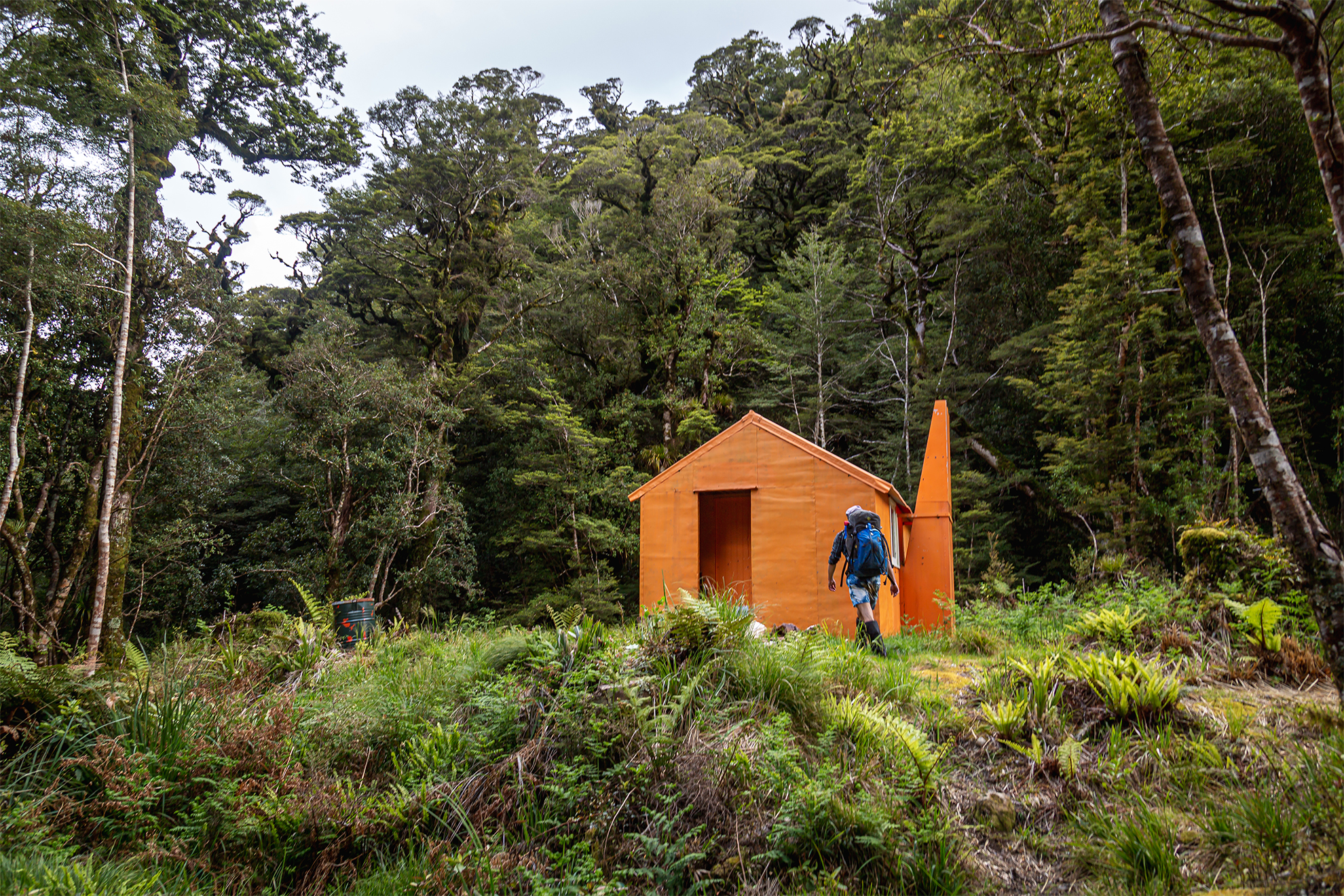
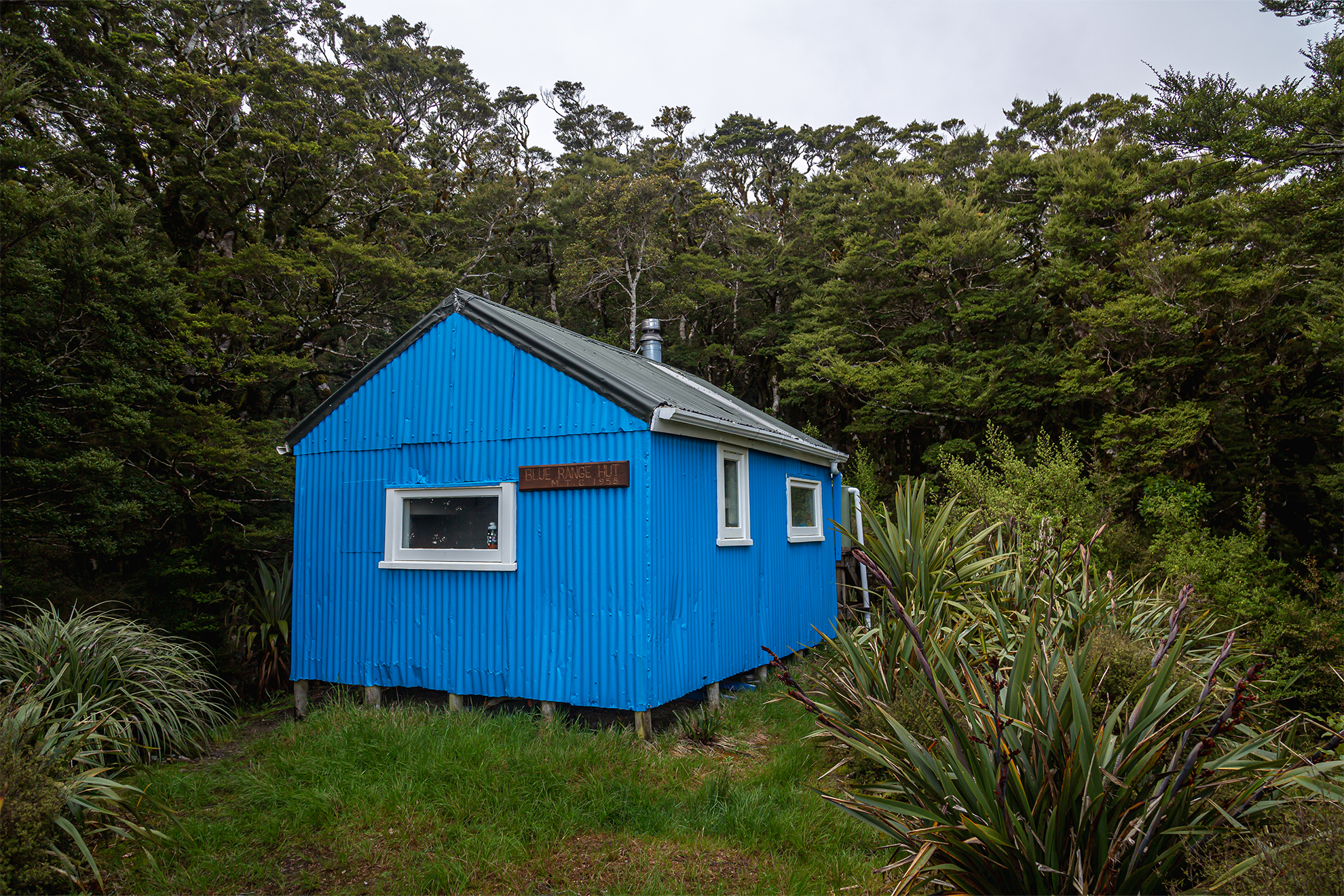
Even the track through the forest was dangerously slippery, and it was a relief to be spat out finally on the banks of the Waingawa. From there we limped through the slow waters to Arete Forks Hut in all its tangerine beauty: our home for the night.

Next morning we gritted our teeth for ‘the worst track in the Tararuas’. But luck was on our side: a hut book entry noted that the track had been cleared recently by the Greater Wellington Backcountry Network.

Many streams cut across the Arete sidle track, offering a chance for a drink. Photo: Sam Harrison

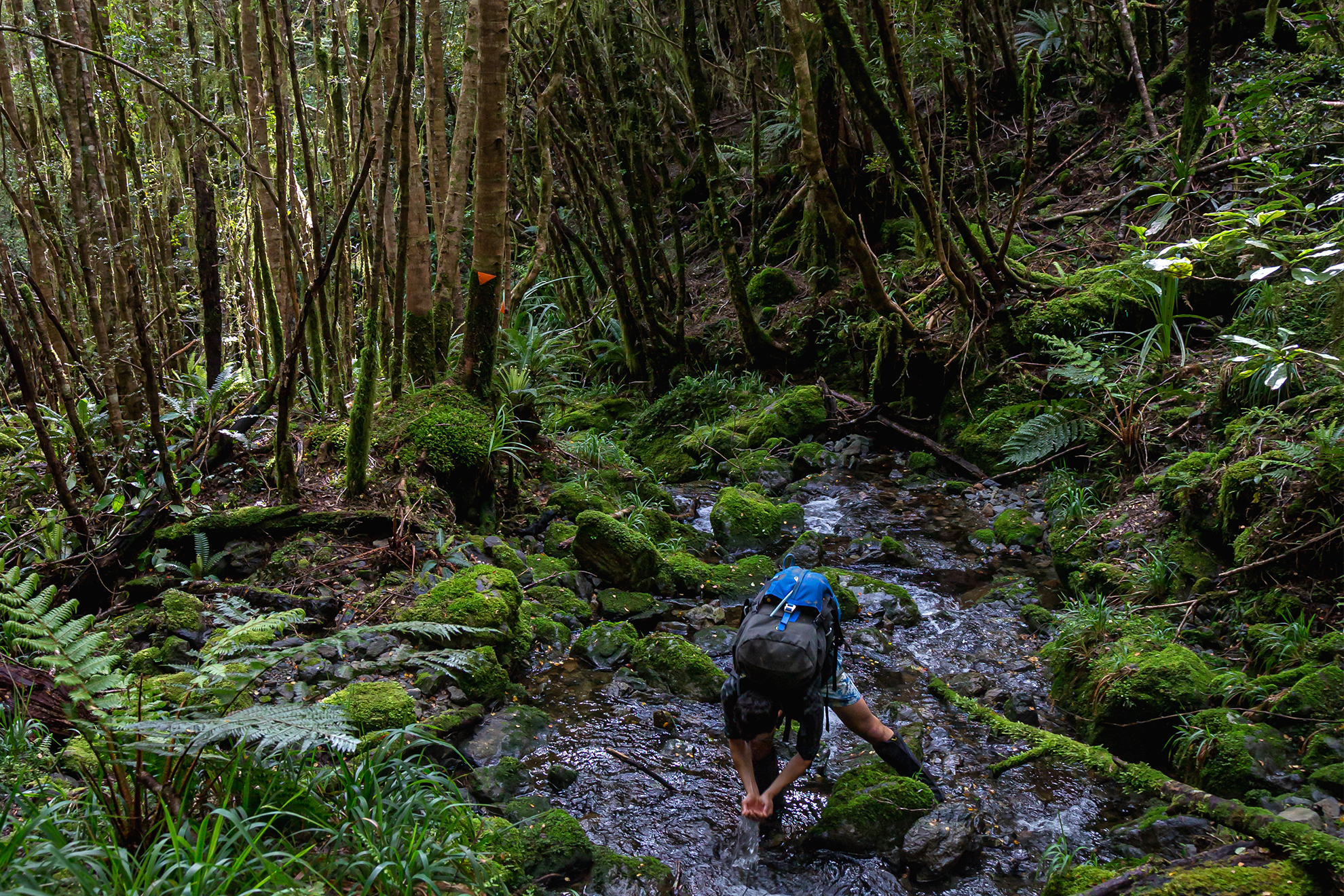
It started with a near-vertical 100m climb above the river, then the track began to sidle. All around was the handiwork of the track cutters. Large fallen trees had been cleared, and parts once overgrown with fern were simpler to follow. The track is still not easy, though. There’s a fair share of ups and downs, but it was nothing when compared to the slippery mess coming down Pinnacle Spur. The only issue with the impeccably cut track was that markers, that had once denoted arduous detours over treefall, could now be skipped – the problem lay in deciding which marker to follow.

We soon began our descent into the final stream before dropping steeply to Cow Creek Hut. It was built in 1960 and should be a pilgrimage site for backcountry trampers, being one of the first of the ubiquitous Forest Service S70 huts. It’s in close-to-original condition (other than the pot belly stove).

From the hut we crossed the Waingawa via a swingbridge, after which the track skirted along the river through open forest for a kilometre then swerved abruptly uphill. Eventually, we reached the descent to Cow Saddle. It was then a simple matter of walking along the ridge before dropping to the old tramway and the Kiriwhakapapa Campsite.

Blue Range Hut is one of the quirkiest backcountry huts out there. Photo: Sam Harrison

The ridgeline traverse of Bannister had proved spectacular, its rocky buttresses manageable with proper attention and respect. As for the sidle track, it was a gut-buster but easily negotiable, in no small part due to the mahi of the track-cutting team. I suspect it is no longer the worst track in the Tararua. For that title, I think the Pinnacle Spur track next door could be in serious contention.

Distance
34km
Total Ascent
4000m
Grade
Difficult
Time
3–4 days. Kiriwhakapapa Campsite to Blue Range Hut, 2hr; to Cow Saddle, 2–3hr; to Arete Hut, 5–6hr; to Arete Forks Hut, 2–3hr; to Cow Creek Hut, 3–4hr; to Kiriwhakapapa Road, 4–5hr
Accom.
Blue Range Hut (standard, four bunks); Arete Hut (basic, two bunks); Arete Forks Hut (basic, six bunks); Cow Creek Hut (basic, six bunks).
Access
Kiriwhakapapa Road
Map
BN34

GPX File

Bannister_Crossing (gpx, 51 KB)

GPX File

Your device does not support GPX files. Please try a different device.
Sam Harrison

About the author

Sam Harrison

Sam Harrison is a chocolate addict who tramps on the side. When he’s not in the bush he can be found pushing paper for a government department in Te Whanganui-a-Tara. Sam graduated from the University of Otago in 2021 with a Bachelor of Law, a Bachelor of Arts, a large student loan and a love of all things tramping. He is easily identified in the hills by his oversized camera and his distinctive knack for finding type II fun.

More From January 2024

More From January 2024

Related Topics

Similar Articles

A lofty location for Brass Monkey

The trail of the tenacious

Walking through the valley of Hope

Join Wilderness. You'll see more, do more and live more.

Already a subscriber?  to keep reading. Or…

34 years of inspiring New Zealanders to explore the outdoors. Don’t miss out — subscribe today.

Your subscriber-only benefits:

All this for as little as $6.75/month.

1

free articles left this month.

Already a subscriber? Login Now