
1 Brown Hut to Perry Saddle Hut, 17.5km
From Collingwood, at the end of Aorere Valley Road, a short gravelled road leads to the 16-bunk Brown Hut. This is a great place to stay for those arriving late and hoping for an early morning start. The track climbs steadily on a wide bench to Aorere Shelter. Though it’s a long climb, you can really get stuck into it and develop a nice peddling rhythm. It continues upward to the highest point of the track at 915m, followed by a short descent to the 28-bunk Perry Saddle Hut. The open tops allow a glimpse of the Gouland Downs and views back towards the Haupiri Range and Mt Olympus.
2 Perry Saddle Hut to Saxon Hut, 13.5km
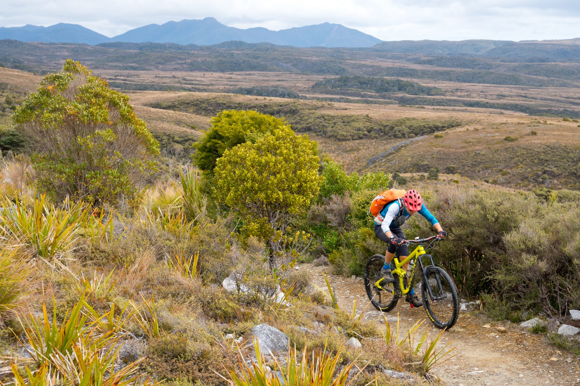
From Perry Saddle, ford a number of small creeks on the way down to the open tussock limestone country of Gouland Downs. It’s a rocky and challenging descent through patches of beech forest and alpine shrubs. If you’re lucky, you may spot a takahē amongst the tussock grassland or around Gouland Downs Hut. After crossing the Downs, the track climbs gradually to Saxon Hut. This 16 bunk hut has bagged a sunny spot in the open with stunning views, making it a favourite place to spend the night.
3 Saxon Hut to James Mackay Hut, 12.5km
The track wanders between rock outcrops, eventually crossing the Blue Duck Creek. It then climbs into the forest, following the Saxon River
to the base of Mt Teddy and back to the 800m mark. The track traverses into Mackay Downs and across a number of small streams with a gradual downhill before a final climb to James Mackay Hut. This 28-bunk hut is perched on the edge of the coastal descent, providing the first beautiful glimpses of the West Coast.
4 James Mackay Hut to Lewis Hut, 12.5km
The downhill starts gradually; building momentum on the long ridge that runs south-west from Otepo, the peak behind James Mackay Hut. This section of track is a seriously great descent on stunning single track. It initially roams through stunted alpine beech forest and then, as altitude is lost, enters West Coast jungle. The Heaphy River comes into view on the lower section and the 20-bunk Lewis Hut is reached soon after. The hut is camped at the confluence of the Lewis and Heaphy Rivers.
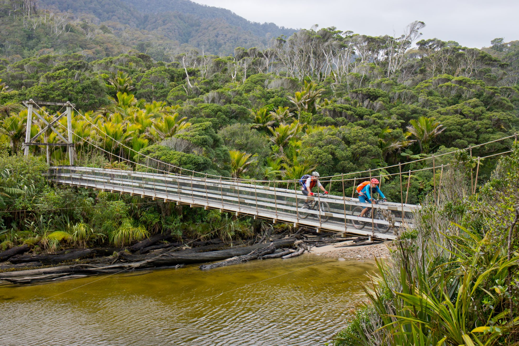
5 Lewis Hut to Heaphy Hut, 8km
A massive swingbridge spans the Heaphy River and the track then follows below a chain of limestone bluffs, through a forest of nikau, massive rata, rimu, and supplejack. After crossing Gunner Stream, the smell of the coast becomes apparent and then the 32-bunk Heaphy Hut is reached. Its large front lawn runs down to a driftwood-chocked sandy beach, estuary and bluffs then out to sea. On a sunny day, this is a place you may want to live at but staying the night is a great option.
6 Heaphy Hut to Kohaihai Road end, 16km
From the hut, the superb single track follows the coast south through sandhills behind Heaphy Beach and then into a forest of nikau palms that never leave the track edge. A blur of sea, sand and the distinctive trunks of the nikau palms follow you south down this spectacular undulating section of coast. A final climb exits Scotts Beach above Kohaihai Bluff, with views across the Kohaihai River mouth and estuary.
The downhill and massive swingbridge soon deliver civilisation, as we know it, with Karamea just 16km south.


