1. Cape Reinga Coastal Route, Northland
Distance: 20km
Time: 8hr
Start: SH1 road end, Cape Reinga.
End: Te Paki Stream, Ninety Mile Beach.
From Cape Reinga, a track heads towards the west coast, past steep cliffs and over rocks to the long, sweeping Te Werahi Beach. Experience gorgeous peach-coloured dunes, unusual dune grasses and views of Cape Maria van Diemen and Motuopao Island. Follow orange marker posts over Herangi Hill, past the turn-off to the cape and along cliff tops of flax and manuka scrublands, before dropping down to Twilight Beach. Exit the south end of Twilight Beach on the 4WD track next to the orange marker.
The track climbs up and over Scotts Point then drops down to Ninety Mile Beach, crossing a swamp via a boardwalk and down a steep set of steps. After an hour or so on Ninety Mile Beach, Te Paki Stream mouth is reached. This is a popular vehicle entrance/exit to the beach so be prepared for cars and tourist buses.
This is a dry section of the trail so take plenty of water. Be wary of blisters from sand in your shoes. At Twilight Beach are two self-sufficient camp sites.
2. Ninety Mile Beach, Northland
Distance: 80km
Time: Three days
Start: One hour’s walking downstream from Te Paki Stream Road, off SH1
End: Boat ramp, Kaka Street, Ahipara Township.
Geoff Chapple loves this corner of the country: “It’s like a desert – a fantastic experience. I discovered I could walk at night [here] – what other trail in New Zealand can you walk in the dark? You don’t trip, you don’t stumble, the stars are wheeling overhead, you watch the meteors burning out in green bursts all over the sky. The sun goes down, the moon comes up, the sun comes up, the moon goes down. That is part of the enchantment of long walking – fitting into a vast natural rhythm.”
From Te Paki Stream, freedom camp down the beach to Ahipara at your own speed. Landmarks passed include The Bluff (20km), Hukatere (49km) and Waipapakauri (67km).
This section is exposed to wind, sun and cold – and water is very scarce.
3. Bream Head Track, Whangarei Heads
Distance: 7km
Time: 5-6hr
Start: End of Ocean Beach Road
End: Small car park at Urquharts Bay
Walk to the southern end of Ocean Beach and climb a very rough track up the cliff to the ridge beyond. Once off the cliff, the track is better formed but still steep. Continue past a Second World War naval radar station to the Bream Head/Te Whara summit. It’s worth the short detour to the viewing platform. The rock formations and coastal views are spectacular.
Halfway along the ridgeline is the track exiting to Ocean Beach Rd (north) and another going steeply down to the south and Peach Cove. This is a 25min one-way detour and a great spot for over-nighting or a swim.
Continue along the ridge to Mt Lion then steeply down to Urquharts Bay, passing the Busby Head loop track.
4. Govan Wilson – Dome Track, Auckland
Distance: 12.5km
Time: 7hr
Start: Govan Wilson Rd, Matakana
End: At the Dome Tearooms’ car park, 7km north of Warkworth on SH1
Once up the steps from Govan Wilson Road, follow the clay 4WD track. Enjoy the views and the rusty old bus while following the ridge to the junction with Conical Peak Rd. Take the right fork and continue on this 4WD track until reaching a turn-off on the left onto a narrow bush track in DOC’s Totara Scenic Reserve.
Follow the marked bush track which eventually descends steeply down the ridge into the Waiwhiu Valley. At the bottom, the track turns right across a small creek and follows the true right of the Waiwhiu Stream for approximately 1.3km. At this point, the track crosses the stream to enter private forestry land where it quickly joins the Waiwhiu Valley Rd (a private forestry road). Turn right and follow the road for some 300m; turn left into a clay 4WD road (Fisher Road) which climbs steeply through pines. Just over the brow, the track turns off the 4WD road, which is easy to miss, into the pines for a short climb to the ridgeline and DOC’s Dome Forest.
This narrow bush track now follows the ridgeline through attractive podocarp and broadleaf forest with glimpses of the surrounding countryside and coast. About 90min from the Dome Tearooms, the track traverses the Waiwhiu Kauri Grove. Here 20 mature kauri of up to 4m girth hint at the forest’s original magnificence.
The track then climbs to the Dome trig. There are a few more ups and downs along the ridge, including a steep scramble around large rocks, on the way to the lookout platform with views across the Mahurangi Peninsula to the Hauraki Gulf. The track then descends 1km on upgraded walkway and steps to the tearooms and SH1.
5. Pirongia Traverse, Waikato
Distance: 15km
Time: 8hr
Start: Picnic area by the Kaniwhaniwha Stream, Limeworks Loop Rd (west of Rolley Rd), north side of Pirongia Mountain
End: Junction of Pirongia West Rd with Omanawa Stream
This traverse of Pirongia Mountain starts with DOC’s Nikau Walk – an easy stroll south from the Kaniwhaniwha car park, following the stream across farmland. Shortly after leaving the farmland and just before a circular walk through beautiful native forest, take the Tahuanui Track leading off to the south-east and a picnic/campsite clearing with toilets and the last opportunity for swimming before the ascent to the summit.
The Tahuanui Track climbs steadily up a ridge through stands of tawa to the summit ridge where several tracks converge on the summit of Pirongia (959m). Half an hour beyond the summit is Pahautea Hut which sleeps 6-8. It has a water supply and campsites but not a fire or cooking facilities.
From the hut, continue west on the new Noel Sandford boardwalk, following the Tiwarawara Route with good views to the south. About 600m before Te Akeohikopiro Peak, take a new spur track to Pirongia West Rd.
6. Tongariro Alpine Crossing, Central Plateau
Distance: 20km
Time: 6-8hr
Start: Car park at the end of Ketetahi Road, 1km off SH46, Tongariro National Park.
End: Mangatepopo Road end, 6km off SH47
The Tongariro Alpine Crossing passes over varied and spectacular volcanic terrain. A cold mountain spring, lava flows, an active crater, steam vents, emerald-coloured lakes and magnificent views combine to make this a challenging, enjoyable and memorable tramp.
Always check the weather forecast, take local advice and carry warm and wind-proof clothing no matter when you walk the crossing. (Note: Te Araroa Trail descriptions work from north to south whereas DOC encourages trampers to walk the Tongariro Alpine Crossing in the other direction starting at Mangatepopo.)
From Ketetahi Road end, the track goes through a cool podocarp hardwood forest which is a relaxed contrast to the long ascent to Ketetahi Hut. From the bush line, the track winds its way up through tussock slopes past some private thermal springs to Ketetahi Hut.
From the hut, the track ascends further before sidling down around the flanks of North Crater to Blue Lake and across the lunar landscape of Central Crater. Then it’s past Emerald Lakes, three water-filled explosion craters. The track steepens on the approach to the summit of Red Crater (1886m), the highest point on the crossing. From there, detour to the top of Mt Tongariro via a poled route (2hr return) or drop down to South Crater. For the fit and enthusiastic, Mt Ngauruhoe can also be climbed (3hr return).
From the saddle between Ngauruhoe and Tongariro, you can be rewarded, on a clear day, by views of Mt Taranaki to the west. Then it’s a steep descent down the Devil’s Staircase to the head of the Mangatepopo Valley where a short side track leads to Soda Springs. It’s then down valley, at a gentle gradient alongside a gurgling stream, around the edges of old lava flows.
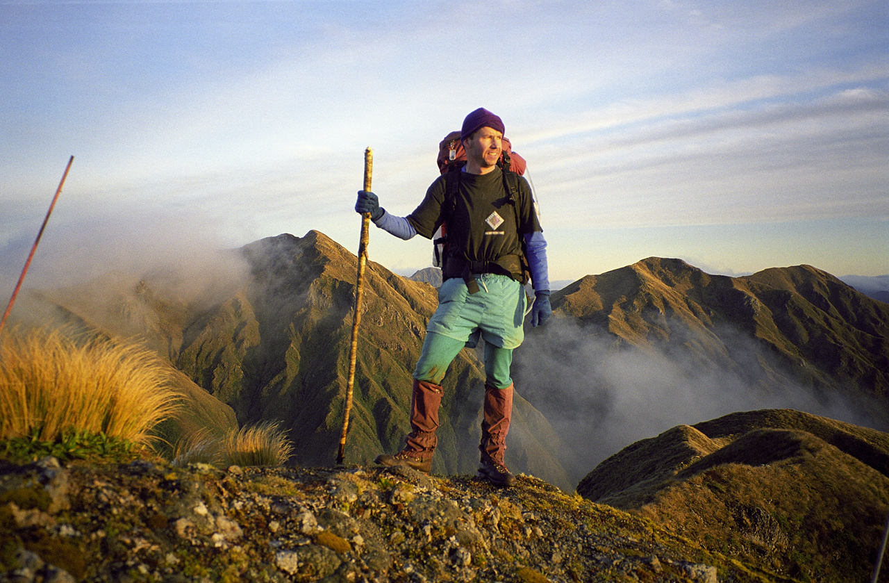
7. Tararua Traverse, Wellington
Distance: 45km
Time: 3-6 days
Start: Poads Road, Levin, via Gladstone Rd.
End: Otaki Forks
This section is through forest and rugged alpine terrain and includes many steep ascents and descents. It begins 150m above sea level and reaches its highest point at 1462m on Mt Crawford. Weather in the Tararua Ranges is notorious for deteriorating rapidly; be prepared for extreme conditions in any season, including snowfall.
Start at Poads Road, 7km inland from Levin, and after crossing muddy farmland, ascend 1000m up the ridge to the rebuilt Waiopehu Hut which offers good views across the plains below. The second day involves traversing undulating ridgelines which can be muddy after rain. Climb over the shoulder of Waiopehu Peak, then Twin Peak – look out for the memorial to a tramper who perished here in a 1936 storm. Push through scrub and crash through leatherwood over Richard’s Knob. Drop down to Butcher’s Saddle and follow the ridge to the recently renovated Te Matawai Hut.
The trail then climbs Pukematawai (1432m), along open tops with breathtaking views. Descend various bumps to the bushline beyond Butcher’s Knob en route to Dracophyllum Hut, a small two-bunk bivouac.
Then, it’s up over Puketoro and the shoulder of Kelleher and Nichols and along the main ridge to the six-berth Nichols Hut. While mainly through bush, the route is unmarked on the tops with the exception of some cairns. Take the ridge to the summit of Mt Crawford for views of Kapiti Island, the coast and possibly Mt Taranaki. Descend to Junction Knob, then turn right to Shoulder Knob where the track re-enters the bush, and descends steeply to Waitewaewae Hut.
Finally, follow the Otaki River downstream before a wet weather track and old logging tramway lead out of the bush. At Parawai Lodge (12 bunks), cross the swingbridge to the car park.

34 years of inspiring New Zealanders to explore the outdoors. Don’t miss out — subscribe today.

Questions? Contact us


