Localised cloud and wind patterns can provide clues as to whether a forecast is unfolding as expected.
Many New Zealand trips involve stitching plans into a narrow weather window and hoping the forecast holds. It’s satisfying to hit that sweet spot – walking out with a storm building behind your back – but it can also leave you vulnerable when the weather doesn’t play out as forecast.
Forecasting is challenging in Aotearoa, where fast-moving systems from surrounding oceans meet complex mountain terrain. Modern global weather models are best at describing ‘the big picture’: high and low pressure systems and the movement and types of fronts. Where they often struggle is with timing. For those in the backcountry, that timing matters: when will the rain actually arrive?
Local observations of clouds and wind show what the atmosphere is doing now. They won’t replace a forecast, but they can provide clues as to whether it’s unfolding as expected – how fast the weather is changing, and what might be coming.
When weather approaches from the West Coast, cloud often begins to spill eastward over low points along the Main Divide. Watching how quickly this develops can give a sense of how rapidly the system is advancing.
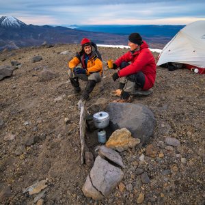
On one trip to Caroline Hut in Aoraki Mount Cook National Park, rain was forecast to arrive from the west around dawn. At sunrise we observed that the clouds seemed fairly stable and were caught up about the Main Divide. Judging the front to be arriving later than forecast, we opted to take a longer route down. If the cloud had been building and spilling over aggressively, we would have taken the fastest, most direct route. The decision wasn’t about predicting the weather – it was about checking whether the forecast timing was early or late.
In a typical Southern Alps weather pattern, strengthening northwest winds precede an approaching low-pressure system (cyclone) from the west and a colder southwest change as the system passes over the island. That southwest change in the wind may signal that the system is passing over and the storm clearing. Be wary when judging overall wind direction by what you feel, however, as local terrain will distort it. High-cloud movement is a more reliable indicator of the broader airflow.
Cirrus clouds form where fast-moving air spreads moisture through the upper atmosphere. A few are common in fine weather, so the ‘big picture’ context matters. If no front is expected, they may mean little. But if a front is forecast, increasing cirrus can be an early signal of its arrival. As they thicken into a high veil (cirrostratus), this often precedes a warm front and rain within 24–48 hours. On a short trip, that might not matter, but it’s a good signal to stop and consider whether your plans are still viable.
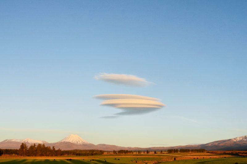
UFO-like lenticular clouds indicate strong winds over mountains. If strengthening northwesterlies are forecast ahead of a front, developing lenticulars suggest that change is already underway aloft, even if conditions feel calm where you are. Conversely, their absence can indicate that the system will be slower to arrive than expected. That could be the difference between a straightforward exit and a rushed one, or a choice of camping high or sheltering below the treeline.
None of these observations allow you to predict precisely when the weather will change, but they can help you to assess whether the forecast is tracking as expected, or whether your weather window is shifting. From there, you can decide whether to commit, adjust your route, or leave earlier.
Forecasts give you the plan; observations tell you whether it’s still working.