This is a two-to-three-day fair-weather trip with extensive river travel. It runs through remote rātā and kamahi country and can be done in either direction.
The track into Griffin Creek begins on the true left of Harrington Creek, off SH73, 4km west of the Taipo River bridge. For courtesy, check in with the local landowners before parking on the old section of highway in the paddock. Then, follow a track outside the fenceline 800m up the hillside before heading into bush beside Harrington Creek.
After 10min the track crosses the creek and climbs steeply through lush bush on the face of the Griffin Range, with southern rātā, supplejack and tree ferns stretching into the canopy. It’s a tough ascent that includes scrambling up the side of a regenerating slip face, only easing off when the narrow spur that bounds Griffin Creek around the 740m mark is reached.
Follow the spur southwards for another 30min to a small clearing at the Wilson Knob turnoff at Pt974. There’s an ancient metal drum here containing rainwater. A little further along, pause to look down into the top of Griffin Creek and the jagged teeth of Razorback Ridge and the Tara Tama Range to the south.
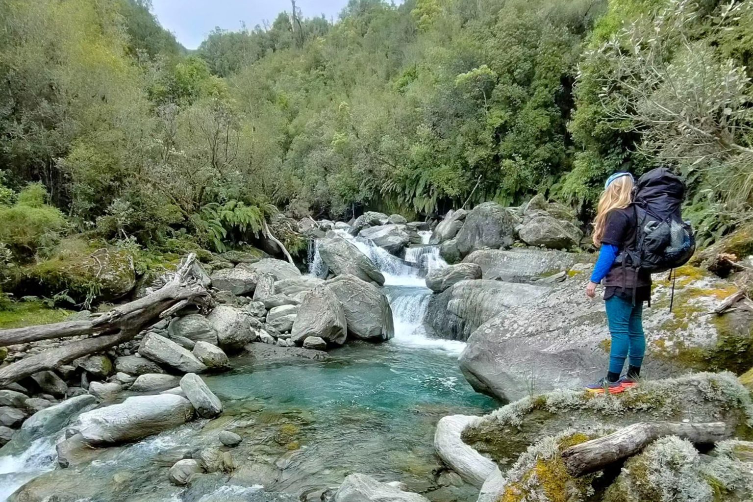
The track turns east and drops steeply into Griffin Creek. In places the 300m descent is slippery and exposed. Once in the creek it’s a further 2km of mostly pleasant river travel upstream to Griffin Creek Hut, made delightful by encounters with whio.
From the tidy four-bunk hut, a short stretch of track leads past the loo to an outdoor wood-heated bath and a sandy waterhole in the creek.
To continue the circuit, retrace your steps for 15min to cross the side creek draining Scotty’s Saddle and sidle around to the next, unnamed, side creek draining Rocky Creek saddle. It’s mostly a grovel up the creek, climbing occasionally onto sections of track for just over 1km to reach the 900m scrub-clad saddle that leads into Rocky Creek.
Negotiate the slip just beyond the saddle into the head of Rocky Creek. After another hour of boulder bashing with multiple creek crossings, there’s a large cairn and Permolat on the true right of the creek. This marks the track to Rocky Creek Bivouac.
There’s space around the two-bunk hut for tents, water is fetched from the nearby creek, and there’s no loo.
Continue down Rocky Creek, staying on the true left where possible. It’s a rough route, at times bouldery and slow-going, but there are whio in the deep pools. The track leaves Rocky Creek at the top of a small gorge, climbing then sidling across a long terrace beneath Mt McInerney to descend on the true left of the Taipo River. Follow a marked track through grass and scrub before emerging beside the Taipo Bridge on SH73. From here, it’s 4km back to the Harrington Creek car park.

34 years of inspiring New Zealanders to explore the outdoors. Don’t miss out — subscribe today.

Questions? Contact us


