Revitalised Renata
Looking for a solid day with steady rather than steep hills to test post-injury fitness, I settled on Renata Hut. It’s in a seldom-visited corner of the Tararuas, despite having one of the closest access points to the urban area.
The track starts at the high point of Akatarawa Road. There is no signpost – which might be a factor in its low usage – but it’s very obvious. It starts fairly steeply before settling into a steady climb. There was the occasional sidetrack, again unmarked, but it’s usually easy to work out which was heading the correct way. The track is either on the crest of a ridge or sidling it.
After a couple of hours, I’d gained 300m, just bypassing a knob named on the map as Kakanui. Occasional breaks in the bush revealed views of a familiar Kapakapanui, as well as north into the Ngatiawa Valley and beyond to the Kapiti Coast.
Height is lost and then regained and eventually the track comes to a large clearing. At the far end, a couple of orange triangles and the remains of two old signposts marked the start of a track to the left. I concluded this was the way to Kapakapanui, and looked for my route to Renata Hut. After clambering up a bank that had seen some foot traffic, there was the track, with an orange marker in the distance adding confirmation.
The track loses 100m fairly sharply onto a saddle and then levels off. Then a sidetrack appears and the hut is just 20m away.
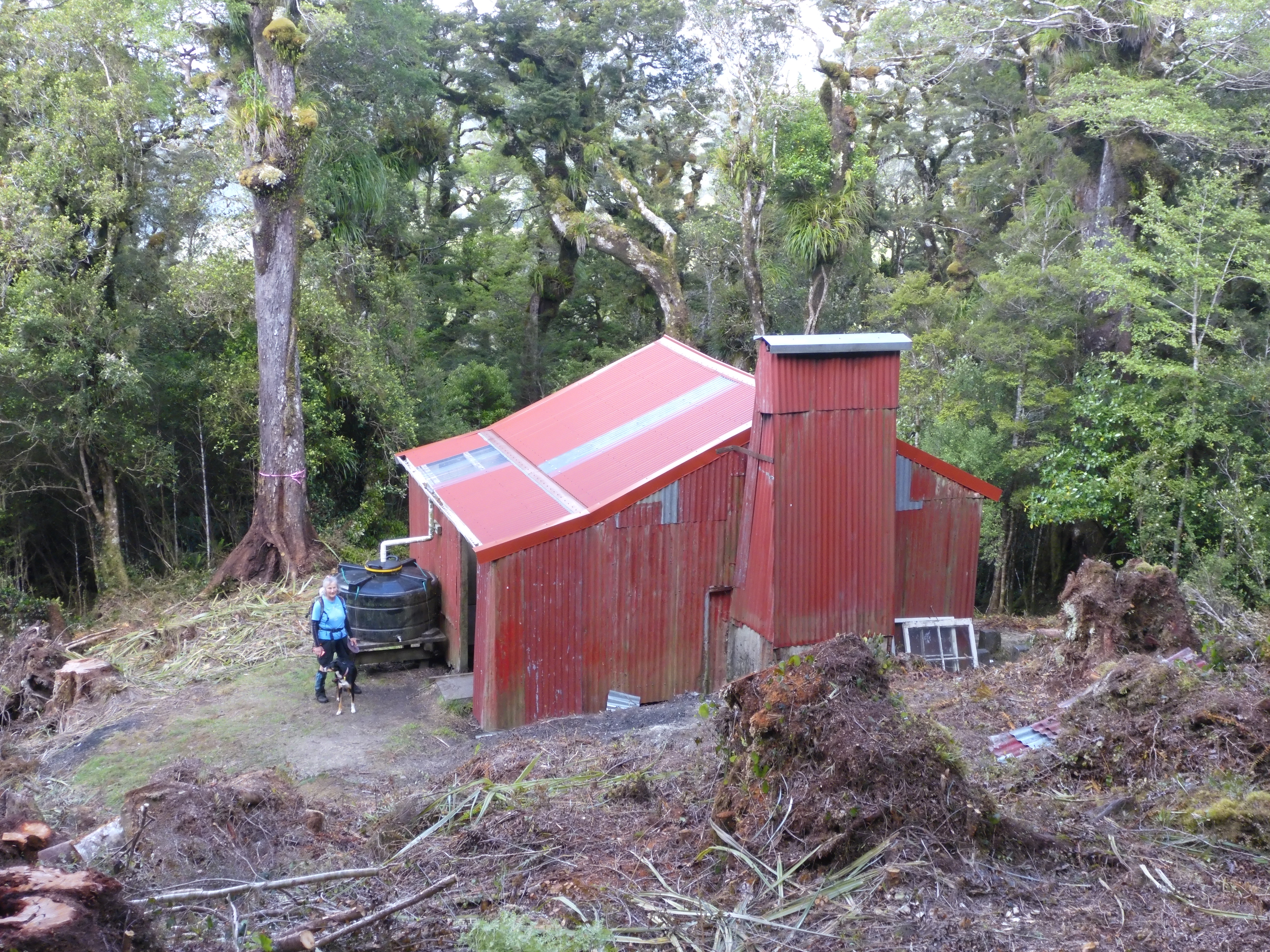
Renata Hut was built in 1956 by the Wellington Catholic Tramping Club. It’s got an open fire and platform bunks that are nominally for six but would easily hold double that. Until recently, it was the only older hut in the Tararuas that didn’t have an active community partner working with DOC on its maintenance and it showed. The hut book references leaks in the roof and chimney.
However, that has now changed with the management of the hut passing to the ex-NZFS group which secured funding from the Backcountry Trust to upgrade it. Since my visit, the group has undertaken major structural renovations, including replacing the roof and adding double glazed windows, all to make the hut as good as new.
After lunch at the hut, and heading back, I was surprised to do the climb to the junction more quickly than I’d descended, but the steady ascent to Kakanui seemed to go on forever.