Mt Hobson, Great Barrier Island

Read more from

On top of Mt Hobson. Photo: Andris Apse

An easy track leads from Kaiaraara Hut (28 bunks) up north branch of Kaiarara Stream.

After an hour or so the first remains of historic kauri dams can be seen.

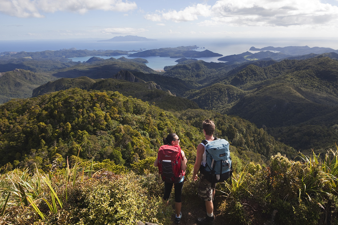
The track continues to climb, with a last steep section consisting of hundreds of steps leading to the 627m summit.

Continue on to Mt Heale and around the headwaters of Kaiarara Stream which the track drops down to and back to the hut.

Distance
9.89km
Grade
Easy / Moderate
Area
Great Barrier Island
Time
6hr
Accom.
Kaiaraara Hut ($15, 28 bunks)
Access
At the end of Kaiaraara Bay Rd
Map
AY34

GPX File

Mt Hobson (gpx, 6 KB)

GPX File

Your device does not support GPX files. Please try a different device.
Alistair Hall

About the author

Alistair Hall

More From Trips

More From Trips

Similar Articles

Thanks, BCT!

DoE a great part of school life

Your trips, your pix – May 2026

Waharau Ridge Track Loop, Waharau Regional Park

Pukekohe Five Summits Walk and Cycle Trail, Auckland

Pararaha Valley–Whatipū Beach Loop, Waitākere Ranges Regional Park

Trending Now

The 2026 Wilderness Outdoor Photographer of the Year competition

Otamatapaio Hut, Oteake Conservation Park

Dirt bike trial on Tongariro Northern Circuit gets approval

A majestic coastal walk

Adventurer and author Dunc Wilson

Subscribe!
Each issue of Wilderness celebrates Aotearoa’s great outdoors — written and photographed with care, not algorithms.Subscribe and help keep our wild stories alive.

Join Wilderness. You'll see more, do more and live more.

Already a subscriber?  to keep reading. Or…

34 years of inspiring New Zealanders to explore the outdoors. Don’t miss out — subscribe today.

Your subscriber-only benefits:

All this for as little as $6.75/month.

1

free articles left this month.

Already a subscriber? Login Now