The Forgotten World highway snakes its way from Taumaranui to Stratford through the Tangarakau Gorge. This is backblocks New Zealand, and the perfect place to lose yourself for a weekend.
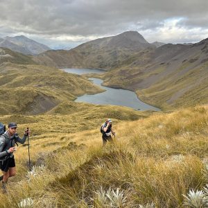
A good option is to head for the splendid isolation of the Moki-Rerekapa Loop. Previously known as the ‘Mythical Moki’, this trail in the wilds of Taranaki is a big adventure.
The two tracks enable you to complete a circuit of 45km on your mountain bike, or 30km if you perambulate and utilise vehicles along the roads between entry and exit points. Since the tracks are some 12km apart at the western end but only 3km at the eastern end, it’s easier to walk the Moki from west to east, and return via the Rerekapa with a car waiting at the track end.
Both routes are easy enough to follow, but fairly remote, rugged in parts, and likely to have some debris on them. In the wet, the mud of the farm roads can be sticky and overgrowth may keep you drenched. But elevation only once exceeds 300m.
The Moki Track (18km) traverses the Moki Conservation Area, generally following the south bank of the upper Waitara River and joining the eastern and western ends of the unformed Moki Road, which was originally a pack trail from Uruti to Tahora.
The track began as a surveyed road alignment to service the rehabilitation farms of soldiers after the First World War.
Accordingly it follows generally easy grades, and is levelled along most of its length – work done by wheelbarrows, picks, and shovels as early as 1910. Three farms were established and the remains of two homesteads can be seen near the eastern end. Land that was cleared of bush is now regenerating.
The track begins with 3.5km of gravel road and 4WD track culminating in a short but cool stock tunnel cut through a papa cliff. Shortly after, the forest, which contains good stands of tawa, kamahi and rimu, is entered. Suspension bridges span five of the deeper stream and river crossings.
A dozen or so wooden bridges also show DOC’s commitment to the track.
At the end of the moki track, turn left and head to the DOC camping ground near the start of the Rerekapa Track.
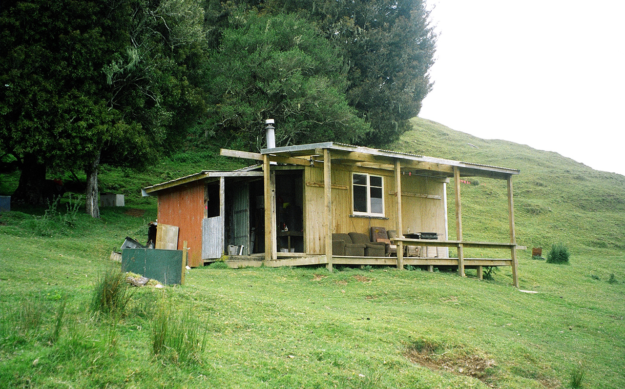
The Rerekapa Track (12km) begins by crossing Irwin farm. Follow the fence line past dilapidated buildings to a former homestead site and the 10m-high Rerekapa Falls. Beyond the boundary fence, the track winds its way to the headwaters of the Waitara River and Rerekapa Hut.
A short while after, climb through undisturbed tawa and kamahi forest to a low saddle, skirting the base of a ridge before heading down to cross Blackett Creek.
Large orange blazes guide trampers through open paddocks to Kiwi Road and the waiting cars.


34 years of inspiring New Zealanders to explore the outdoors. Don’t miss out — subscribe today.

Questions? Contact us