Longview Hut, Eastern Ruahine Forest Park

Read more from

Longview Hut. Photo: Ricky French

A poled track crosses Moorcock Stream then heads north on the true left bank through paddocks before swinging west towards the tops through regenerating scrub.

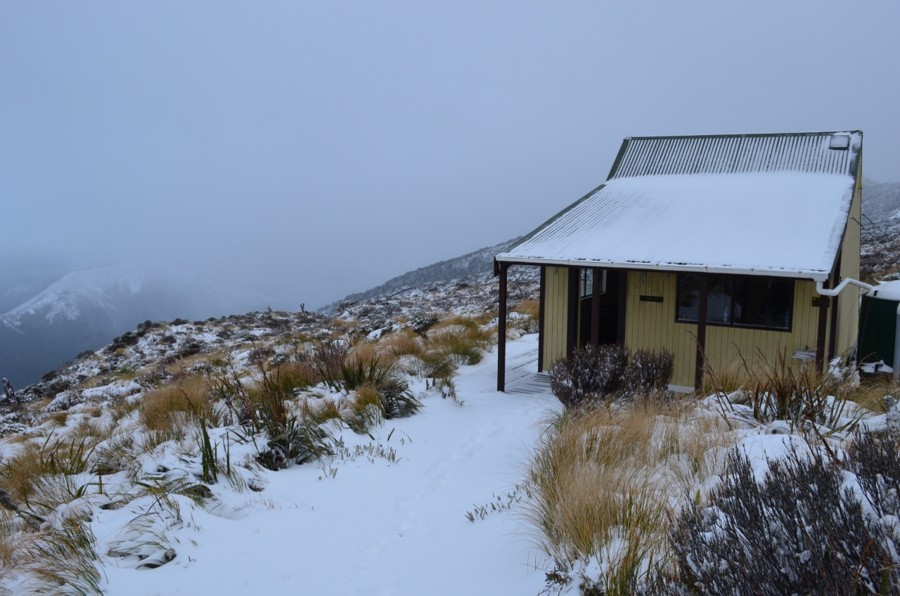
It’s about an hour to the ridge crest and track junction from the forest edge, where you turn left towards Longview Hut.

A sign indicates 30 minutes, but it can take an hour and takes in the high point: peak XIIA no. 2 at 1232m.

Distance
2.7km
Total Ascent
1232m
Grade
Easy
Area
Eastern Ruahine Forest park
Time
2-3hr
Accom.
Longview Hut (serviced, 12 bunks)
Access
Thirty minutes from Hastings on SH5, turn east onto Makaretu Road^ left into Mill Road, left into Kashmir Road
Map
BL36

GPX File

Longview Hut (gpx, 4 KB)

GPX File

Your device does not support GPX files. Please try a different device.
Alistair Hall

About the author

Alistair Hall

More From Trips

More From Trips

Similar Articles

Thanks, BCT!

DoE a great part of school life

Your trips, your pix – May 2026

Manson, Kāweka Forest Park

North Whetu Bivouac, Kaweka Forest Park

The best trip on Topo50 map BL36 – Norsewood

Trending Now

The 2026 Wilderness Outdoor Photographer of the Year competition

Otamatapaio Hut, Oteake Conservation Park

Dirt bike trial on Tongariro Northern Circuit gets approval

A majestic coastal walk

Adventurer and author Dunc Wilson

Subscribe!
Each issue of Wilderness celebrates Aotearoa’s great outdoors — written and photographed with care, not algorithms.Subscribe and help keep our wild stories alive.

Join Wilderness. You'll see more, do more and live more.

Already a subscriber?  to keep reading. Or…

34 years of inspiring New Zealanders to explore the outdoors. Don’t miss out — subscribe today.

Your subscriber-only benefits:

All this for as little as $6.75/month.

1

free articles left this month.

Already a subscriber? Login Now