Home / Trips / Westland

Hole in the Hill, Charleston

Photo: Neil Silverwood
Area
Charleston
Distance
4.2km
Total Ascent
Easy
Time
2hr return
Access
Four Mile Road is 3.5km south of Charleston. Drive down the gravel road and park on the left just before the road descends to the Nile River
Map
BS20
GPX File
Hole in the Hill West Coast (gpx, yo 19 KB)
Your device does not support GPX files. Please try a different device.

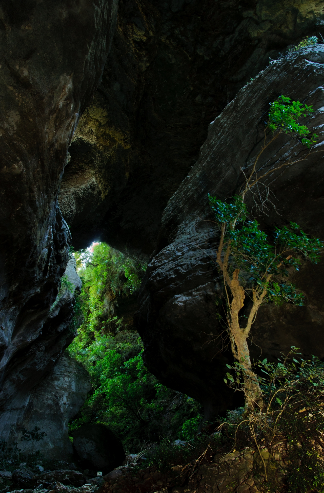
The West Coast is renowned for its dramatic karst scenery, especially its limestone arches. In the upper Oparara Basin near Karamea, tannin-stained rivers, the colour of tea, wind their way though the dense rain forest and caves. Moria’s Gate, Honeycomb and the Oparara Arches are regularly visited and photographed. There is, however, one other arch tucked away. It’s little known, seldom visited and is a long kept secret of local trampers and cavers.

The Hole in the Hill arch (known locally as Hole in the Wall) is in a rugged area of karst inland from Charleston. The land is administered by the Department of Conservation and lies between two parts of Paparoa National Park: the large, rugged, bush covered area inland from Punakaiki, and the fragment containing the Metro Cave in the south.

The trail to Hole in the Hill begins 5km down Four Mile Rd and, initially, follows a series of muddy ditches northwards (a pair of gumboots wouldn’t go amiss). Look for a vague track heading left, which is marked with reflective markers. Don’t miss it, or you will disappear into a vast area of bush and karst.

The trail descends to Makirikiri Stream and the Hole in the Hill. On either side of the track are damp, ominous looking shafts. Water trickling into the soluble limestone has dissolved the rock, leaving behind tomos. These caves can be extensive and often contain sub fossil remains of New Zealand’s extinct birds. The Hole in the Hill is grand. The arch towers over the Makirikiri Stream. It’s 15m wide and some 80m high – impressive by any standards.

Downstream from the Hole in the Hill, the Makirikiri joins the Nile River. It,s about an hour,s walk to the confluence. There are no formed trails, and you feel like you’re the first person that’s ever walked there. It is easy travel in open beech forest. Stay on the true left. From here you can head up the Nile and back to the car park (as shown on the map and GPX file). The trip is a good day out and travels through some impressive country. The area will hopefully, one day, gain the protection it deserves and be incorporated into Paparoa National Park. In the meantime, it,s nice to visit an accessible area with a wild feel and where you know you will have the place to yourself.