Home / Trips / Southland

Dusky Track, Fiordland National Park

Supper Cove was named by Captain Cook on his first voyage in 1770. Photo: Ray Salisbury
Area
Fiordland National Park
Distance
84km
Total Ascent
3828m
Time
8-10 days
Grade
Difficult
Accom.
Numerous huts
Access
Most people walk in the opposite direction to that described in this story. Both ends of the track are only accessible by boat. Some parties fly into Supper Cove by float plane or helicopter, then walk out
Map
CD06, CE05, CE06
GPX File
Dusky Track (gpx, yo 161 KB)
Your device does not support GPX files. Please try a different device.

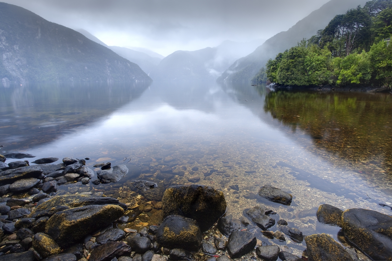
Doing the Dusky, New Zealand’s most difficult track, is not straightforward. The 84km route is about the same length as the Heaphy, but takes twice as long due to the rugged terrain.

The track can be walked in either direction – most commonly from south to north, but these notes describe the reverse.

To get started on this classic tramp, cross the 414m deep Manapouri Lake to West Arm, board a bus headed for Deep Cove at the head of Doubtful Sound, but after 10 minutes, have the driver stop at the trailhead. Follow the Spey River (which occasionally turns to knee-deep bog) to the first of 21 walk-wires. A boardwalk eventually leads to Upper Spey Hut, and then carries on until it hits the valley wall and climbs upward. A 60-degree rock step requires careful footwork to ascend, eventually, topping out into a hanging valley; a subalpine world of tussock and wild flowers.

The track meanders over Centre Pass; the sheer face of Mt Memphis, 1405m, to the left. The trail descends through a tussock basin, skirting a smattering of tiny tarns. Below the bushline, a three-metre drop requires some nerve to negotiate. Beyond this hazard, the terrain is rooted and rough underfoot.

A pair of walk-wires are crossed to reach Kintail Hut. Leaving the hut takes you past the restful reaches of Gair Loch, giving way to a track with a handrail chain

above the river. The valley widens where the Seaforth River merges into Loch Maree and Loch Maree Hut.

The track to Dusky Sound heads west from the hut down the Seaforth River, eventually reaching the northeastern corner of the sound. At low tide, it’s possible to cross the mudflat to Supper Cove Hut.

You’ll need to retrace your steps to Loch Maree Hut the next day.

From Loch Maree, there is an arduous ascent onto the Pleasant Range. It’s steep and straight up – no zigzags. At the bushline, snow poles beckon you onwards and upwards in an undulating walk through a tanrscattered landscape until the roller coaster ride drops to Furket Pass and Lake Roe Hut.

Descend into the headwaters of Hauroko Burn and enjoy the easiest section of the trail. In 3.5hr you should arrive at Halfway Hut. Easy peasy!

The final day of the walk is along the flats to Hauroko Burn Hut. Spend a night here then meet your scheduled water taxi.