I was a 12-year-old in 1990 when I set off with my uncles and cousin to tramp the Tararua Northern Crossing.
We began just east of Levin, and the trip did not get off to a good start. We followed the Ohau River, looking forward to a leisurely lunch at South Ohau Hut on the riverbank. But after sloshing upstream for more hours than expected, there was no sign of the hut. We sat down to consult the map and realised with horror that we’d missed a fork and were on the north branch of the river instead of the south. Shaking our heads at our stupidity, we trudged back to the forks then shook our heads some more. How did we miss such an obvious junction? Were we that unobservant? If only there had been some sort of marker to alert us to this critical confluence. If only someone had built a cairn…
Look around, cairns are everywhere. Marking tracks, high points and turn-offs; acting as gravestones or memorials; sometimes there for no reason at all. Assembled literally from stuff lying around, they are nature’s most natural navigation aid, and one of civilisation’s oldest constructions. Cairns have been used for centuries across countless cultures. In their purest tramping form they guide travellers along ridgelines and spurs, like a trail of breadcrumbs, and mark re-entry points for tracks on the far side of rivers or slips. They can be transient or enduring, official or casual, useful or useless. They also serve purposes not many people know about. Some even hold secrets.
No qualifications are needed to build a cairn, anyone can have a go, and in New Zealand’s mountains, they most assuredly do. Although generally built to guide those who come later, cairns can also serve a more selfish purpose. Solo climbers tackling an unfamiliar peak will often build small cairns on the way up, so they don’t lose their way on the descent should the weather turn. Tidy climbers will usually knock them over on the way down, leaving no trace.
Despite their informal appearance, DOC deems cairns a legitimate way of marking tracks and routes. DOC’s Brian Dobbie wrote the department’s Track Service Standards handbook, which states that markers (orange triangles), poles or cairns can all be used to mark tracks. Therefore, many of the cairns you see would likely have been constructed by DOC, not by trampers. As well as being quick to build and fit for purpose, bean counters in Wellington are happy – cairns being constructed entirely from materials at hand at no cost other than staff time.
While most cairns earn their place, more recently – and more controver- sially – they’ve been propagating wildly as the social media-driven craze of ‘rock stacking’ sweeps the world, and raises the ire of many. The New York Times reports that between 2016–2017 volunteers destroyed nearly 35,000 rock stacks on two mountains in Acadia National Park in Maine. In Australia, Queensland National Parks, frustrated with the proliferation of stone stacks in Cania Gorge, inland from Bundaberg, announced fines of more than $750 for ‘constructing an unauthorised structure or works in parks’. Is that a police state gone too far, or a justified punishment to deter reckless stone stackers?
Pam Haworth, a DOC ranger on the popular Mount Somers Walkway in Canterbury, says some trampers feel the need to add another stone to every cairn they see (shout out to my uncle Bruce, here), turning a simple, unobtrusive cairn into a great pyramid. Or they dismantle them, thinking the navigational cairn is just another unnecessary Instagram installation. Haworth says considerable time is spent reshaping or rebuilding cairns, and that new trampers in particular need more education about their function. She fears the craze of rock stacking – usually confined to sites close to roadsides – may be entering the world of tramping, especially with its surge in popularity since the pandemic. “People see a small cairn on a track and think it’s the beginning of something,” Haworth says. “They should understand that cairns are not there for decoration. They’re there for a purpose.”
An older purpose of cairns might surprise you. Long before hut books, cairns often served a similar role as a sort of intentions book, a place to leave a record of your visit. One in particular, on a mountain top in the Ruahine Ranges, has helped a local family unpack a history of early Ruahine tramping going back 130 years.
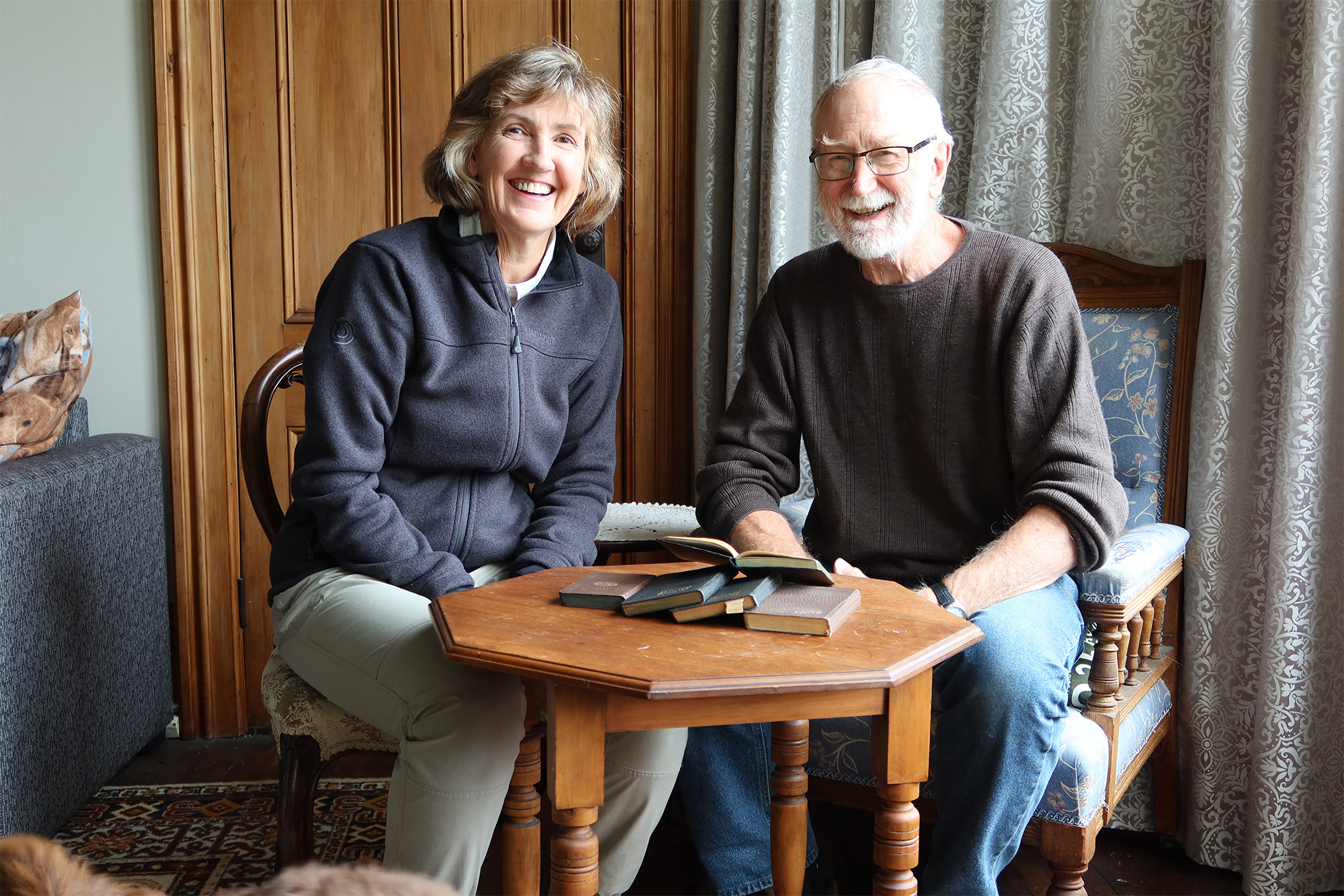
In 1936 a tramping party completed a full-length traverse of the Ruahine Range. It was a feat so intrepid it made the local newspaper, which reported the party finding an old tin hidden in a cairn on top of the high peak Rangioteatua. Inside were handwritten notes, with names and dates going back to the 1890s. One of the names was Bruce Bibby, dated 1922, from a tramp he did with brothers Hugh and Basil. Claire Bibby, a relative, recently found the newspaper article. She knew that her grandfather and great uncles had been pioneering Ruahine trampers, but she didn’t know about this tramp. Her interest piqued, she dug out old family diaries and found that Hugh and Bruce had kept meticulous notes of that tramp. In his diary, Hugh writes of finding a cairn containing a rusty tin with wet papers inside. Written on the papers were names and dates. Two names in particular caught their eye: those of their own father James Bibby (Claire’s great-grandfather) and their uncle Tom, proving they had been on the same peak in 1893. Hugh wrote that they replaced the leaky tin with a new one, popped the note back and added a new note with his own name and date.
As a history lover from a long line of trampers, Claire Bibby was astounded that one cairn could be the receptacle of so much valuable information. “To find out not only these three young brothers had done this epic tramp in 1922 and recorded their names in a cairn, but that they were following in the footsteps of their father and uncle, was just amazing. It’s part of the history of both my family and the Ruahine Ranges.”
For many years Bibby was involved with land search and rescue. She says cairns were always checked by searchers, in case they contained notes. She remembers her father leaving their names in a cairn near Armstrong Saddle (near the present-day Sunrise Hut) on a family tramp in the early 1970s. “It was a common thing to fossick in the bottom of the cairn for a tin, then sign and date the paper, as a record to show you’d been there.”
Bibby is now planning another tramp, this time to Rangioteatua, to visit the cairn and check if maybe, just maybe, that old tin bearing her great-grandfather’s name is still there. “It’s a long shot,” she says, “but just seeing that cairn will be special.” If she gets there, you can be sure she’ll leave a note.
The Bibby family story bears an uncanny resemblance to a famous fictional scene. In the 1931 children’s adventure book Swallowdale, by Arthur Ransome, the children protagonists climb a mountain called ‘Kanchenjunga’. In the cairn on the summit they discover a biscuit tin containing a note left by their parents and uncle 30 years earlier, possibly the first and only time a cairn has been used as a plot device in literature. Not incidentally, ‘Kanchenjunga’ was based on a real peak (or ‘fell’) in England’s Lake District, called The Old Man of Coniston, which indeed does bear a remarkable cairn, built on a hefty pile of slate foundations. The stories it could tell…
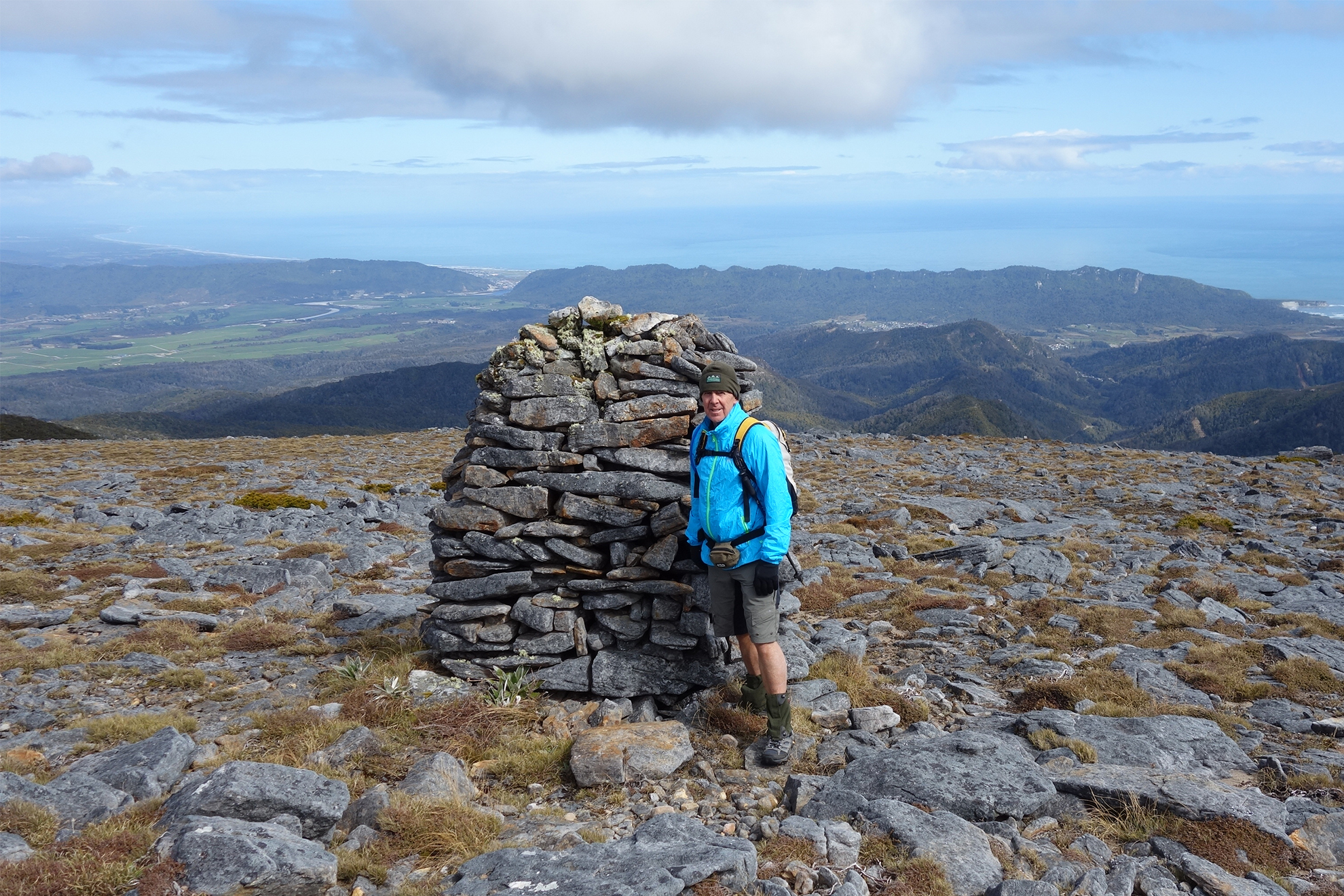
The prize for New Zealand’s most impressive (and impeccably moulded) cairns must surely go to the colossus constructions that mark the route of the Coolgardie Track near Mount Davy, at the southern end of the Paparoa Range on the South Island’s West Coast. They have a distinctive ‘beehive’ shape and stand sentinel, around two metres tall, atop the exposed ridges and rock escarpments between Brunner and Blackball. Their exact provenance is uncertain, but they likely date back to the gold and coal mining days of the 19th century, when prospectors and local councils were opening up tracks to link towns and mines. In another quirky feature, lines of stones define the edges of the track between the cairns, much like runway lights, so travellers don’t drift off route in the low cloud that commonly harangues the ranges.
Hokitika tramper and former NZ Forest Service ranger Glenn Johnston has been a long-time admirer of these beehive cairns, not only for their historical significance but for their unmissable presence. “They’re unique in style in New Zealand, although similar ones exist on the English moors. Their shape makes them less prone to weathering by the elements. They were built to last, and they have.”
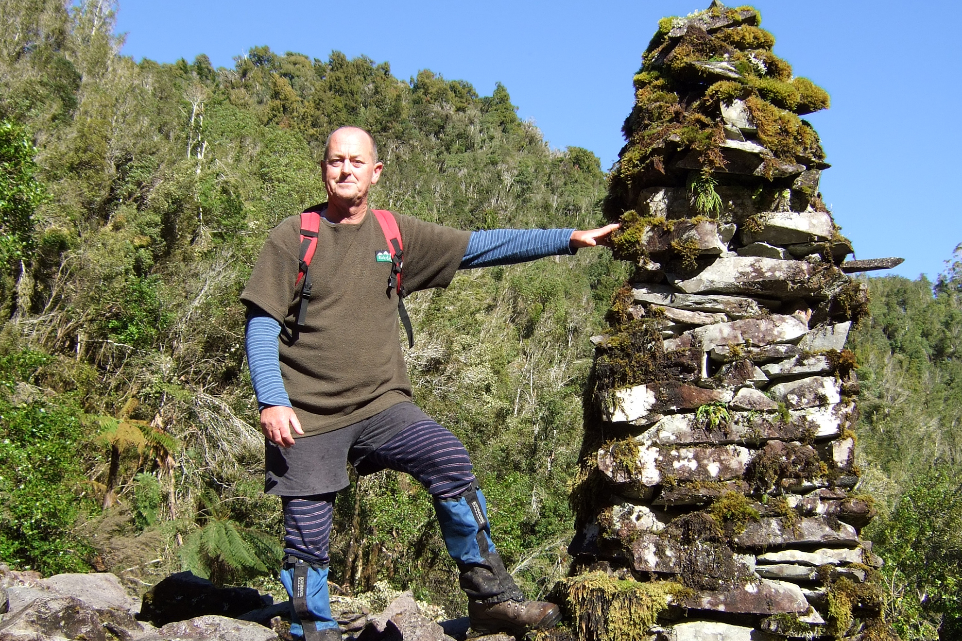
They have nearby competition, though. Just off the Moonlight Pack Track, north of Blackball, stands a cairn taller – if somewhat slimmer – than the beehives cairns, enshrouded in moss and mystery. “It’s built from the tailings of old gold workings,” says Johnston. “But no one seems to know its history, or why it’s there. It’s a bit of a mystery.”
One of New Zealand’s most historic cairns is still standing today, although it’s poorly known. Ten years ago author and tramping doyen Geoff Spearpoint was working as a guide for the TVNZ television series First Crossings, which recreated pioneering New Zealand adventures. This particular episode followed in the footsteps of explorer Charles Douglas and surveyor Gerhard Mueller, who in 1885 completed a mapping reconnaissance mission in the Arawhata Valley in the present-day Mount Aspiring National Park. Cairns were often built to mark trig points, and the map Mueller created from the 1885 trip showed a cairn the party built on an unnamed bump on the remote Oli-vine Range. When Spearpoint and crew members went to the spot, they discovered the cairn, still there, overlooking the braided river valley where few trampers venture. “It’s got no relevance for travel today,” says Spearpoint. “But it’s got huge historical significance.”
Spearpoint says that cairns as a navigation tool remain a crucial part of backcountry infrastructure, especially in remote areas. He sees them as an unintrusive, empathetic adornment to the backcountry, constructed from the landscape itself and returned to the landscape when no longer needed. That ephemeral nature can be a blessing or a curse, though, and he points out that sometimes cairns can send you the wrong way.
“People like to be helpful in the hills,” says Spearpoint, “so they build a cairn to help the next person. But sometimes they miss the main track’s position.”
A good example is at the head of the Dart Valley, on the popular Cascade Saddle Track in Mt Aspiring National Park, where the moraine walls of the valley are constantly shifting and slumping, year by year, altering the best route down from the saddle.
“People would build new cairn lines every year,” says Spearpoint, “and there would be old cairns littered all over the place. Some could lead you astray in a big way.” He says park rangers had recognised the problem, and came in early in the summer season to dismantle the unhelpful cairns and re-cairn a new route for that season.
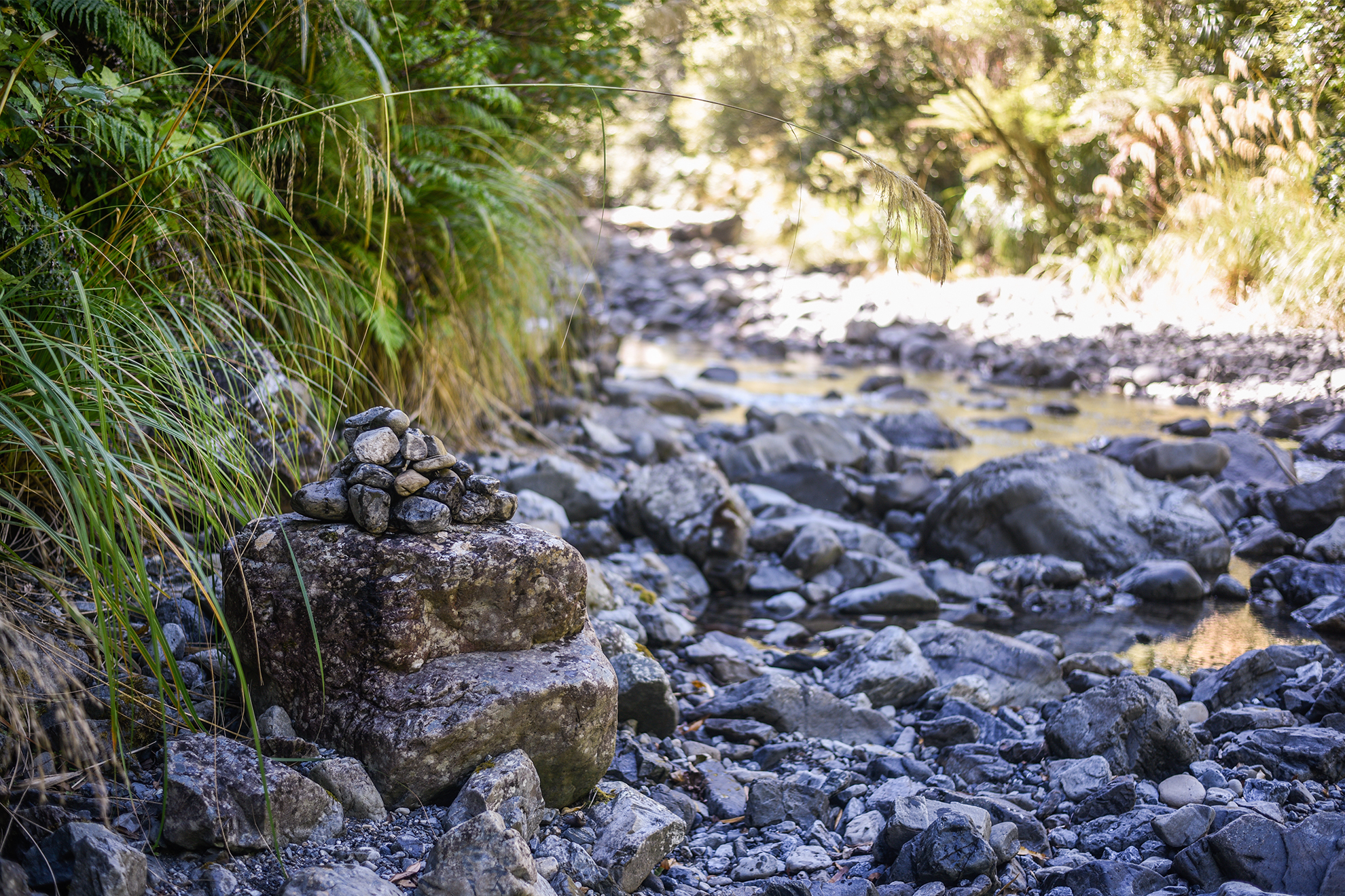
I had some unfinished cairn business to attend to. In January this year I returned to the Ohau River and once again took the north branch, but this time on purpose. I was tramping with a family group spanning three generations, including uncle Bruce and cousin Zoe who were with me on the Northern Crossing tramp with the memorable false start, 30 years ago. We stayed at North Ohau Hut, which didn’t exist back then, and the next day sloshed back down the river to the junction with the South Ohau. I shook my head again, wondering how we could have been so stupid to miss the obvious forks. Then, on top of a large, flat rock on the edge of the river, I built a cairn. It was more symbolic than useful, and sure to be washed away in the next flood, but it felt fitting, maybe even therapeutic. Cairns as closure.