
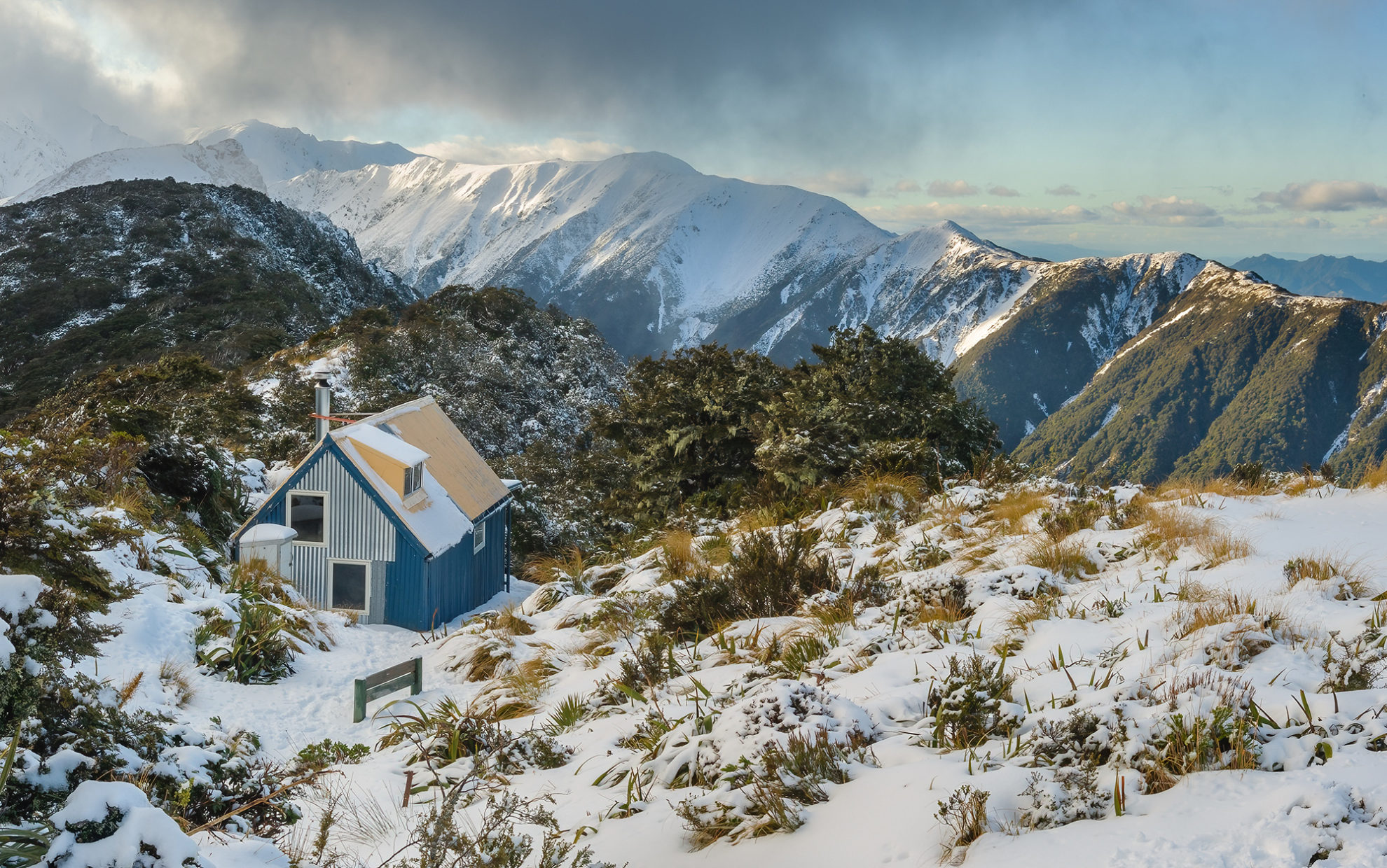
Crosbies Hut
Coromandel Forest Park
Location Waikato
Time 2 days
Grade Easy
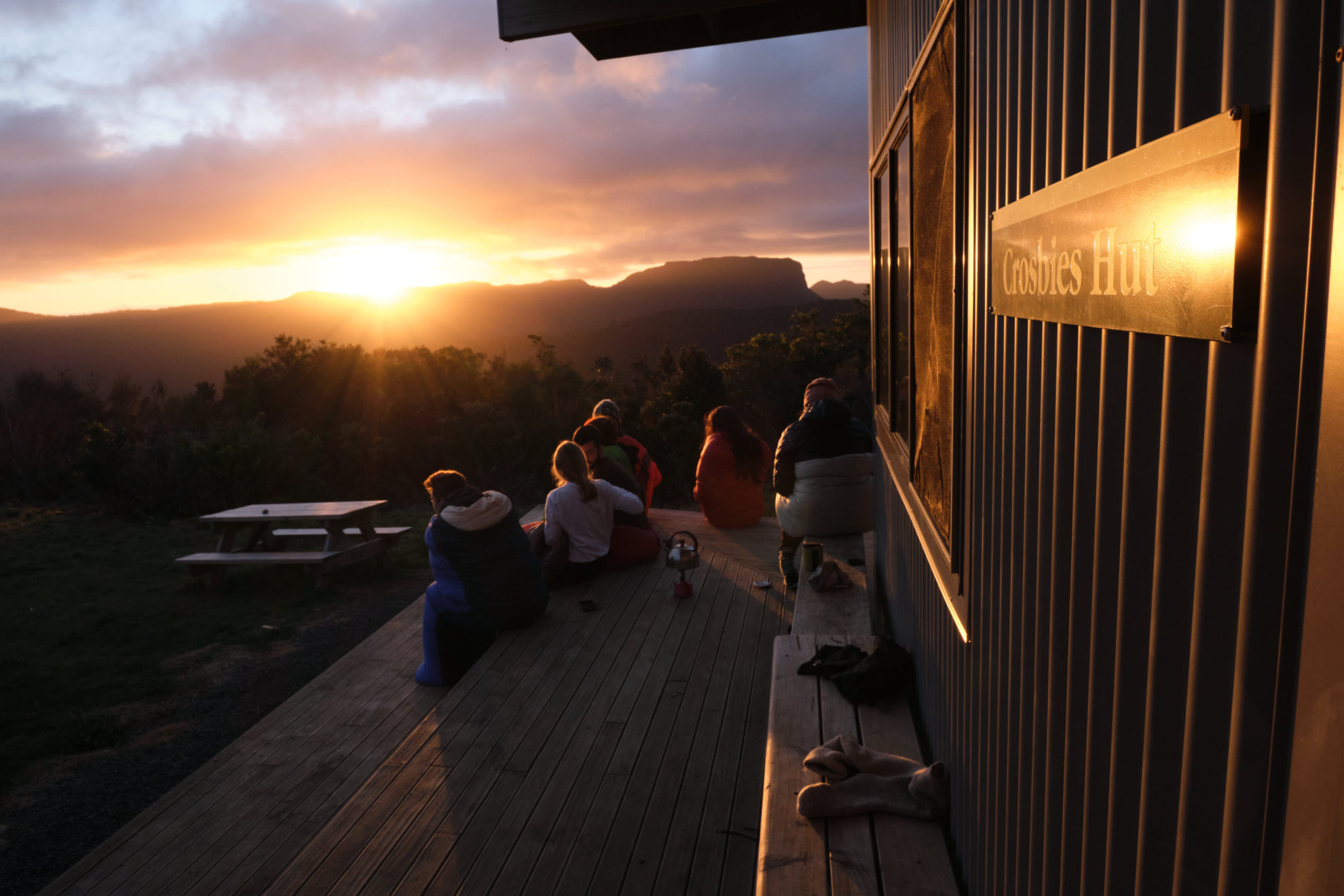
The best hut in Coromandel Forest Park isn’t found on the Pinnacles Track; it’s not even close. When you stumble into Crosbies Settlement clearing, it’s like arriving on the front lawn of a trendy family bach, such is the architecture of the modern 10-bunker. Situated in a historic clearing – farmed by a family of hardy Scots in the mid-19th century – the hut looks down the barrel of a valley to the twinkling lights of Whitianga. It can be reached by several tracks (some remain affected by kauri dieback closures), though a good option is a loop from Thames, via the Waiotahi and Karaka tracks. The Waiotahi is a wide all-weather track that climbs steadily from an access road behind town and offers a few pleasant views over the Firth of Thames. The Karaka Track is more challenging but offers more interest: a decent swimming hole, abandoned mines and rusty red rock outcrops overlooking kauri forest.
– Matthew Cattin
North–South Track (Kaimai Ridgeway)
Kaimai-Mamaku Conservation Park
Location Bay of Plenty
Time 5–7 days
Grade Moderate
The Kaimai Range dominates the skyline and divides the plains of the Waikato from the Bay of Plenty. The mountains are volcanic in origin, rugged in places, heavily forested, and were the subject of controversy in the 1970s when conservationists fought Forest Service plans to mill native trees. Conservationists wanted a national park, but the Forest Service instead created a forest park.
In recent years, the Kaimai Ridgeway Trust has undertaken a significant upgrade to the old North–South route that spans the length of the range. They’ve done up old huts and built a new one called Te Whare Okioki. The trust’s work is not yet complete but it has made possible one of the region’s few multi-day tramps. It’s still a challenging route with some long and rugged sections but trampers can choose to tackle sections between road ends.
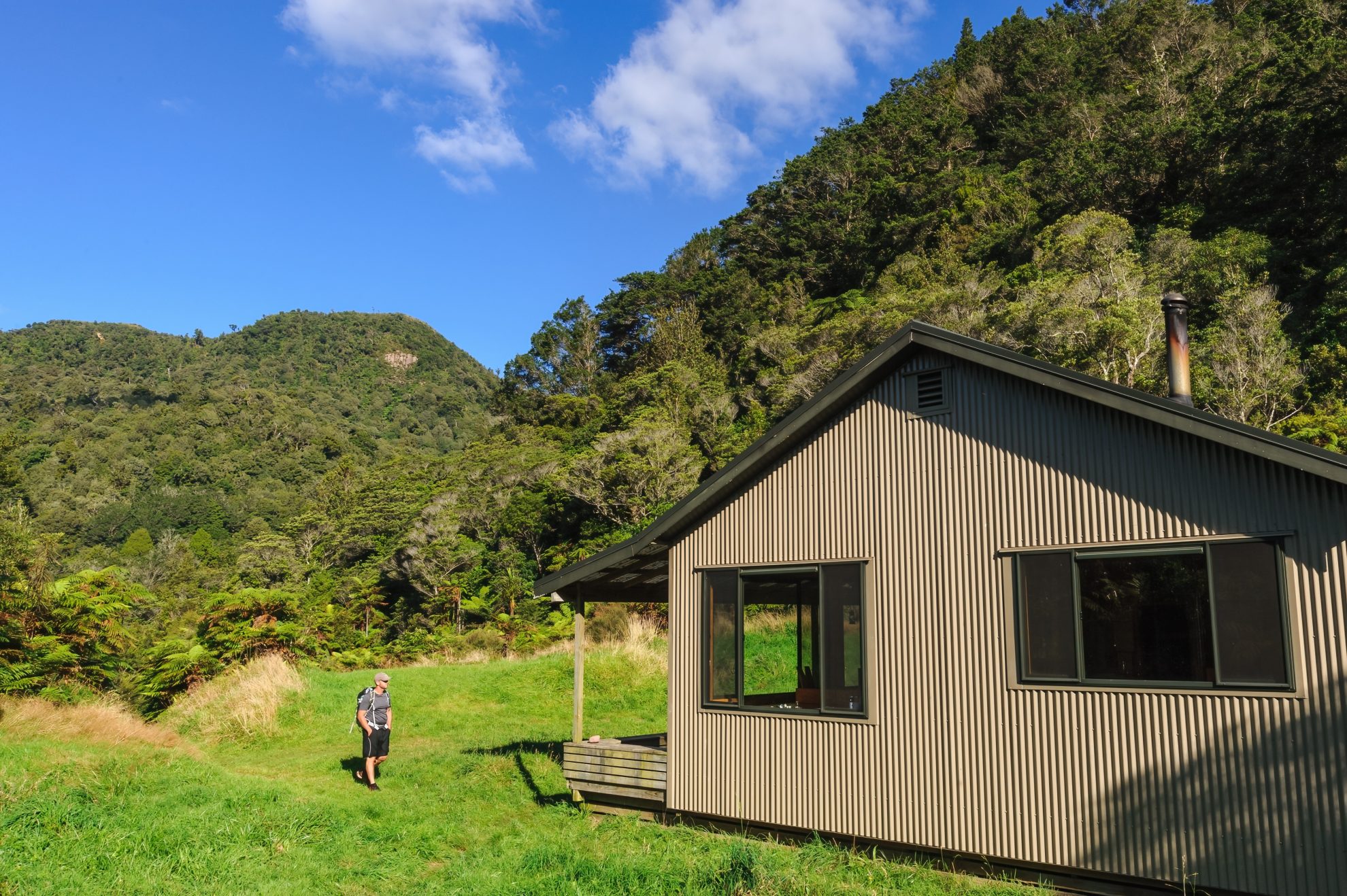
The Waitawheta Valley makes an excellent start, following a historic logging trail, with plenty of restored relics, to the comfortable Waitawheta Hut (26 bunks) for the first night’s accommodation. Beyond, the track becomes a tramping route, linking several huts: Te Rereahukahika, Motutapere, Kauritatahi, Te Whare Okioki and Hurunui.
Check out the Kaimai Ridgeway Trust’s website for a detailed route guide: www.kaimairidgeway.nz
– SB
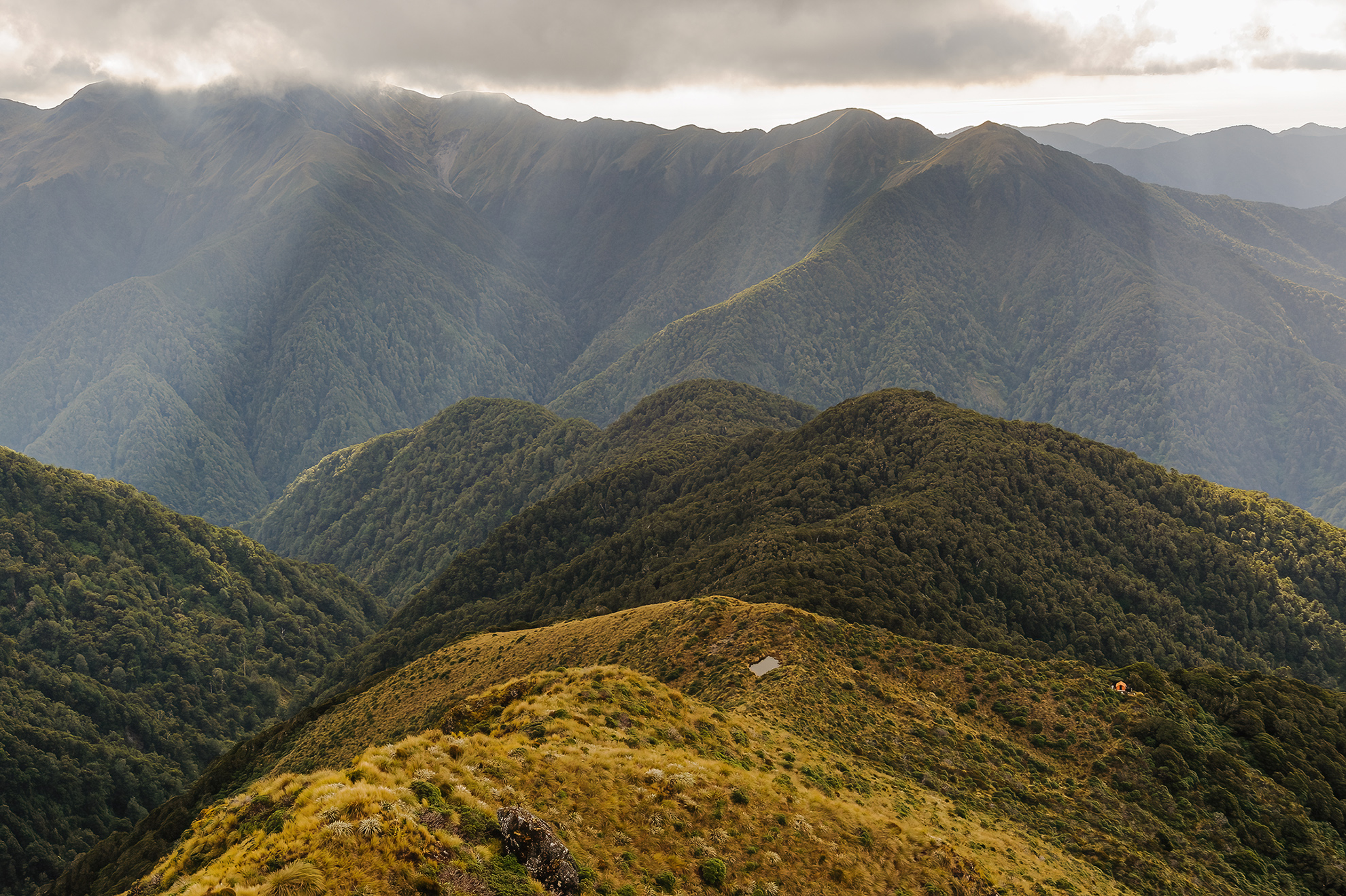
Mangamate Loop
Whirinaki Forest Park
Location Bay of Plenty
Time 3 days
Grade Moderate
Whirinaki Forest is a living embodiment of the fairytale woods in childhood stories. The looming and ancient podocarps stand like giants, and around every corner is the chance of stumbling into something wild – a startled deer, whistling whio or a pool of trout.
The Mangamate Loop is a perfect immersion into the park, offering a mix of easy and moderate tramping and many kilometres in waterlogged boots.
The route takes in the ethereal Te Whāiti-Nui-a-Toi Canyon in the first 10 minutes before leaving the well-trodden day walk for the gentle Lower Whirinaki Track. Central Whirinaki Hut is reached within five hours. It’s nestled in a serene clearing within earshot of the river and is a great spot to listen for calling kiwi at dusk.
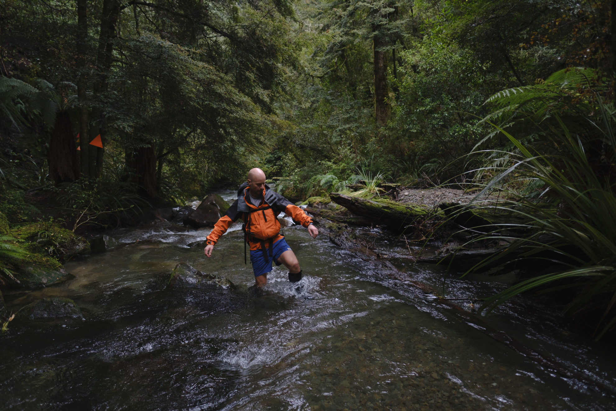
Bid adieu to dry boots on day two, which descends into the river for a deeper wilderness experience. As a short day (8.2km), it’s worth diverting to Upper Central Whirinaki Hut for a loop that takes in large caves (marked on the topo map) and a stunning – though tricky – river section. Mangamate Hut is tired – and a little ratty – but provides pleasant views down the valley.
On the final day the track descends to Mangamate Stream and the best river walking of the loop. Watch out for the fierce nettle ongaonga, which lines the banks, and also for whio, which are likely to be spotted.
– Matthew Cattin
Tauranga Taupō Gorge
Kaimanawa Forest Park Location Central
Location North Island
Time Two days
Grade Easy–moderate
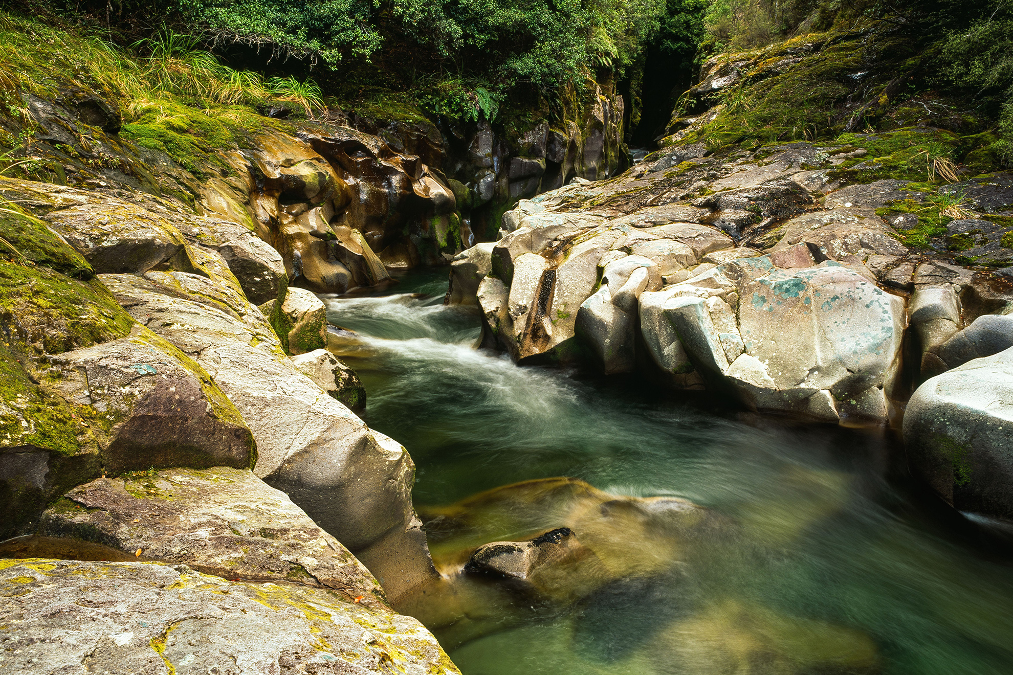
The Kaimanawa mountains lie between the volcanoes of Tongariro and the Kaweka Range. Defining features of the Kaimanawa Forest Park are the exquisite ignimbrite gorges, and this one, in the headwaters of the Tauranga Taupō River, is possibly the best.
From the campsite at the end of Clements Mill Road, a track leads up Hinemaiaia Stream, its own small gorges hinting at the marvels ahead. A solid climb up a forested ridge leads to 1240m before the track descends to the Tauranga Taupō River, where flat travel leads to Cascade Hut, renovated in 2021. From the hut, 10 minutes up the Tauranga Taupō River leads to the edge of a narrow gorge where stunning brown vaults of ignimbrite, festooned with moss, close in on either side of the cascading river. There are whio in the nearby river and more interesting rapids in the tributary Cascade Stream.
– SB
– SB
Longview–Howletts tops
Ruahine Forest Park
Location Hawke’s Bay
Time 3 days
Grade Moderate–difficult
There’s a huge number of huts and bivouacs in the Ruahine Range, many superbly located but few matching the charm of Howletts Hut and its stunning position on Daphne Ridge.
This tramp begins from Kashmir Road and the marked track climbs to a bush ridge before a long descent to the Tukituki River. Daphne Hut (eight bunks) lies a short distance upstream and requires a few fords, which can be challenging when the river is up. Daphne Spur is a gut-buster of a climb up an unrelentingly steep track, so spare a thought for the members of the Ruahine and Heretaunga Tramping Club who carried materials for the hut up here in the 1940s. The existing Howletts Hut (12 bunks) is the second on site, completed in 1978. Its attractive steep gabled roof and orange-blue colour give it a distinctive appearance.
The next day involves an open tramp along well-poled but rugged tops following Daphne Ridge to just beyond Taumatataua (1415m), where a descent through subalpine scrub leads onto more open terrain and the summit of Otumore (1519m). A solid descent leads to Pohangina Saddle, and Longview Hut a short distance later. The last day is a short tramp back to Kashmir Road.
– SB
– S
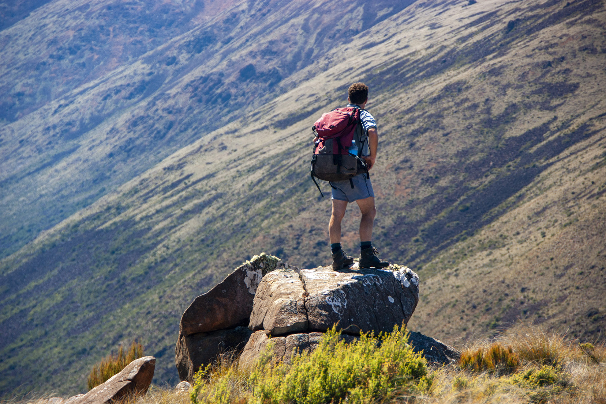
Broken Axe Pinnacles
Tararua Forest Park
Location Wellington
Time 3 days
Grade Difficult
Māori adzes found on the tops of the Tararua Range provide evidence that Māori travelled over these rugged mountains. One such broken adze was discovered by Harry Holmes late in the 1800s at a location known ever since as the Broken Axe Pinnacles. It’s rugged terrain, with a very steep section on the north pinnacle.
From the popular Holdsworth Road end, this tramp begins up the well-trodden Atiwhakatu Valley and climbs to Jumbo Hut. Poles lead to the summit of Jumbo / Pukeahurangi (1405m) then it’s off the beaten path onto unmarked tops. Past a few tarns, the route swings northwest and onto Angle Knob (1510m). Past more tarns, a signpost indicates the route down to the small but cosy McGregor Biv, which has commanding views over the Waiohine Valley and Tararua interior.
The second day starts with a climb back to the ridge crest and then a traverse over McGregor (1540m) to the Broken Axe Pinnacles. These days, an alternative marked route sidles around the eastern side of the pinnacles, avoiding the steepest section.
Beyond, easier travel leads past a tarn to South King and the descent route over Baldy. The Baldy Track heads down a steep spur to intercept with Barton Track, which leads towards the Atiwhakatu. Many a tramper has cursed the up-and-down nature of this route, but once the nicely graded Atiwhakatu Track is reached, travel improves vastly. The reward is completing a satisfying and challenging circuit, imbued with Tararua folklore.
– SB
Harper Pass
Lake Sumner Forest Park
Location Canterbury
Time 4–5 days
Grade Moderate
The ancient Māori pounamu trail over Hurunui Saddle (962m) was renamed after Leonard Harper in 1857. Four Māori from Kaiapoi guided Leonard and Edwin Lock over the route in an expedition that lasted three weeks.
Prospectors from Canterbury used Harper Pass before a more direct way to the coast was found over Arthur’s Pass. Today, you are likely to encounter Te Araroa Trail walkers on the track.
Beginning at Windy Point on the Lewis Pass Highway (SH7), an impressive swingbridge over the Boyle River leads to the open expanses of Hope Valley. Beyond Hope-Kiwi Lodge, there’s a low saddle before beautiful Lake Sumner, lined with red beech forest. Here, in the Hurunui catchment, are the attractions of plenty of huts, a few hot springs, and easy walking on the grassy river flats.
If the forecast is favourable, cross over Nōti Taramakau through dracophyllum scrub into the Taramakau River watershed, which is rocky underfoot with rātā and rimu overhead. This gnarly river demands respect and needs to be crossed with care, as does the Ōtira River, before reaching SH73. It may be prudent to begin on the West Coast side of The Divide in fine weather.
– Ray Salisbury
Tautuku Hut
Catlins Rainforest Conservation Park
Location Otago
Time 2 days
Grade Easy
Tucked far away from SH1 along the Southern Scenic Route is one of New Zealand’s most under-appreciated regions, the Catlins. Nowhere else in the country do long sandy beaches sit empty next to lush primaeval rainforest. These rainforests are protected by the 53,000ha conservation park.
For fans of short walks there is a multitude of impressive water-worn features, such as McLean Falls, the Catlins River Track or Tautuku Beach.
For those looking to spend a night, Tautuku Hut is an enjoyable escape. It’s accessed from the McLean Falls car park and the track is suitable for all levels. It meanders under the rainforest for 3.5km to the hut.
It’s been renovated by Permalat Southland and the new deck is an ideal place to soak in the surrounding bush on long summer nights.
– SH
Snowy Gorge
Ahuriri Conservation Park
Location Canterbury
Time 2 days
Grade Easy-difficult
The windswept tussock and open terrain of the Ahuriri Valley can epitomise the beauty and grandeur of the South Island high country. This overnighter will give trampers a taste of the area and its history. It includes two huts, one dating from the late nineteenth century and the other the mid-twentieth.
From Birchwood Road, ford the Ahuriri (only possible in low to average flow) and tramp wide tussock flats towards a whaleback-shaped mound (1254m), around the north end of which bends Snowy Gorge Creek. At the base of the whaleback, the track goes past a small lake and towards a rocky and scrubby face, below which is tucked historic Hideaway Biv. Built in the 1890s (and then called Camp Creek), the hut was faithfully restored in 2005.
Northwest of the hut it’s a gentle climb onto open tops towards Pt1115, rising steadily above Snowy Creek Gorge on an unmarked route, then over Pt1622 and down to a prominent saddle at about the 1500m contour. Here, angle down across scree and boulder slopes, through prickly subalpine plants, into the great open basin at the head of Snowy Gorge Creek. The five-bunk Snowy Gorge Hut is basic but comfortable, with the serrated summits of Mt St Mary (2337m) and Mt Stafford (2208m) towering above.
After a night at the hut, head downstream. Travel is easiest on the true right, using old river terraces above the creek to avoid gorges. The inward route is joined at the base of the whaleback.
– SB
Mt Fyffe–Kōwhai Circuit
Ka Whata Tu O Rakihouia Conservation Park
Location Canterbury
Time 2-3 days
Grade Moderate-difficult
This Conservation Park straddles the Seaward Kaikōura Range, encompassing some 88,000ha. The mountains are high and relatively dry, characterised by steep slopes, scree, shrublands and some distinctive native plants and animals, including Hutton’s shearwater, which breeds only here.
The area’s most accessible tramping circuit traverses Mt Fyffe, a prominent landmark near Kaikōura. From the end of Postmans Road, a steep vehicle track (shared with mountain bikers) climbs through forest, then shrublands and finally open tops to reach Mt Fyffe Hut at 1103m. Beyond, the route climbs through exotic wildling pines and onto the summit of Mt Fyffe (1602m). It has views eastwards over the Kaikōura Peninsula, and westwards towards the high ramparts of the Seaward Kaikōura Range.
Following the ridge crest north and traversing minor summits, including Gable and Gables End, leads to a steep descent to Kōwhai Saddle. A rough route through shrubs descends into the head of the Kōwhai River. Follow this downriver (no track) to the six-bunk Kōwhai Hut. Downstream, a track on the true left bank leads to a junction with Spaniard Spur Track (an escape route back to Mt Fyffe Hut in case the Kōwhai River is high). Beyond, travel is in the riverbed, through a small but negotiable gorge, and eventually to the car park.
– SB
Red Hills
Mt Richmond Forest Park
Location Nelson
Time 2 days
Grade Easy
Here’s an overnight trip, 10km from St Arnaud, that provides a moderate physical workout, a modern hut, interesting geology and breathtaking views of nearby mountain ranges.
From Six Mile Creek in the Wairau Valley, an access track sidles for 20min to an old cobb cottage on Rainbow Station. From here, sidle up a 4WD road to six-bunk Red Hills Hut, sited on an expansive grassy clearing (910m).
Behind the hut there’s a faint ground trail to follow before it peters out in tussock and low dracophyllum scrub. Occasional cairns then lead to a broad, rocky knob featuring a trig station (1131m) and a panoramic mountainscape. Across the Wairau Valley is the rugged Raglan Range, and the snow-crested Southern Alps rise above Nelson Lakes nearby.
Beyond the trig is an expansive tussock plateau. Look out for myriad small tarns and concealed bog holes. At the far end, some 2km further, you’ll be gazing into the dry, barren headwaters of the Motueka River’s south branch. Towering above are the craggy tops of Red Hill (1791m), the highest point in Mt Richmond Forest Park. The terrain is ultramafic rock, toxic to plant life and therefore devoid of vegetation.
This delightful alpine upland features peculiar geology and is a welcome alternative to tramping through bush.
– RS
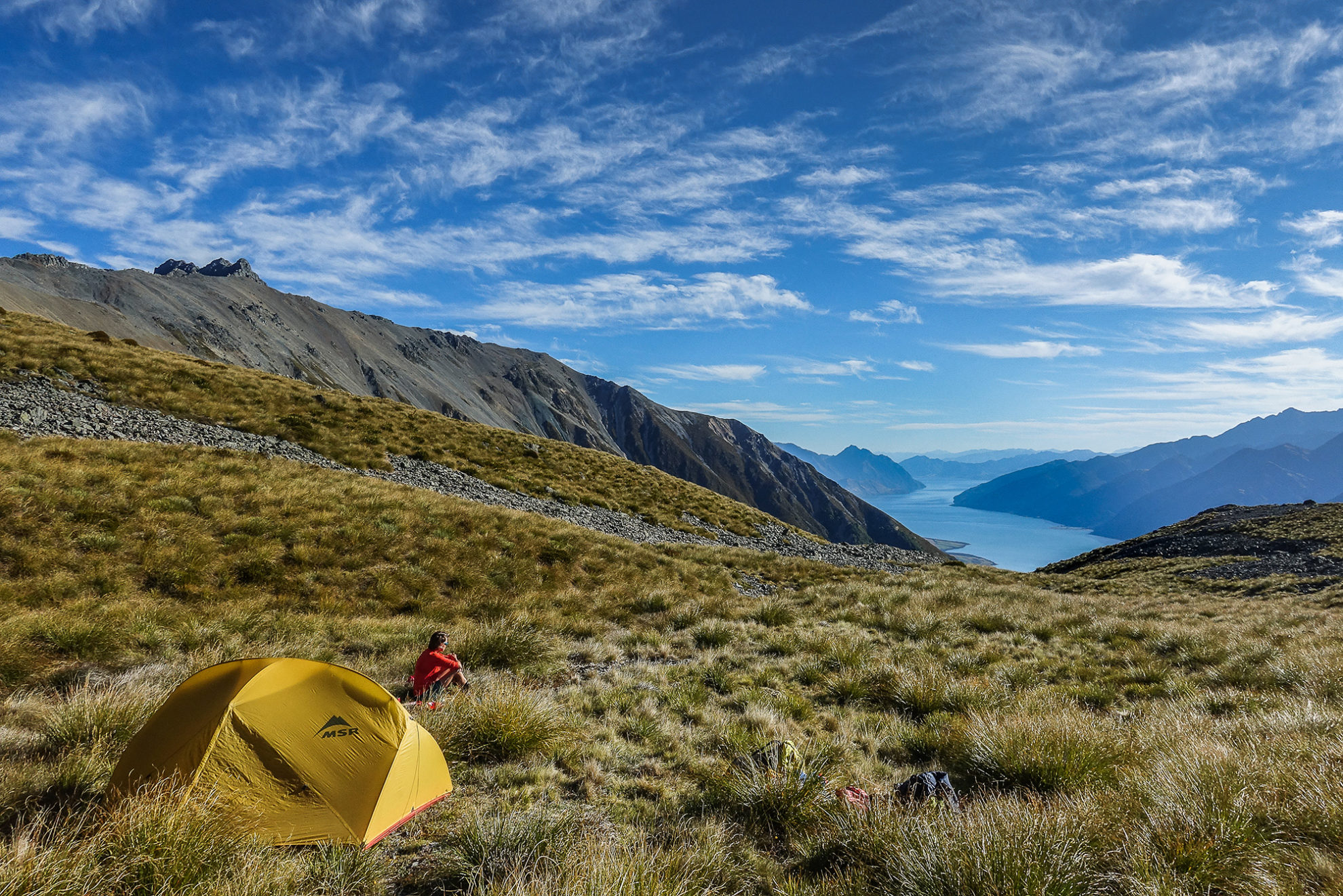
Upper Dingle Burn circuit
Hāwea Conservation Park
Location Otago
Time 3–4 days
Grade Difficult
Hāwea Conservation Park covers 105,000ha of rugged mountain ranges and valleys to the north and east of Lake Hāwea. A trip into the head of the Dingle Burn, an eastern tributary of Lake Hāwea, is a good introduction to the area. The best access is from the Ahuriri Valley, where an easy zig-zag track crosses over a low ridge to Top Dingle Hut.
There’s a track leading down valley from the hut, but if you like scrambling high ridges and enjoy off-track travel and navigation, a spectacular 3–4 day loop traverses high over the Huxley Range to a tarn at the head of the Dingle Burn.
An old cullers’ route is followed up the valley opposite the hut onto the Huxley Range, where there are expansive views to Lake Hāwea and across the Hunter Valley to the McKerrow Range. A good head for heights is required whilst sidling screes high above the Hunter Valley. The terrain is steep, and the way is up through gullies and around rocky outcrops to the top of Celtic Peak (2198m). More gentle slopes then lead to the tarn perched under Highlander Peak.
A shorter option for an overnight trip is to head straight up the Dingle Burn to the tarn where there are good campsites.
– Jo Stilwell
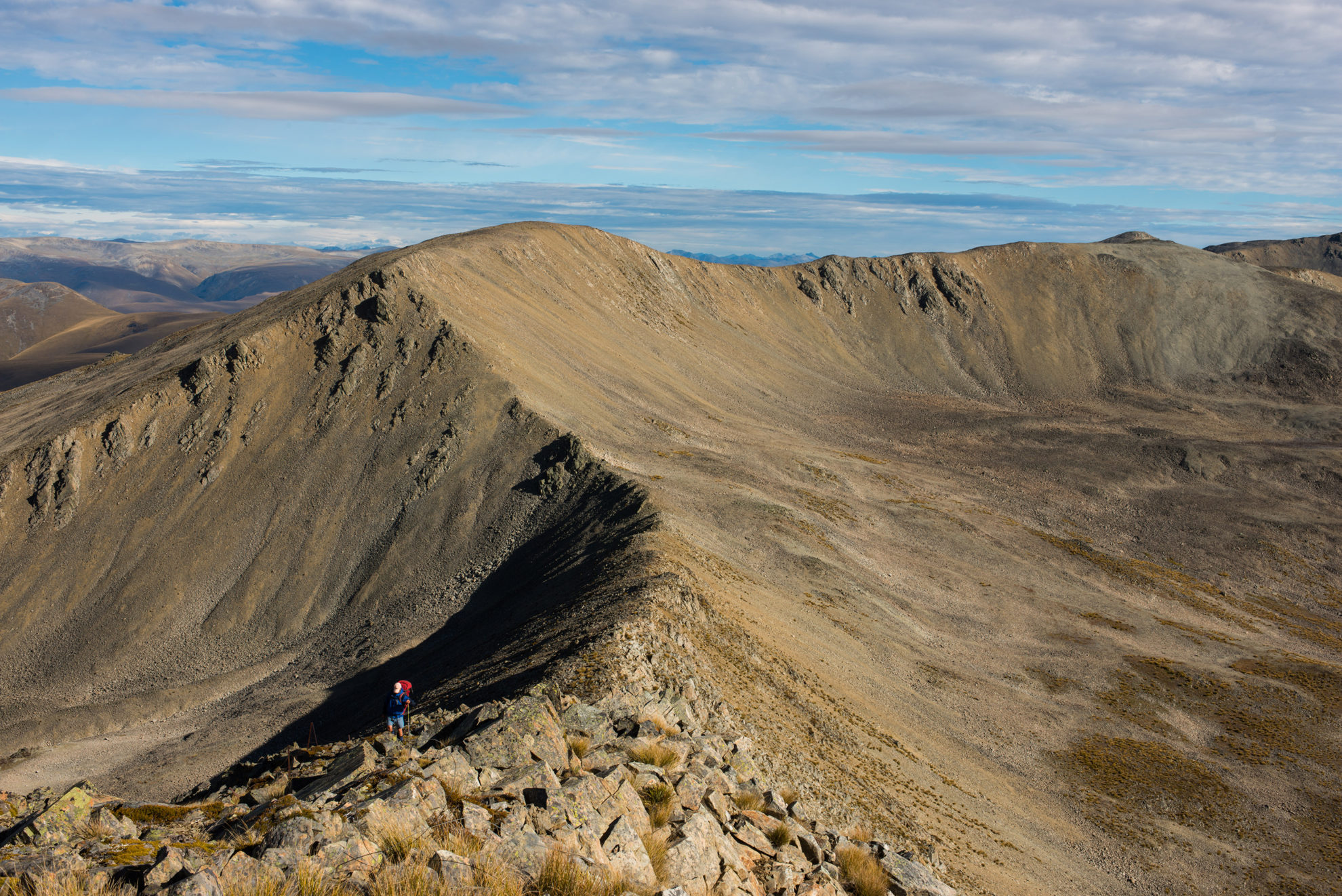
Klondyke Valley
Victoria Forest Park
Location West Coast
Time 3 days
Grade Difficult
Victoria is the largest of the forest parks, encompassing 206,000ha of granite mountains, beech forests and steep rivers. It’s also one of the least developed, with only a dozen huts and comparatively few tracks.
This is a rugged three-day circuit that takes advantage of tracks in the Klondyke and Lake Stream Valleys, and traverses a challenging section of tops between the two. Good navigational ability is required, as is a head for heights, and the right weather. (Alternatively, Lake Stream Hut makes a good overnight destination, as do the superb tarns at the head of the Klondyke.)
The track begins at Rahu Saddle on SH7 east of Reefton. The Klondyke Valley Track climbs up the Rahu River Right Branch, occasionally fording the river and eventually emerging above the bushline into a two-tiered basin, both with tarns. The bottom tier is more sheltered; the top more scenic.
Beyond the head of the basin, climb onto the ridge crest to Pt1531. North of here the ridge narrows, offering exhilarating but exacting tramping, sometimes sidling to avoid steep sections, and always with angular granite jumbles to negotiate. Mt Blackadder (1556m) is named not after the character famously played by Rowan Atkinson but a local Springs Junction family. North of Pt1472 are glimpses of the lake in Lake Stream, but don’t head directly down as this route has challenging bluffs. Instead, continue onto the saddle south of Pt1456 and then angle into the valley head.
Lake Stream Hut is a basic two-bunk bivouac. The Lake Stream route is a marked track that crisscrosses the stream, passing through exquisite beech forest, to end again at SH7.
– SB
Hawkdun Range
Oteake Conservation Park
Location Otago
Time 3–4 days
Grade Moderate–difficult
South of Ōmarama is a stunning treeless alpine environment where high, rounded ridgetops reaching 2100m predominate, wide gulfs of mountain valleys separate the ranges, and a few small huts are dotted about at major river forks. This is Oteake Conservation Park, once the preserve of musterers, their dogs and horses, and fenced for mile after mile along the ridge crests with steel standards and number-8 wire. It is now a playground for four-wheel drivers, mountain bikers and a few trampers.
An interesting traverse of much of the Hawkdun Range can be made from Little Ōmarama Saddle in the north. Heading east from there onto the range (a steep climb) and then south along the range crest and over innumerable unnamed 1800m summits to reach a suitable spur, perhaps at Pt1834, to descend to the Manuherikia River. Follow this upstream on 4WD trails into Camp Creek and on to Little Ōmarama Saddle. The saddle is best reached by 4WD or mountain bike from Broken Hut Road and the access road onto the saddle.
There are several tarn-filled basins on the Hawkdun’s eastern aspects in which to camp. There are no huts on this circuit.
– Pat Barrett
Kāweka Walkabout
Kāweka Forest Park
Location Hawke’s Bay
Time 4–5 days
Grade Moderate
Ragged ranges, steep terrain, mountain beech forest, several huts and the mighty Ngaruroro River feature on this appealing circuit. It’s an ideal introduction to the Kāweka Range for those with moderate fitness.
Beginning from Makahu Saddle, tramp up Makahu Spur past Dominie Biv to reach the area’s highest summit, Kāweka J (1724m) – marked by a significant rock cairn dedicated to soldiers who lost their lives in World War Two. On a good day there are views across the Kaimanawa Ranges to the distant Tongariro volcanoes. A poled route leads eastwards to Back Ridge Hut, a four-bunker set beside a babbling stream at the bush edge.
On the second day the track follows bush ridges, past Back Ridge Biv then down a long spur to reach the Ngaruroro River at Rocks Ahead Hut. Day three involves a significant climb back to the tops and the commodious Tira Lodge, also known as Venison Tops Hut.
On the last day, the track follows an undulating bush ridge onto the open terrain of the main Kāweka Range, past the turnoff to Ballard Hut and to Whetu. Open, flat tops rise gradually to North Kāweka, the second highest peak in the park at 1707m, before a final descent back to Makahu Spur and on to Makahu Saddle. Alternatively, from Whetu, trampers can walk down Camp Spur to Middle Hill Hut and exit via the Kāweka Flats.
– SB


