


Contemplating tramping companionship on a three-day solo walk in Kaimanawa Forest Park.
It’s September. First month of spring. My plan is to storm up the Umukarikari Track in the last of the daylight and camp on a shelf at the bushedge. Sure, I’ll be in darkness for the last hour or so, but I’ve done this before. And up there, I’ll be perfectly positioned to photograph the sunrise on Ruapehu.
It’s windy in the darkening forest, the bush flails, branches crack. As someone who has lived in Wellington for a quarter century, I don’t mind wind. But in the mountains, it’s unnerving.
The wind is rattling me now. A tops campsite will be exposed and I’m not sure my tent can handle strong winds. After barely 30 minutes, my resolve folds like a deck chair. I find a flat spot in the bush and pitch the tent. A voice whispers: ‘You’re getting soft. And lazy. There won’t be any sunrise to photograph down here.’
I ignore the niggling voice, but it persists, taking on a new thread. ‘Can’t handle going solo any more?’ It has been a while.
As I crawl into my sleeping bag, I ignore that voice and write in my diary and look at the map. The last time I’d crossed the Umukarikari Range came at the end of a Kaimanawa traverse more than a decade ago. This time the plan was to follow a poled route over the ridge connecting the range with Urchin, a peak to the south. Then to drop into the Waipākihi River, follow it up to Waipākihi Hut, and exit back over the Umukarikari Range. A fairly straightforward three-day tramp with tops, river, and bush. Mostly on poled routes, but with some off-track travel in the valley.
Next day it’s fine, and I’m away early, keen to make the most of the lengthening spring daylight. Last night’s annoying voices seemed quelled, for now. In the pleasant light of day, those voices are easier to dispel.
Sure, I am getting soft. Does that matter? As my wife Tania, a psychologist, would tell me, the voices are just a cracked record of unhelpful and repetitive chiding. Part of the legacy of our imperfect human brains.
As I climb through the beech forest onto the tops, I slip in my ear-buds and listen to the latest audiobook that had taken my fancy: The January Man, by Christopher Sommerville.
Like me, Somerville has spent his career writing about walking. I’d read Somerville’s first book, The Road to Roaringwater, about walking around Ireland, when he was a young man starting out. The January Man is his latest book and details his walks through parts of the British Isles, interwoven with memories of his father, John Sommerville, a man who served in the Navy during the Second World War, and afterwards with the British Intelligence Service, and a lifetime rambler. Sommerville’s father was a reserved and sometimes stern man, typical, maybe, for the time. The book was prompted by Sommerville’s experience, two months after his father died in 2006, of somehow seeing him: ‘a momentary impression of an old man, a little stooped, setting off for a walk in his characteristic fawn corduroys and shabby quilted jacket.’
Sommerville walked each month of a year, seeking to understand his father’s generation; one so reticent about their wartime experiences. He also recalls the walks he did with his father.
Why would I listen to an audiobook when my preference is to immerse myself in the sights and sounds of where I’m tramping? I guess part of me simply wants company.
Frost has pushed thin filaments of ice up through the light pumice soils, which are leftovers from the great Taupō eruption more than two millennia ago. But the frost is only in the shade; elsewhere the sun has already melted it, and the day promises to be warm. I’ll need to take care not to get sunburned.
There’s pleasure in the flat, undulating tops of the Umukarikari Range, which offer hands-in-pockets strolling. As I climb a short rise, I listen to Sommerville’s account of a minister who survived a night lost and floundering during a terrible snowstorm on some bleak English mountain. There’s a delicious incongruence between the frozen story playing in my head and the warm sun on my face.
A slim trail diverts off the main track towards Tara o te Marama (1434m), so I drop my pack and climb gradually to the crag-flanked peak. From here, there are broad views of the ridge I will soon follow.
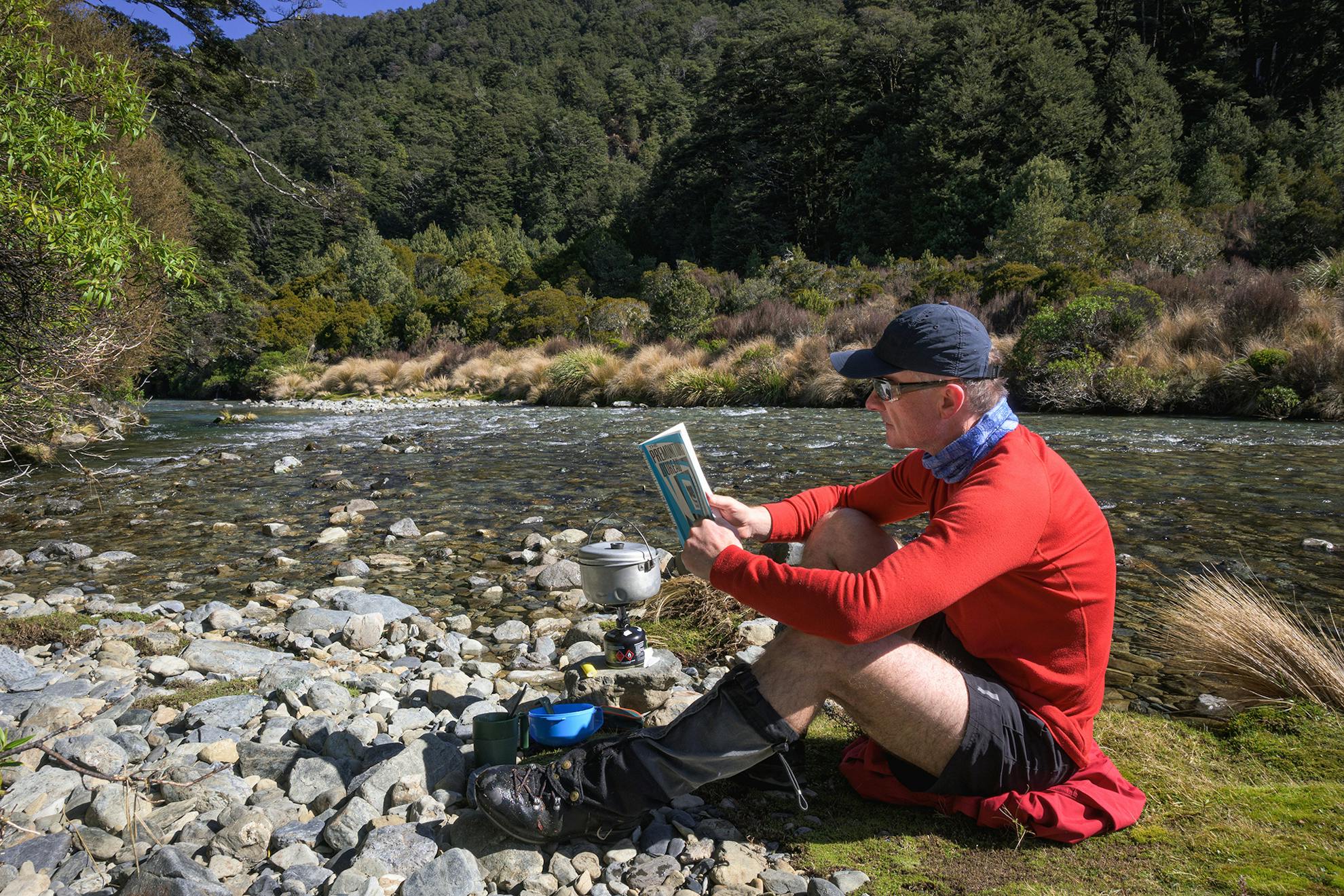
Back on the main track, I climb towards Sharp Cone, which seems an exaggerated name for such a benign peak. The route I’ll follow branches off the Umukarikari Range at a signposted junction between Sharp Cone (1481m) and Umukarikari (1591m). I take an off-track shortcut that avoids three-sides of a square, and cross a fledgling creek, so take advantage of the water and boil the billy. This is more like it; I’m in the zone, enjoying this solo gig, revelling in a tramp at my own pace and on my own terms.
Well, solo, except for my companion. The January Man.
The poled route leads south, gradually downhill, towards the distant bushline. On one broad plateau the Kaimanawa interior appears, and the Waipākihi Valley below. I notice outcrops of rock, thin-veined and sharp-edged, not at all like the greywacke typical of the North Island mountain axis; more like schist, I ponder (a later online search confirms this is part of a schist band in the Kaimanawa).
With the midday sun upon me, I’m grateful to enter the shade of the forest, although the mountain beech is stunted at this altitude, reaching not much higher than four metres. An hour or so passes in the forest, listening to Sommerville talk about a walk across a Yorkshire moor.
His descriptions made me think about ‘rambling’ and ‘hill walking’, and how appropriate those terms seem for English landscapes. Sommerville’s father walked in wool, and never took a raincoat (a tougher generation), although there was a warming pint in the pub at the end of the trail (perhaps not quite so staunch).
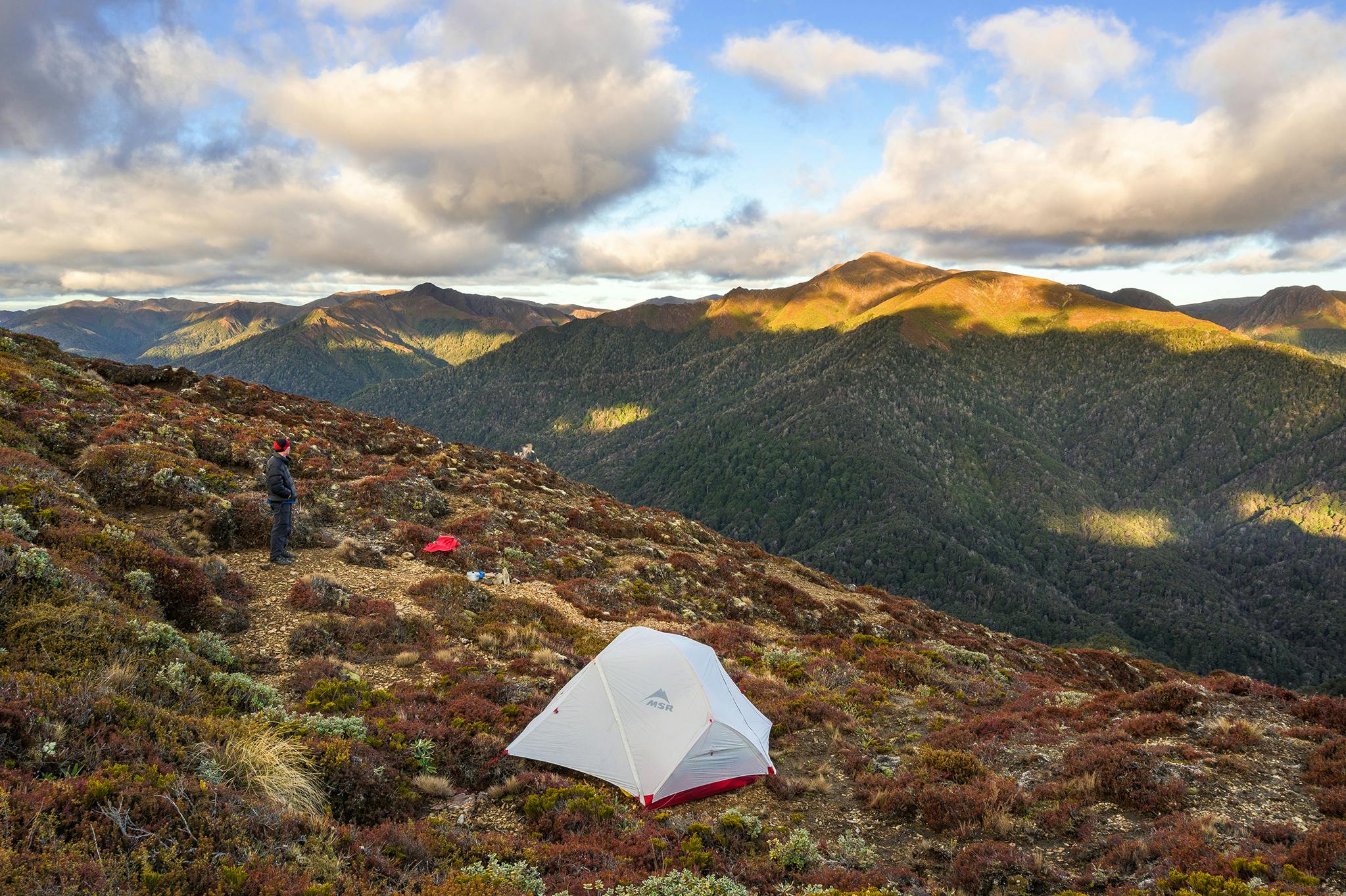
I’m carrying all I need: tent, stove, billy, sleeping mat and sleeping bag, plus food, and so laden, tramping seems the more appropriate term. No pub for the night, but a gravelly ledge to the east of Urchin, where there’s some shelter from a pushy westerly breeze.
Urchin is a 1392m peak with a curious name. Despite some recent research, the origins of its name remain murky. Russet-coloured vegetation, mats of Dracophyllum recurvum, lie on its summit. This is the smallest of this genus of grass trees, spiky snow tōtara, thick-leaved Brachyglottis, and a native Daphne. A place of warm colours and textured plants that mimic the land’s contours.
After dinner, I drift off to sleep listening to Sommerville. His actual voice, not an actor playing narrator. I like that.
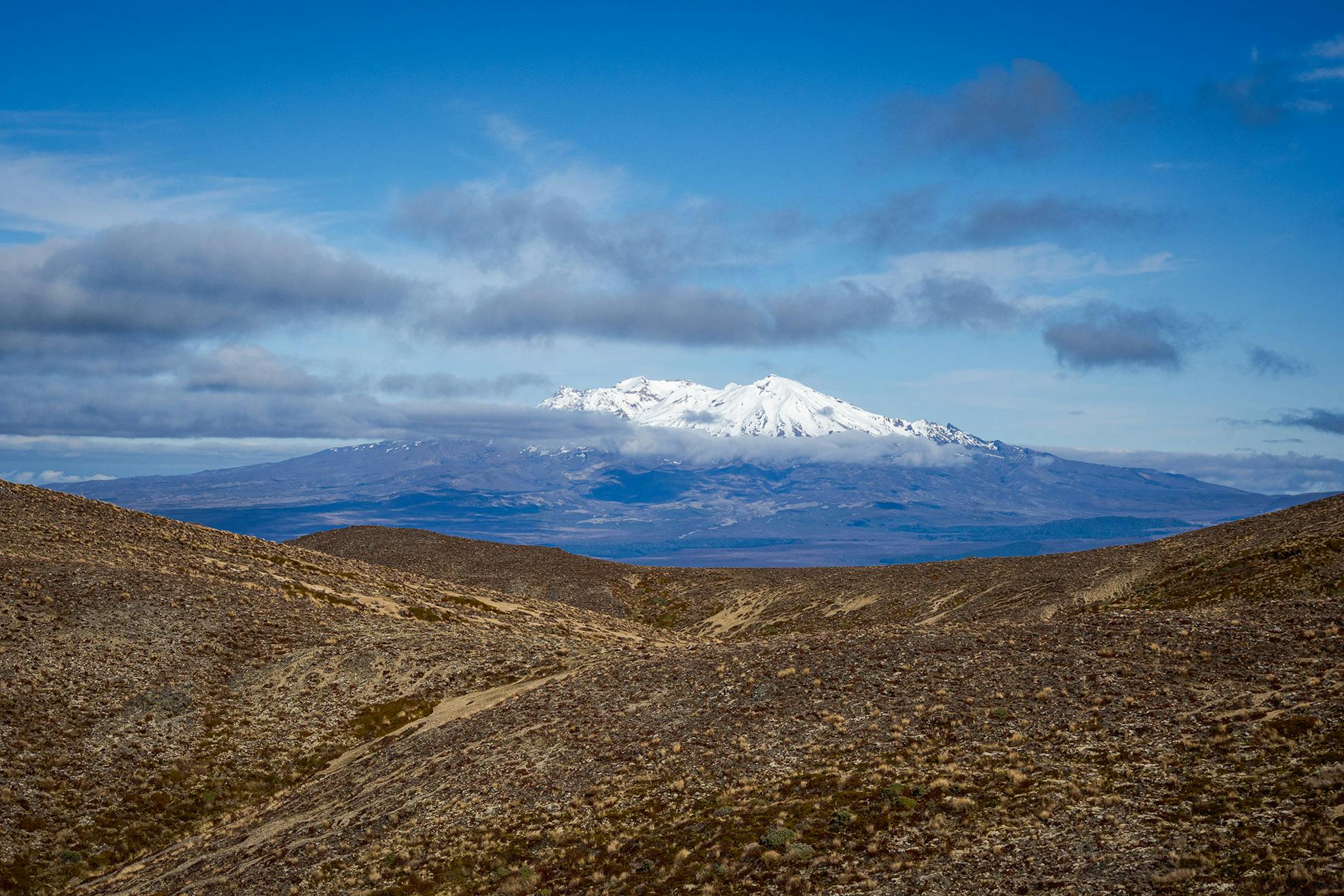
Up before sunrise. Despite the polypro gloves, the cold metal of my camera and tripod hurts my fingers. I stamp against the frost, rubbing my hands between bouts of pressing the shutter. The sun rakes over the ridges of the Middle and Island ranges to the east, with the Waipākihi below still in deep, dark shadow. White frost on the flats. Then the sunrise glow hits the high snows of Ruapehu, lighting up the volcano.
After packing, I backtrack to the route that drops into the Waipākihi, and enjoy a quick, easy descent on a good track, to reach a well-defined hunter’s campsite at its base. It’s fast progress up valley on the flats, crossing the river at will, as it’s clean, clear and low, the sun almost painfully bright; glinting where it dances over rapids and boulders. I feel like this is what we humans were born to do. To stride, to exert ourselves, then to pause, and observe the natural world. To take notice of the patterns and differences between places.
The Waipākihi has many flats, and in that way resembles an eastern South Island valley, but the likeness is only skin deep. The curious mix of trees and shrubs marks it as belonging to the central North Island. Mountain celery pine, pygmy pine, Dracophyllum filofolium, red tussocks, and koromiko. Golds and green, khaki and russet-brown.
No need for hurry, so I boil the billy again on a sun-drenched flat and sip coffee to the sound of Sommerville’s narration and the nearby rapids. Rivers have a narrative too. The Waipākihi’s is a story of purity, of how rivers should be, with their catchment intact, forested on all sides, and wetlands to filter out impurities, ensuring good water to drink from a cupped hand. Later on I strip off, plunge in, gasping at the cold, but exhilarated afterwards as the hot sun dries me.
Past where a large unnamed tributary comes in on the true left, the valley narrows, and the going slows. On the dam-per flats, umbrella fern wetlands suck at my boots and elsewhere I push through dense vegetation, which rips my earbuds out and I give up and appreciate some silence for a while. Sometimes I scramble near the river edge, other times I follow deer trails on the terraces above. The navigation up the untracked valley goes pretty well apart from one dense bush-bash for 20 minutes above a minor gorge. Should have crossed to the other side.
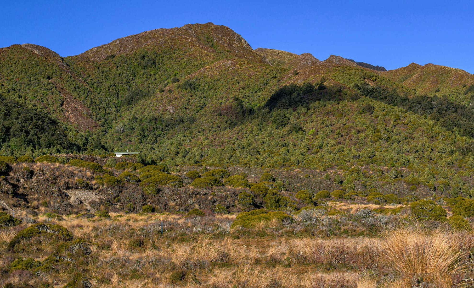
Late in the afternoon, I emerge at the broad basin where several tributaries of the upper Waipākihi merge. Oily residues leak out of the alpine wetlands here, and the final short climb up to Waipākihi Hut seems to take more effort than it should. No one is there.
DOC has flown in two big bags of firewood recently, so I spend the rest of the day unpacking these into the woodbins, out of the weather. The hut is a Lockwood design with one living room with a woodburner, an extensive deck, and two bunkrooms. I drag a mattress onto the deck and there enjoy my evening meal. I’m content to be alone, well satisfied by the minor challenges of the day’s tramping.
Last day. A climb, thankfully in the shade, following the poled route back onto the Umukarikari Range. Easy, undulating travel, with a large cairn marking the summit of Umukarikari itself, just off the track. The sun is hot, the Tongariro volcanoes shimmer in a heat haze.
I admire patterns in the light soils formed by frost and sun, freeze and thaw. The Kāweka Range rises far to the east, with the snowy summit of Kāweka J obvious despite the distance. Pipits wag their tails, then flit off. Their flight has a lilting quality; dip and rise, dip and rise.
Near Sharp Cone, I meet my inward route. Not far beyond, back in the bush, koekoeā/long-tailed cuckoos screech, loud enough to overcome Sommerville’s voice. The cuckoos are down from the Pacific on their annual visit to lay eggs and outsource the parenting of their chicks to another, much smaller species. Despite their large size, koekoeā are seldom seen. When I do spot one, the aptness of its name is apparent in the length of its tail.
Before reaching the car park, I finish The January Man. It feels as though I have had not only Sommerville as my companion but his father, too. A generation that endured much, and fathered not as well as other circumstances might have allowed.
During the Second World War, my own grandfather (‘Poppa’), served as an aircraft engineer in the Pacific. Then back home in New Zealand, put up with the blatant and wrong criticism that he had served in a ‘tropical paradise’, not anywhere really harsh, like the African Desert, or Italy’s Casino, or the beaches of Normandy. Partly for that reason and partly because men of that generation weren’t encouraged to do so, he never talked much about the war to my father. Poppa died too young (at my age), of a heart attack, just as he was mellowing enough to open up.
With these thoughts, I conclude my solo tramp. While congratulating myself that I am back in the groove of tramping alone, my friend Kathy Ombler arrives to pick me up in her car. It’s so good to see her, to tell of my trip, talk about The January Man and my Poppa.
Experiences and places take on more meaning when you can share them.
- Distance
- 41.1km
- Total Ascent
- 2070m
- Grade
- Moderate / Difficult
- Time
- Three days. Car park to Sharp Cone, 3-4hr; To Urchin campsite, 3-4hr; To Waipākihi Hut, 7-9hr; To car park via Umukarikari
- Accom.
- Waipākihi Hut (12 bunks, $5)
- Access
- Waikakaho Campsite, off Kaimanawa Road
- Map
- BH36
GPX File
- Umukarikari Range (gpx, 45 KB)
GPX File
- Your device does not support GPX files. Please try a different device.
