No less than four tracks begin at the car park in the Mt Thomas Forest Conservation Area, which covers 10,800ha between the Ashley and Okuku rivers.
A 26-degree scorcher had been forecast, so the Summit Track up Mt Thomas, with its forest cover virtually all the way, seemed an ideal choice.
After crossing a plush lawn, the track started off rather scruffily, crossing an area of scrub and hopping a stile next to a logging road. Then the climb began in earnest. We headed straight up, for 30 minutes, through a tunnel of sweet-smelling pine trees, our knees creaking. The one consolation was that we were gaining height quickly but our legs were crying out for a zigzag.
We exited the trees momentarily to cross the logging road but the upward grind continued, although, thankfully, with a few wiggles to the route.
The trees mostly spared us direct exposure to the blazing sun, but that didn’t stop us sweating. After 45 minutes, we stopped for a drink and met a man with a dog coming down. He cheerfully informed us we were ‘about halfway to the top’.
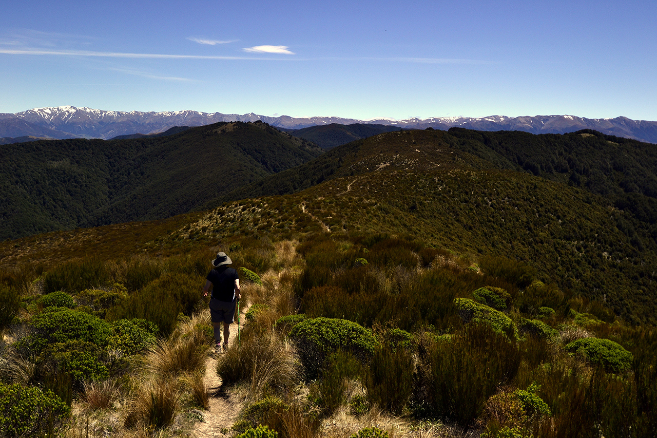
The track became more interesting as the longed-for zigzags finally materialised. After what seemed an age, we abruptly popped out of the pine trees to turn left onto a wide track that spiralled around the edge of the hill. To the south there are views all the way to Christchurch and the Port Hills. We followed the track and were surprised when it joined a logging road as the summit was just five minutes further on.
It is not the most scenic summit, endowed as it is with a wide flat expanse of grass, a jumble of meteorological towers and the largest trig I have ever seen. But the views of the Canterbury Plains and the curve of ocean, the Lees Valley and the tops of the Puketeraki Range were compensation. A perfect place to have lunch.
Having refuelled we set off along the Ridge Track, crossing a bush saddle covered with tussock, daisies and turpentine scrub. The track then dove off left and returned to the forest. In contrast to the pine trees of the Summit Track, this section is a remnant of the old beech and podocarp forests that once covered the area and is all the nicer for it.
The birds seemed more abundant, as they serenaded us down a steep rocky path. At a junction, we had a choice of continuing on the Ridge Track or turning onto Wooded Gully Track. The map showed that the latter appeared more interesting, with several creek crossings, and it was shorter, so we chose that way.
It proved to be a roller-coaster of a route. We crossed a ridge with trees dropping down either side, went down and up and down and up to several creek crossings, and shared the track with a stream for 50m. We also met a number of people as we passed several junctions for shorter tracks in the lower reaches of the forest.
Finally, the track settled into downhill mode, with several long zigzags, passed through a stand of fire-blackened trees and bottomed out at a bridge with a picnic table beside the wide river. Five hours after departing, we re-crossed the lush lawn and were back at the car park.
– Andrew Lowton


34 years of inspiring New Zealanders to explore the outdoors. Don’t miss out — subscribe today.

Questions? Contact us


