
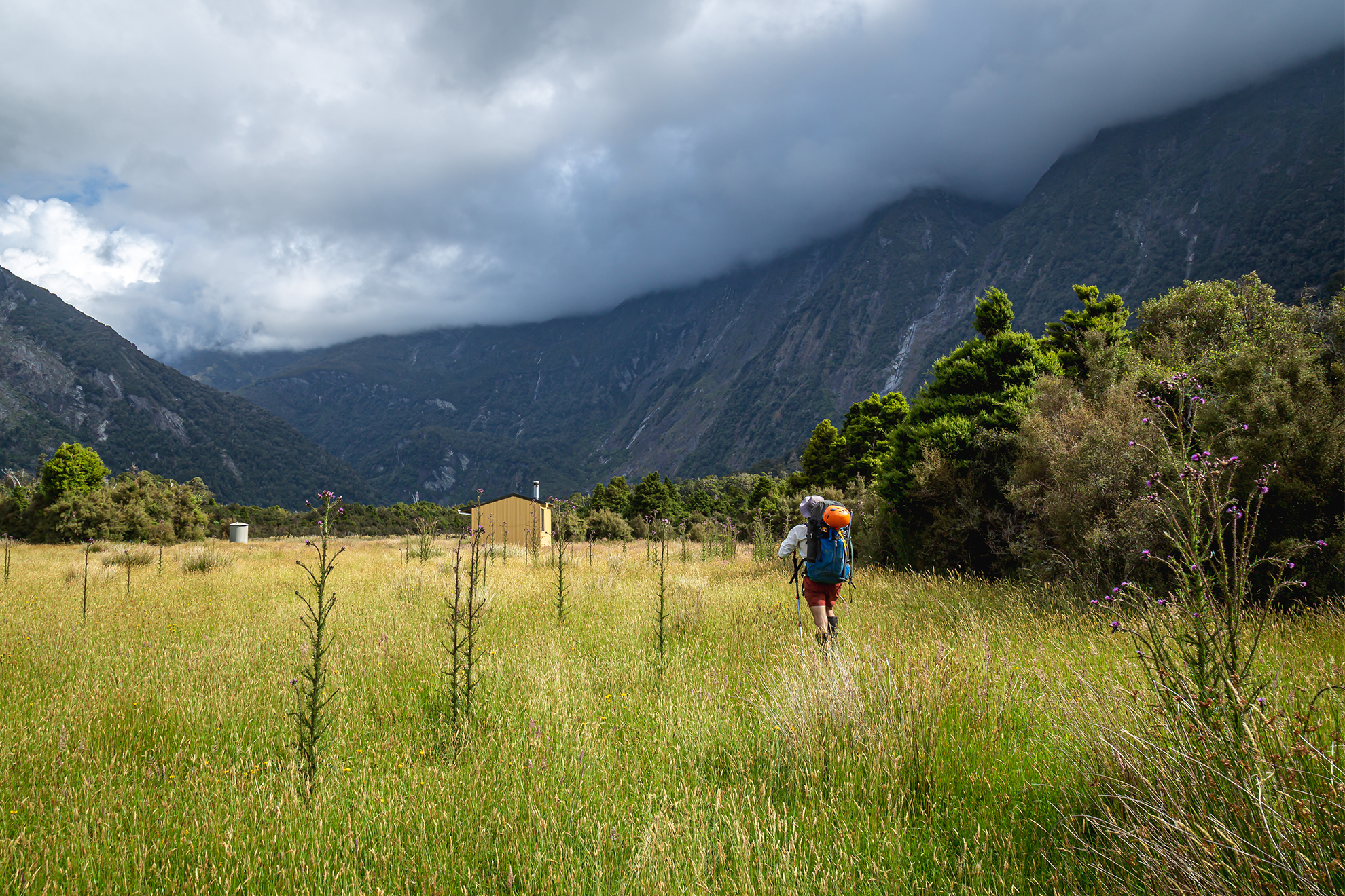
It was slow going through the flat upper Regina Creek due to treefall, but by 9.30am we were looking out over the creek’s three-wire bridge. This took us safely across, but a short distance on we encountered a slip that had carried large trees with it. The resulting clearing had been colonised by a mess of bracken and fern, with hidden holes and things to knock your shins on. We eventually crawled out of the fern and picked up the orange markers at the base of the hill. ‘Steep’ does not do the 500m climb justice; vertical is more fitting. We swung on branches to skirt around the tops of open slips. It was a relief to emerge from the bush and climb the final 100m to the saddle between Conical Hill and Pt1428, above the tarns and in the open.
It was hot on the tops, but not as muggy as the day before. The views were exceptional, stretching all the way to the Main Divide. Below us we could see tarns twinkling in the sunshine next to a suitable camping area, a popular spot to break up the trip to Horace Walker Hut.
The next section was a grunt uphill to Pt1428, and the ridge soon narrowed and travel became more technical. The route was well marked and wove around ‘germanderie’, according to Moir’s Guide. I was perplexed by the term, so imagine my surprise when I was confronted by pinnacles of rock on the ridgeline rather than friendly French police. The terrain fell away on either side, leaving nothing but air between us and the foaming water of Douglas River and Regina Creek half a kilometre below.
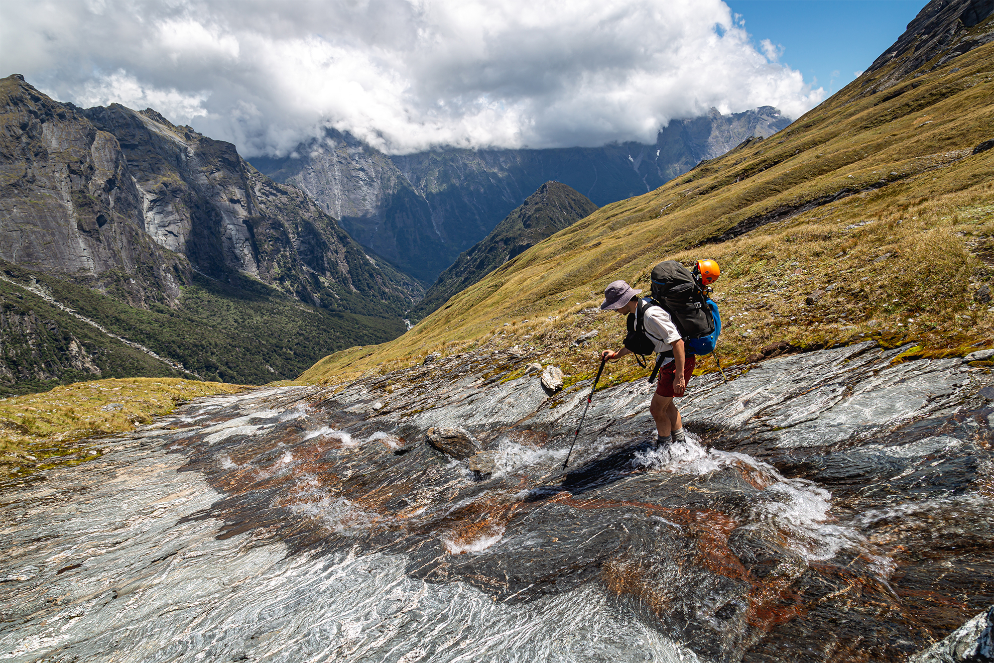
This kilometre-long technical section ended near Pt1428, where a large totem pole marked the beginning of a lengthy traverse under jagged rocky peaks. Streams of snowmelt fell from the high pinnacles in impressive ravines, and the route crossed these in precise spots where the ravines’ edges were eroded and the water moved slowly. Poles led us to each crossing in turn, with just a bit of guesswork required.
The route crossing the final two streams flowing from Pt1848 was incorrectly marked on the topo map. Rather than following the 1480m contour, the actual route dropped right down to where the streams cascade over bluffs into the Douglas far below. Crossing here was okay (if nerve-racking), and soon we were climbing back to the route marked on the map. A colourful pole marked the beginning of the descent to Horace Walker Hut.
We then dropped steeply to the old moraine wall of the Horace Walker Glacier. Dry stream beds along the flat top of this wall provided easy travel before we dropped to grassy flats alongside the Douglas River. Then there was just the river draining the glacier to cross. When I reached it, one of my companions was already on the far side.
“It’s not terrible, but I wouldn’t have liked it without a pole,” he shouted.
He launched his walking pole back to me. I put my camera in its drybag and entered the swirling waters. Strong currents tugged at my shorts and I made a mistake. I stepped off the edge of a rock and the icy waters gripped me to my waist. I fought the water to reach a boulder on the far side and, using all my strength, launched myself at it, fingers curling tightly around the rough surface as I hauled my bedraggled body out of the flow. I shivered on the bank, cursing how a moment’s inattention had almost led to disaster. I helped the last of our party across before going on to Horace Walker Hut.
Cloud and rain delayed our start the next day, but when it cleared a bit around 10am we decided to make a run for it, down the true right bank of the Douglas River until opposite the stream that drained The Gladiator and Mt Howitt (1958m). We crossed here, linked up, taking slow cautious steps in the freezing flow. It was strong but we were soon safely on the far side.
From here the route alternated between the creek itself and its grassy banks. Soon, though, our babbling brook turned into a waterfall that apparently blocked all paths forward. Moir’s Guide suggests going into the bush on the true right, following the creek ‘as close as practically possible’, before finding an old hunter’s trail marked with tape 50m up. We debated the exact meaning of the word ‘practically’ as we battled through undergrowth and dense, disorientating bush, the ground covered in Dracophyllum fronds. We finally stumbled on a stream and followed it uphill, unsure if it was leading on- or off-route.
Crawling along, I yelled in excitement when I spotted a bit of faded pink tape. From here it was simply a matter of following tape to tape, usually along the path of least resistance. Once at the bushline we moved between clearings, winding up beside massive boulders. To get higher meant navigating through a series of bluffs, which we did by passing through the easternmost of two notches in the bluffs.
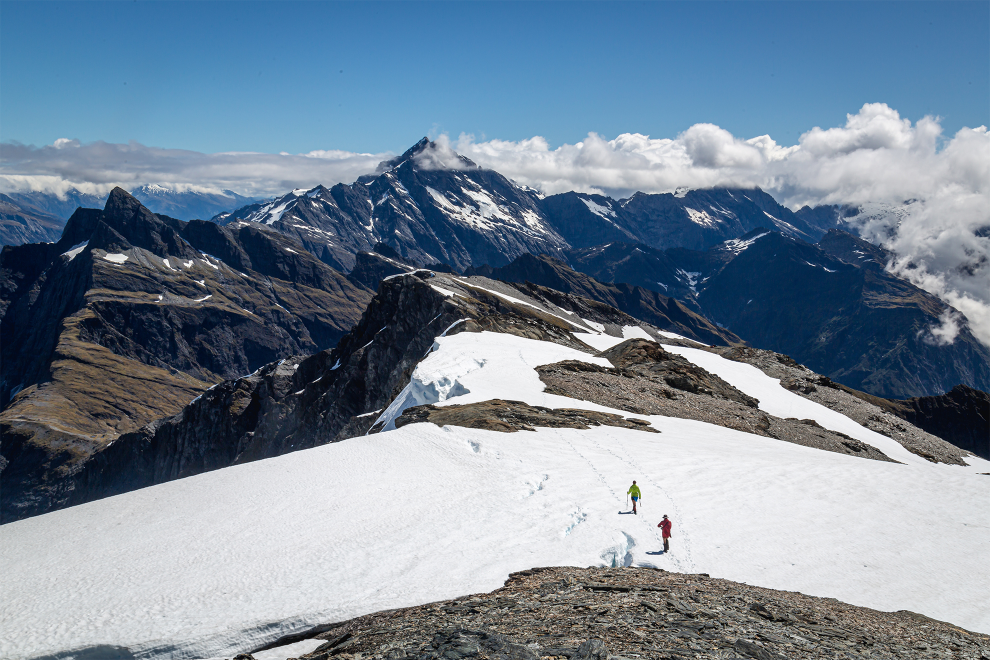
Above the bluffs was an alpine basin littered with house-sized boulders, and this we left via a snowgrass gully beneath an overhanging rock. It was then a matter of plodding higher in the vague direction of The Gladiator. We reached the ridge at around 2000m and dropped our packs for one last push to the summit.
The ridge was easy travel, as long as we didn’t stray too close to the bluffs dropping to the Landsborough. In front, Mt Sefton and the Douglas Neve were displayed spectacularly.
At the summit it was time for photos and a moment or two of relaxation before heading back to the packs. Along the ridge towards Mt Howitt there was one scrambly section before the peak to get past a deep ravine on the Douglas side.
Over Mt Howitt we descended a snow-covered shelf to the north-east before climbing back to the ridge. There’s a good view into Christmas Flat and the Karangarua from here. Dropping into the Karangarua Valley, we negotiated remnant snow and descended large, broken scree before crossing to the true right of the creek around the 1400m contour. This creek started okay but quickly grew bigger, at times forcing us into the scrub to avoid cascading waterfalls. It seemed never-ending, and it was a great relief to finally stumble into Christmas Flat Hut around 7.30pm.
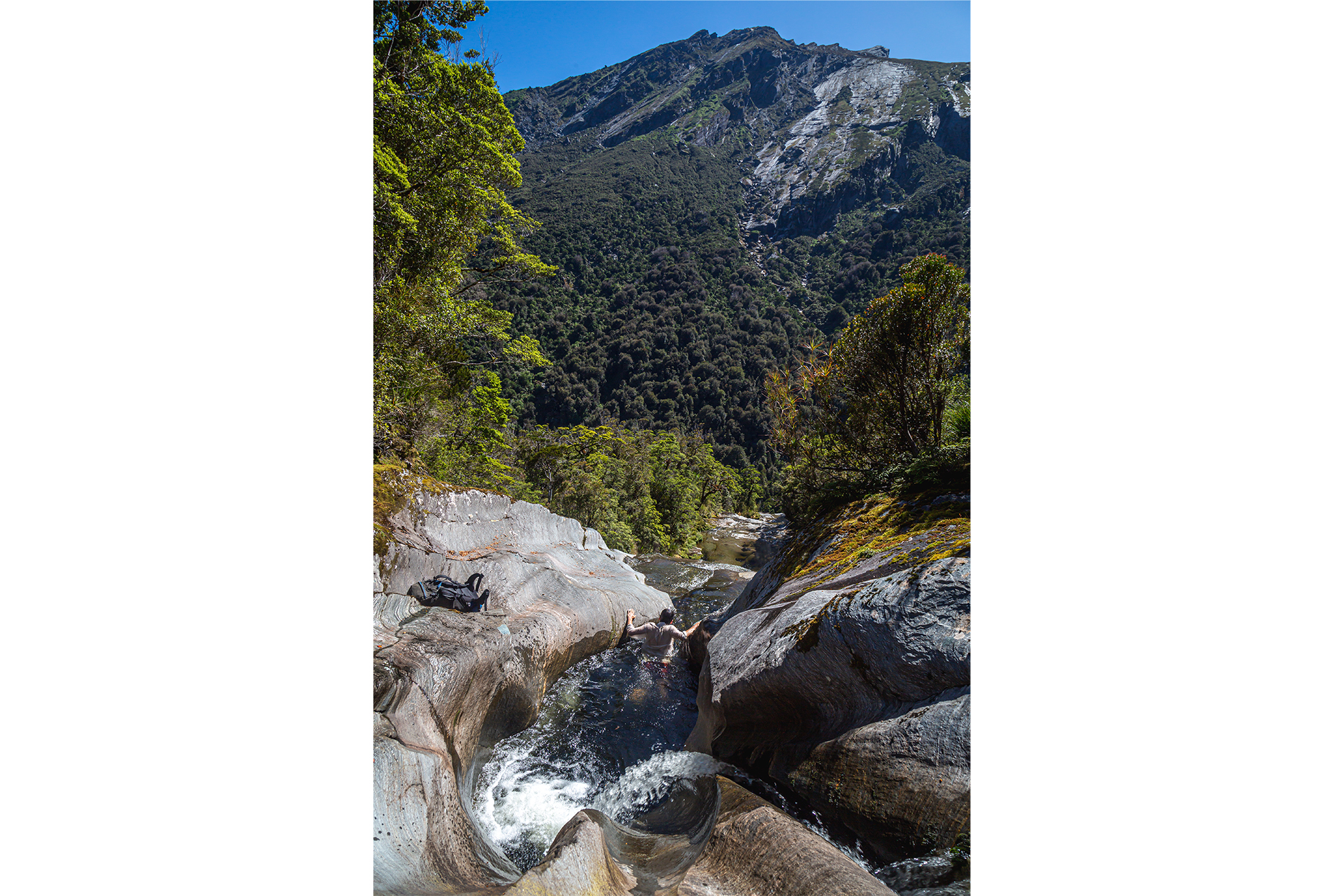
Next morning we headed to Lame Duck Hut on the freshly cut track. About halfway we emerged on the banks of the Karangarua where the Troyte River flows from its alpine basin. The setting was breathtaking and the river calmly reflected the magnificence of the surrounding mountains. It took just 90 minutes to reach Lame Duck Hut. It’s swampy going from there, broken up by streams running down treacherous rocky slabs with the occasional enticing pool. After crossing the stream that drained Jagged Spur, the track climbed steeply to the 700m contour, and from there we negotiated a few slippery creeks with extreme care and few handholds. Soon altitude was being lost rapidly, and at the scrubby saddle between Tui Creek and the Karangarua there was an old slip to the Karangarua itself.
We welcomed the easygoing river bank after a couple of hours of ups and downs, and soon the clear blue waters of the Karangarua met with the glacial grey of the Douglas and we were back at Cassel Flat Hut. We flew down (and up) the track, retracing our steps to the familiar sight of the Karangarua Bridge.
Over four days, this slice of rugged Westland had been a mighty host to us three trampers, as we traversed two valleys to reach one worthy tramper’s peak: The Gladiator. It hadn’t been easy but that only made it more rewarding.


