


Hydro scheme will ‘alter character’ of Waitaha River
DOC is accepting submissions for comment on a proposed hydro scheme on the Waitaha River, near Harihari on the West Coast of the South Island.
Greymouth-based Westpower Ltd has applied for a 49-year term in which the Waitaha would be diverted into a tunnel at the head of the Morgan Gorge, and would be returned to the river 2.6km downstream below the powerhouse.
Westpower’s proposal is similar to its scheme on Amethyst Creek, a tributary of the nearby Wanganui River. The company’s application for concession states that it expects the Waitaha scheme could provide up to 25 per cent of the West Coast’s energy needs, powering the equivalent of 12,000 households. The plan also states that it would be the largest hydro scheme on the West Coast, and would provide a resource for renewable energy.
Justin Venable lives in Hokitika and is a passionate white water kayaker. He is opposed to the scheme and said it would be devastating not only from a recreational aspect, but also on a conservation basis.
“The fight is not because we’re losing a valuable kayaking resource, it’s the fact that the gorge, in and of itself, deserves protection. It’s stunning and unusual, and it represents the pinnacle of backcountry unique, natural landscapes in New Zealand,” Venable said.
Andrew Buglass, Permolat Trust member, said the proposed scheme would mean restricted access to the track network in the gorge. Kiwi Flat Hut is just a kilometre from where the proposed powerhouse would be built. Buglass said Westpower has promised that access will be maintained via a new track through the bush, but he said it will undoubtedly change the enjoyment and aesthetic of the tramping route.
“If you look at the overall wilderness value, the natural features, that’s really where the impact is going to be. The Waitaha is a great piece of wilderness,” Buglass said. “Anyone who takes a look at it would kind of scratch their heads as to why they actually want to alter the character of that place.”
Submissions on the proposed scheme will be accepted until November 14. To weigh in, send submissions by mail to Director-General, Department of Conservation, Private Bag 701, Hokitika 7842. Alternatively, email Pauline Adams at permissionshokitika@doc.govt.nz.
Franz Josef gondola would phase out heli flights
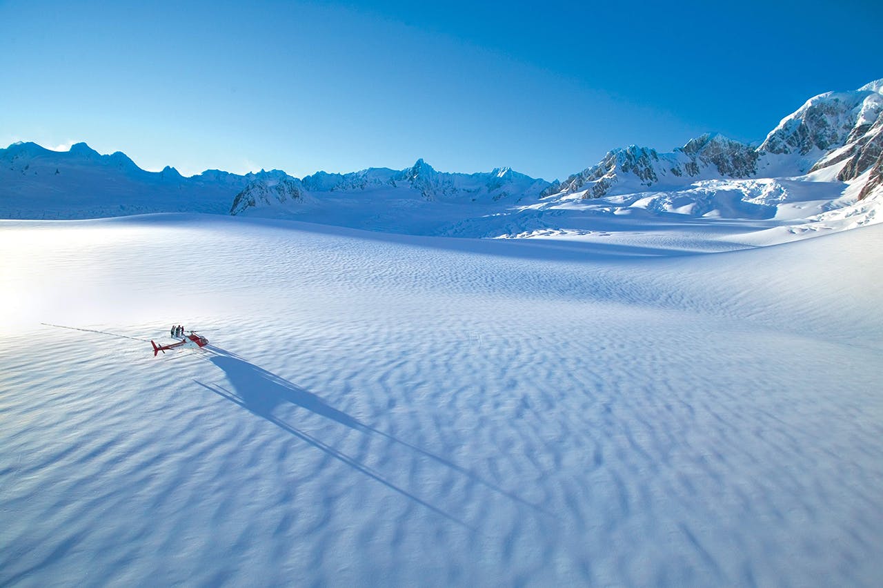
Helicopter landing on Franz Josef glacier. Photo: Supplied
If you’ve ever been to Franz Josef glacier in the peak of tourist season, you’ll recall the throngs of visitors on the trail and nearly constant buzz of helicopters overhead. But that could change soon; tourist company Skyline Enterprises is proposing building a gondola that would give tourists a closer view of the glacier.
Skyline Enterprises Chairman Mark Quickfall said the idea for a gondola was first raised in the 1980s, but only became a real potentiality recently.
“What’s changed since then is that you can no longer access the glacier by foot – you have to fly in,” Quickfall said, adding that technological advances make it more feasible.
“When the face of the glacier collapsed in 2012 and foot access was no longer an option, we recognised there are a lot of people missing out. Despite the fact that we operate the helicopters, weather’s not always favourable.”
Quickfall envisions the gondola following the path of the ridges on either side of the glacier, with the possibility of a viewing platform at the top.
Federated Mountain Clubs president Peter Wilson said there is a case for the gondola.
“Usually, the answer would be no to developments like this, but given climate change, the importance of Franz Josef to Westland, and its long history of public access and guiding, there is a case for the amenity area and gondola,” Wilson said. “It would allow us to phase out helicopter flights in favour of a much more environmentally friendly mode of transport.”
Our bad, your gain
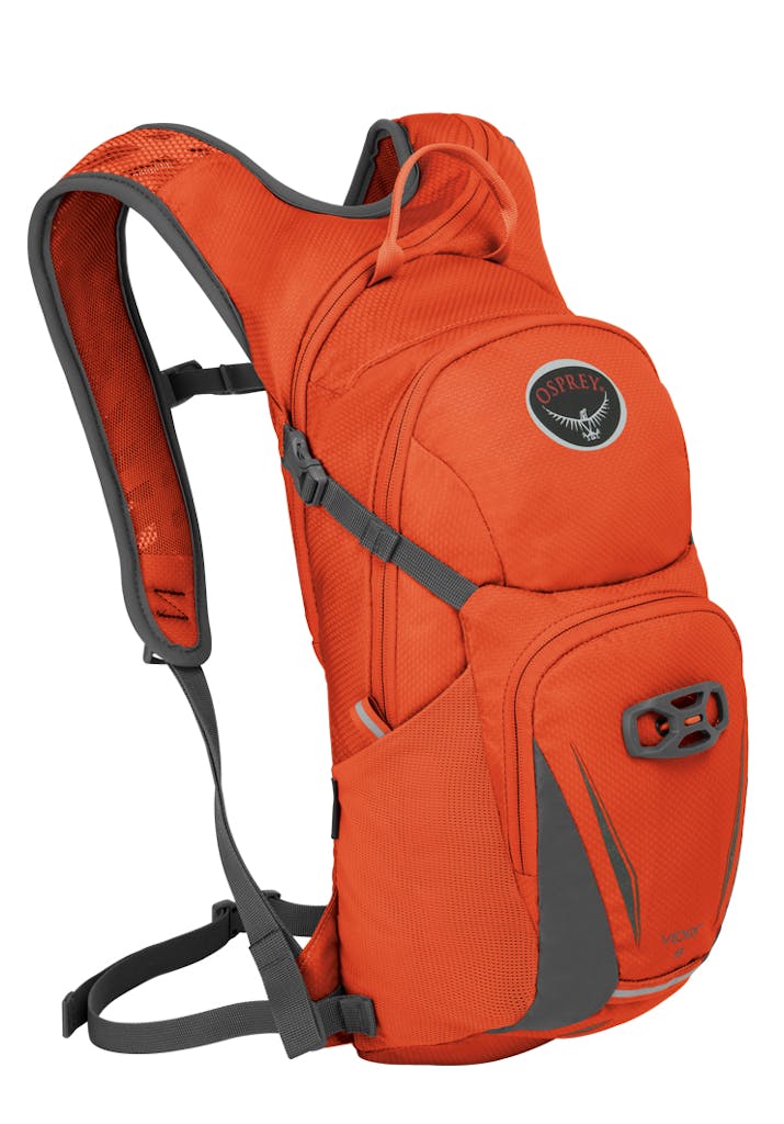
Osprey’s Viper 9 hydration pack
In our October hydration pack gear guide, we mistakenly included the wrong image for the Osprey Viper 9 pack. The correct image is pictured above.
So, by way of correction, we’re giving a Viper 9 away to a Wilderness reader who can answer the following question: how much does the Osprey Viper 9 weigh?
The easiest way to find the answer is to read buyer’s guide on hydration packs and search ‘Osprey Viper 9’. Send your answer, along with your name and address, to competitions@lifestylepublishing.co.nz.
Clean-up underway in Whirinaki Conservation Park
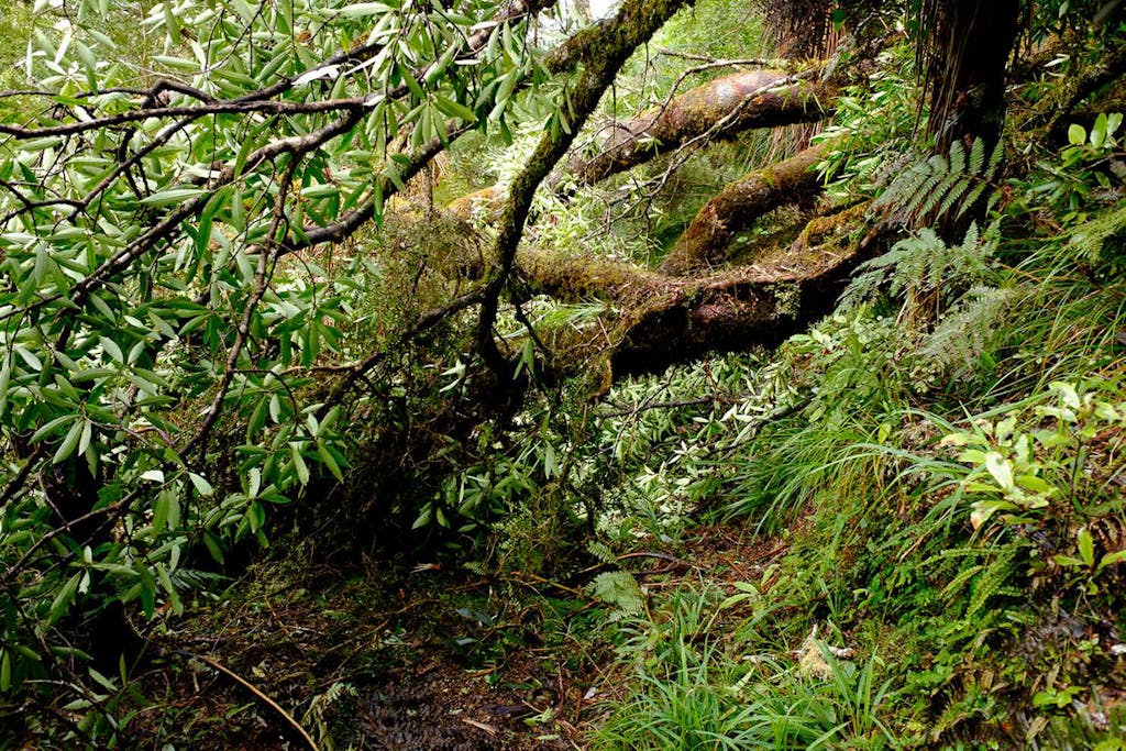
Heavy storms caused significant treefall in Whirinaki Conservation Park. Photo: DOC
Heavy snowfall from winter storms has done a number on Whirinaki Te Pua-a-Tãne Conservation Park. Several tracks were damaged, making access to tracks and huts difficult.
DOC has 16 current alerts for the East Coast park, most of which refer to sections of tracks that have been washed away or blocked by treefall.
Kohu Kohiti, a DOC ranger from the Whirinaki district, said the weather this year has been the worst experienced in 10 years.
“It’s brought down a whole heap of trees, mainly in our backcountry section,” Kohiti said, adding that there are also several areas of washout. Most of the tracks are still open despite the damage, but he says travel time is now increased by at least a couple hours on most tracks to negotiate the treefall and washout.
One of the damaged areas is Arohaki Lagoon Track, which has a washout five minutes from the start of the track near the footbridge, and there’s a fallen rimu tree halfway along the track. The Moerangi mountain bike track is closed to both walkers and bikers from Moerangi Hut to Whirinaki Waterfall Loop Track. Work is underway to clear that trail, and Kohiti was hopeful it would be completed by the middle of November. Other damaged tracks include the trails to Central Whirinaki Hut, Mangakahika Hut, and Mangamate Hut.
Kohiti said he had to recruit help from other districts, including local volunteers and Department of Corrections volunteers from Whakatane.
“It’s been slow moving but we’ve boosted our calls for help in other districts, so we have other offices lending a hand where they can, which is great.”
Kohiti recommended that anyone heading to Whirinaki should check the DOC website for a full list of current alerts.
Kiwi plan aims to boost numbers to 100,000
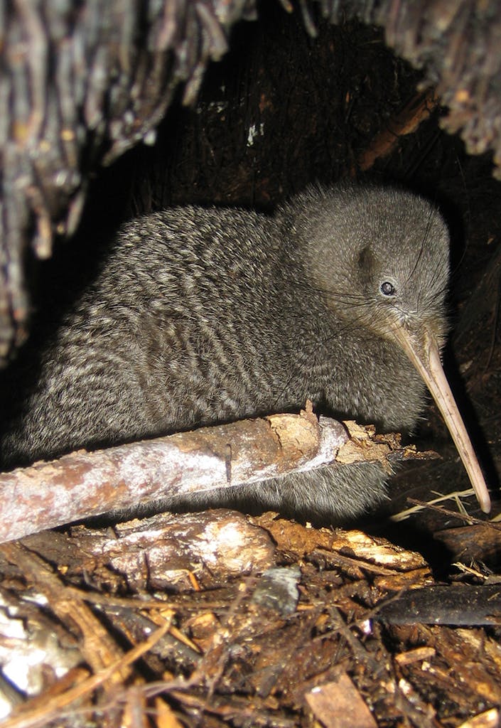
There are currently an estimated 68,000 kiwi in New Zealand. Pictured is a little spotted kiwi. Photo: Andrew Digby/DOC
The Government has announced a plan to boost kiwi numbers to 100,000 in the next 10 years. DOC’s Kiwi Recovery Plan 2017-2027 aims to grow populations of all five kiwi species by at least two per cent each year, restoring distribution, and maintaining the genetic diversity. There is currently an estimated 68,000 kiwi in New Zealand.
Helen Taylor, a University of Canterbury researcher who helped contribute to the recovery plan, has done extensive kiwi research, and said maintaining the genetic diversity of kiwi is vital.
“I think if you say ‘kiwi’ to most people, they would imagine a North Island brown kiwi, because that’s what they’re most familiar with,” Taylor said. “When you start talking about the different species, they’re actually quite surprised.”
The five species include the little spotted kiwi, which live on several offshore islands and two mainland sanctuaries; the great spotted kiwi/roroa, found in the north-western South Island and around Arthur’s Pass; the brown kiwi on the North Island; the rowi found on the West Coast of the South Island; and the tokoeka found in Fiordland, the Haast Range and Rakiura. The rowi and Haast tokoeka are the most critically endangered species, which DOC says were once limited to only a couple of hundred birds, but now number from 400-500.
Taylor said the current kiwi population is only 25 per cent managed. “To grow the population of each species by two per cent – that’s quite a big job, because you’ve got 75 per cent of kiwis not receiving any kind of management right now,” said Taylor. “It’s super ambitious, but I think the advantage we have with kiwi is that we understand the agents of decline. It’s almost 100 per cent due to introduced mammalian predators.
“Because we understand this, we know how to tackle it.”
Large donation buys more public access to Port Hills
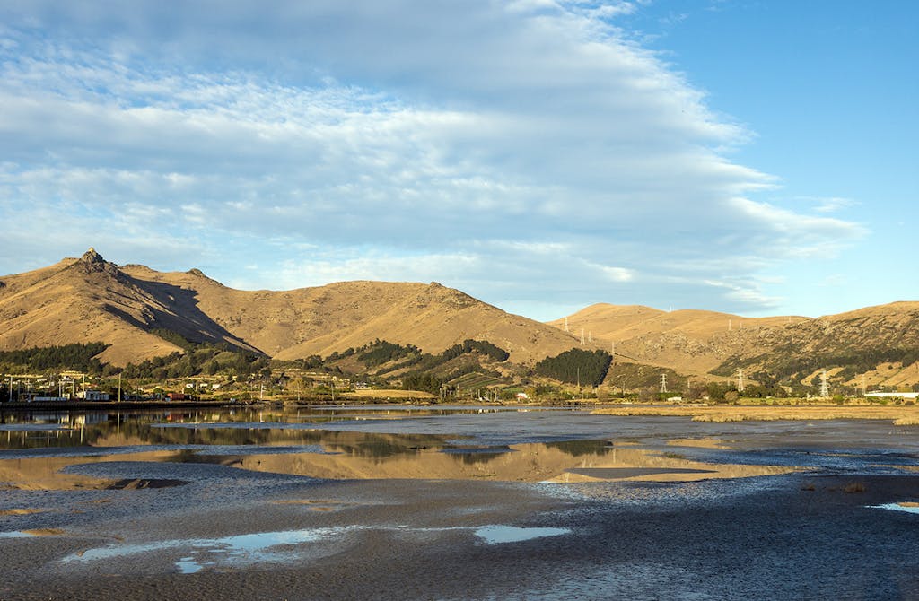
The purchase of Tussock Hill Farm adds 233ha of public access to the Port Hills. Photo: Christchurch City Council
The Summit Road Society of Canterbury has just purchased a 233ha farm in the Port Hills with the aim of turning it into a public park with walking and mountain biking tracks.
The purchase of the farm was made possible thanks to a large donation by the society’s president.
Bill Woods gave $600,000 to help secure the Tussock Hill Farm, which he says is one of the largest pieces of private land in the Port Hills region.
“We have intentions to turn it back into its natural state,” Woods said, adding that they’ll be improving the tussock and other vegetation on the property, and will conduct plantings near streams to improve the water quality and prevent further erosion.
Woods’ donation helped round out the $1.8m parcel of land, which he agreed to donate under the condition that it be named after his late wife, Linda, who passed away 25 years ago. The rest of the money came from several other bequests and donations.
“We are really excited about the whole thing – that’s the purpose of the society: to protect the Port Hills, which was the dream of Harry Ell,” Woods said.
Ell was a prominent Canterbury conservationist in the early 1900s, helping to develop public access along the summit of the Port Hills and around the Banks Peninsula. His grandson, John Jameson, founded the Summit Road Society in 1948, which aims to promote recreation and protection of the peninsula.
Woods expects the society will begin work on the new park early next year.
100 years of recreation on Banks Peninsula
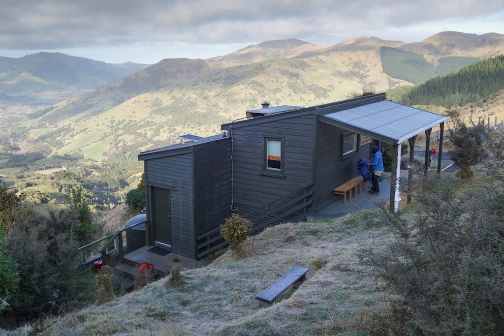
Rod Donald Hut on the Te Ara Pataka track. Photo: Rod Donald Trust
The new, improved, and recently renamed Te Ara Pataka walkway is being celebrated in conjunction with a centenary event acknowledging the track’s pioneer, Harry Ell.
On November 26, the Rod Donald Trust and DOC will celebrate the formal opening of the walkway with Ell’s granddaughter, Paula Jameson as the keynote speaker.
Ell was a Christchurch conservationist who built the Sign of the Packhorse Hut in 1916 as a rest house on the proposed Summit Road, a recreational route from Christchurch to Akaroa along the ridge of Banks Peninsula. In 2013, the trust teamed up with DOC to give the Summit Walkway a facelift by building Rod Donald Hut and upgrading the tracks with markers and signage. The track, was also renamed Te Ara Pataka in order to reflect the cultural and historical significance of Banks Peninsula to Maori. Maori call the peninsula Te Pãtaka o Rãkaihautu which means ‘the food basket of Rãkaihautu’. Te Ara Pataka means ‘the walk of the food basket’.
On November 25, groups from the trust and DOC will tramp in from opposite ends of the track, one group staying at Rod Donald Hut and the other at the Packhorse Hut. The next day, the groups will meet at Mt Herbert/Te Ahu Pãtiki, where they’ll be joined by four different day-walking groups. The event is open to the public, and they expect to meet at 1pm on the summit.
Suky Thompson from the Rod Donald Trust says it’s significant that the completion of the track coincides with the centenary.
“We need to acknowledge that in the work we’ve done for Te Ara Pataka, we’ve essentially fulfilled Harry Ell’s dream, that you could go all the way from Lyttelton to Akaroa on the summit ridges,” Thompson said.
Given its close proximity to Christchurch, Thompson said she hoped the network of trails would lure locals.
“Our real target market is people from New Zealand; families, and especially local people from Christchurch,” she said. “It’s a great trip for grandparents to take their grandchildren on – this is the recreational opportunity to pass the baton on to younger generations.”
5 things we learned this month
- The male rifleman weighs only 6g
- Some self-resetting traps can be left in the field for up to a year, killing multiple pests during that time
- The Adams Wilderness Area was gazetted in 2003, 22 years after it was first proposed
- Restoring old huts can be as much as $68,000 cheaper than replacing them with new
- Prisoners are cleaning up waterways by planting trees and clearing rubbish from our beaches
