View to Wharite Peak from the road. Photo: Jem Bakker

Wharite Peak, Ruahine Forest Park

May 2019

Read more from

May 2019

The Ruahine’s southernmost hill

The mist was still lingering in the early morning sun, making the forest eerie. Intermittent sunrays probed their way through the trees, the forest still except for the occasional bird competing with the cicadas and the gentle gushing of the creek.

I was on the Wharite Peak Track, which starts 20 minutes along Coppermine Creek Track. I had stopped at the junction and looked at the leaf-carpeted track meandering to the right. It led over farmland to loop back to the car park. Another lovely wide track led straight ahead into the creek before heading back into the trees.

But Wharite Peak Track heads straight up the sparse hill. Resigned, I extended my walking pole and started up the hill. The track climbs steeply and after a long summer with little rain, it was dusty. This, in turn, made it slippery, but before long, it merged into the classic hard dirt, leaf-strewn track.
A few markers line the track, but they are few and far between. Often the ferns, shrub and grasses crowding onto the trail were head high. Navigation is tricky in places and a bit of bush whacking and guesswork is required to follow the track.

May 2019

Read more from

May 2019

The view to Hawke’s Bay from Wharite Peak. Photo: Jem Bakker

Point 904 is reached around 90- minutes after leaving Coppermine Creek Track with Wharite Peak looming up ahead. The transmitter tower at its summit looked within reach to the left.

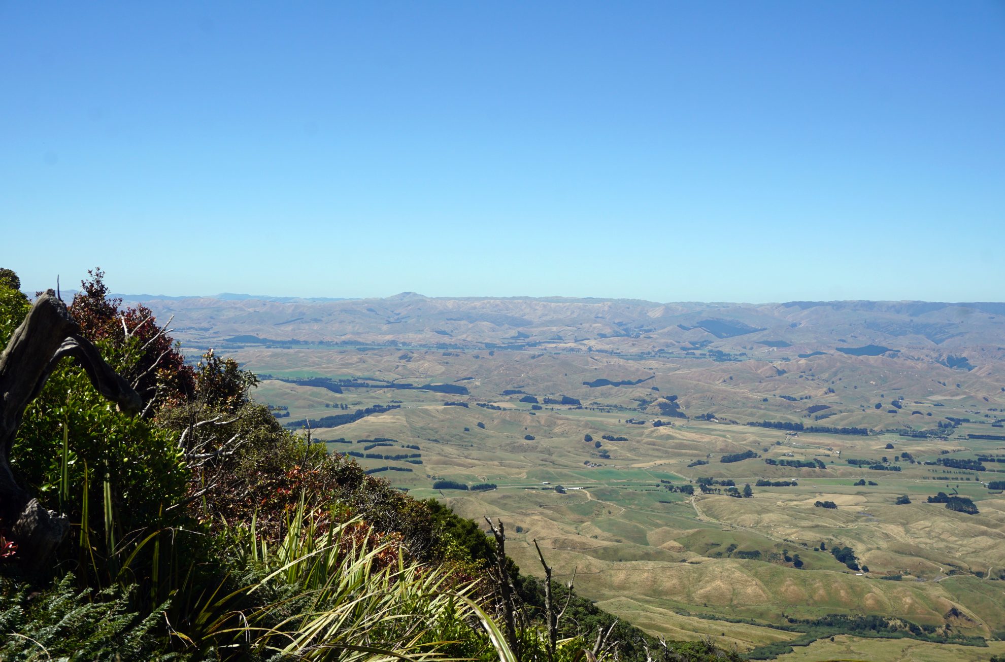
Wharite Peak, while steep and overgrown, was pleasant to climb. Below, the Hawke’s Bay stretched into the distance, baked dry from a relentless summer sun.

However, the peak kept itself in the distance, never seeming to appear closer. It took 45 minutes to reach the summit since first viewing it from Pt904. The track ends at the transmitter tower that dominates the skyline on the southernmost tip of the Ruahine Range. Looking out from the tower the views stretch to Taranaki, Tongariro National Park, the Manawatu and across the Hawke’s Bay.

Distance
4.84km to summit
Total Ascent
737m
Grade
Moderate / Difficult
Time
6-8hr return
Access
At the end of Coppermine Road outside Woodville, Hawke’s Bay

GPX File

Wharite Peak (gpx, 3 KB)

GPX File

Your device does not support GPX files. Please try a different device.

More From May 2019

Related Topics

Similar Articles

Tongariro Northern Circuit huts no longer first-in, first-served during winter

Influencers now required to pay $100 to make content in Tasmania’s national parks

FMC condemns approval of hydro scheme in pristine West Coast river

Triangle Hut, Ruahine Forest Park

Dianes Hut via Dead Dog Hut, Ruahine Forest Park

Kaimanawa Circuit (Sharp Cone and Mt Urchin), Kaimanawa Forest Park

Join Wilderness. You'll see more, do more and live more.

Already a subscriber?  to keep reading. Or…

34 years of inspiring New Zealanders to explore the outdoors. Don’t miss out — subscribe today.

Your subscriber-only benefits:

All this for as little as $6.75/month.

1

free articles left this month.

Already a subscriber? Login Now