Travers Peak, Hanmer Conservation Park

Read more from

Google Earth view of the route to Travers Peak
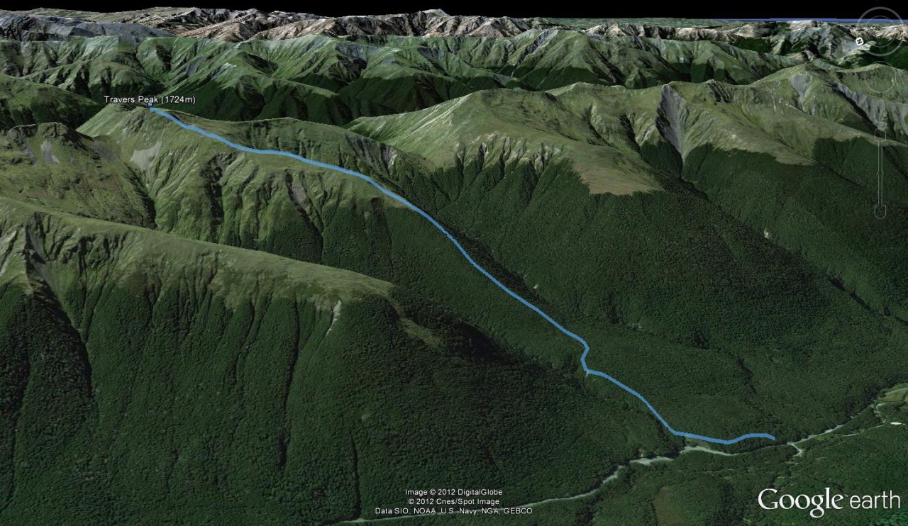
A well-marked trail that climbs onto the terrace above the road and slowly turns to the east to gain the spur between Goings and Foleys creeks which ascends to the bush edge on Travers Peak (1724m).
Alistair Hall

About the author

Alistair Hall

More From Trips

More From Trips

Related Topics

Similar Articles

Trampers say decision to remove beloved hut failed to follow process

Kiwi hiker’s brush with grizzly bear caught on video

New less toxic stoat sausage bait results impress DOC

Mt Wakefield, Aoraki Mt Cook National Park

Edwards Hut, Arthur’s Pass National Park

Lagoon Saddle huts, Craigieburn Forest Park

Trending Now

Seven overseas trails you’ll love

Lowry from Days Bay, East Harbour Regional Park

A tale of adventure and tragedy

Roaming the red rocks

The 2026 Wilderness Outdoor Photographer of the Year winners

Subscribe!
Each issue of Wilderness celebrates Aotearoa’s great outdoors — written and photographed with care, not algorithms.Subscribe and help keep our wild stories alive.

Join Wilderness. You'll see more, do more and live more.

Already a subscriber?  to keep reading. Or…

34 years of inspiring New Zealanders to explore the outdoors. Don’t miss out — subscribe today.

Your subscriber-only benefits:

All this for as little as $6.75/month.

1

free articles left this month.

Already a subscriber? Login Now