
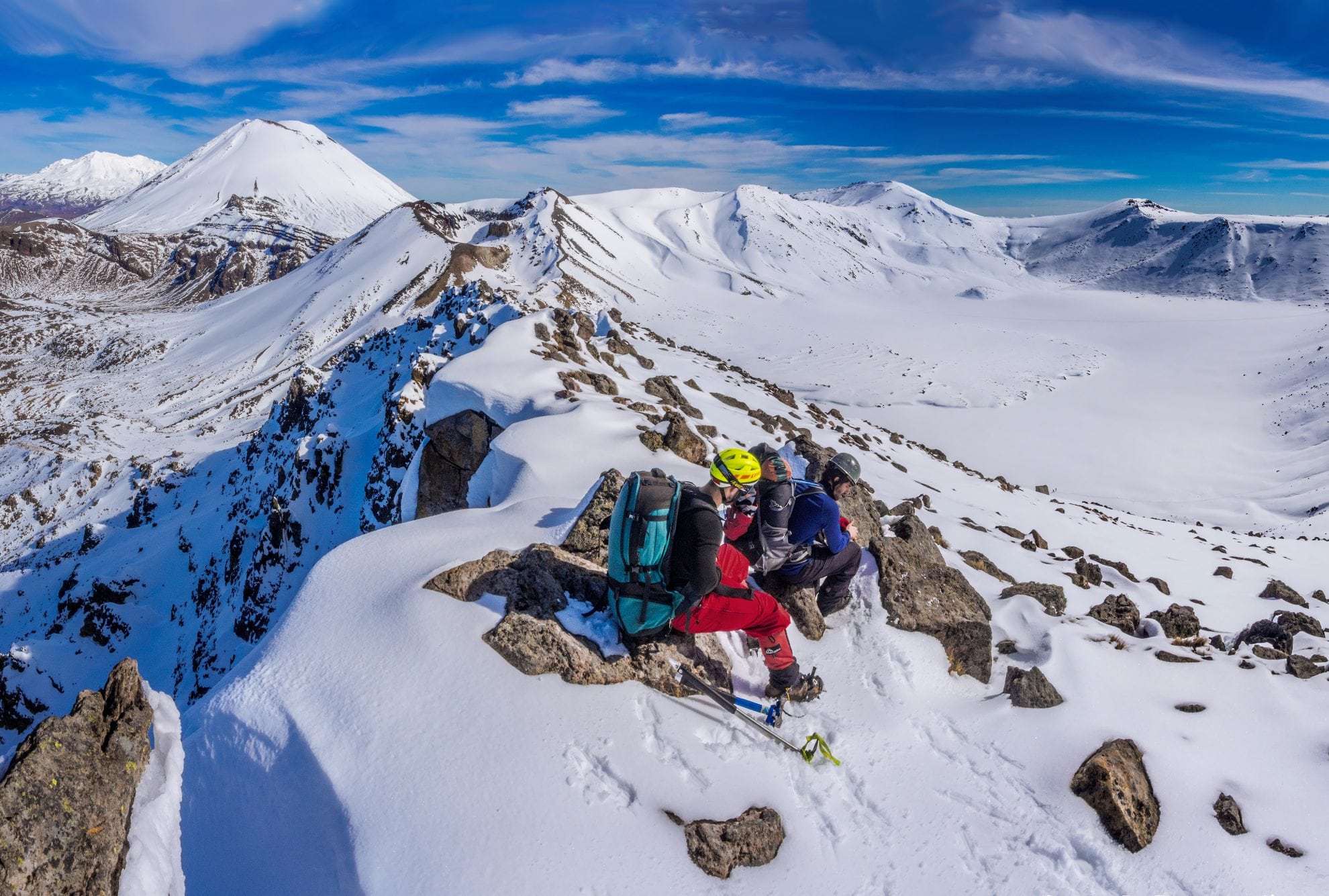
Camping here put us in a position to enjoy a bluebird day amongst the crater-pocked landscape. Our route skirted around North Crater across a large flat plateau. From there, we dropped down 100m on what proved to be the steepest section of the day, requiring some front-pointing, to the northern end of the Alpine Crossing above Ketetahi. Then we climbed again, eastward to the top of Rotopaunga (1856m) and gazed out over lakes Rotoaira and Taupo to the north. In the foreground lay Te Mari (1739m), the site of Tongariro’s most recent eruption.
From Rotopaunga we dropped again, this time skirting the eastern edge of a frozen Blue Lake. At its southern end there is an unnamed 1850m highpoint from where we could view almost our entire route, with spectacular views of some intimidating vertical cliffs, Central Crater directly below and Red Crater just to the south. In warm sunshine and with not a breath of wind, we watched a straggly line of guided ‘ants’ plodding along the crossing route below. We descended to Blue Lake and joined the TAC, which we followed back to the Mangatepopo road end.
Even on a trail bereft of snow due to the heavy traffic, it was still a 200m vertical slog up to the top of Red Crater’s rim. Each high point rewarded us with yet another magnificent panoramic perspective of the other-worldly volcanic landscape. After all, the TAC is famous for good reason. Our own tour of the craters in the snow had certainly been outstanding.


