
From Footstool, there was a steep 150m descent to a saddle where we encountered the first of two small campsites. At the first was a pan, half-filled with rainwater – an unexpected bonus given the lack of drinking water on Mitre Peak. A little further on, at 730m, was the second campsite where we decided to stay. We found a nearly dry tarn nearby and scrounged a couple of extra murky litres of water which we thoroughly boiled for tea.
Depending on who you talk to, Mitre Peak is either a straightforward rock scramble or an epic undertaking. We carried a 60m rope, harnesses and a few slings just in case and for us, the route was somewhere in between.
If we’d had more time I’m certain we could have free-climbed the entire route and I’m not a rock climber. But, unless you’re an Alex Honnold kind of guy, the yawning exposure can’t be ignored. I was acutely conscious much of the time that a single misplaced step or careless handhold would end in a freefall to the fiord.
It was too windy to contemplate going for the top that day, even though we still had enough daylight. But overnight the wind dropped completely. Next morning we set off for the summit just after 6am, leaving the rope and harnesses at camp to travel as lightly as possible.
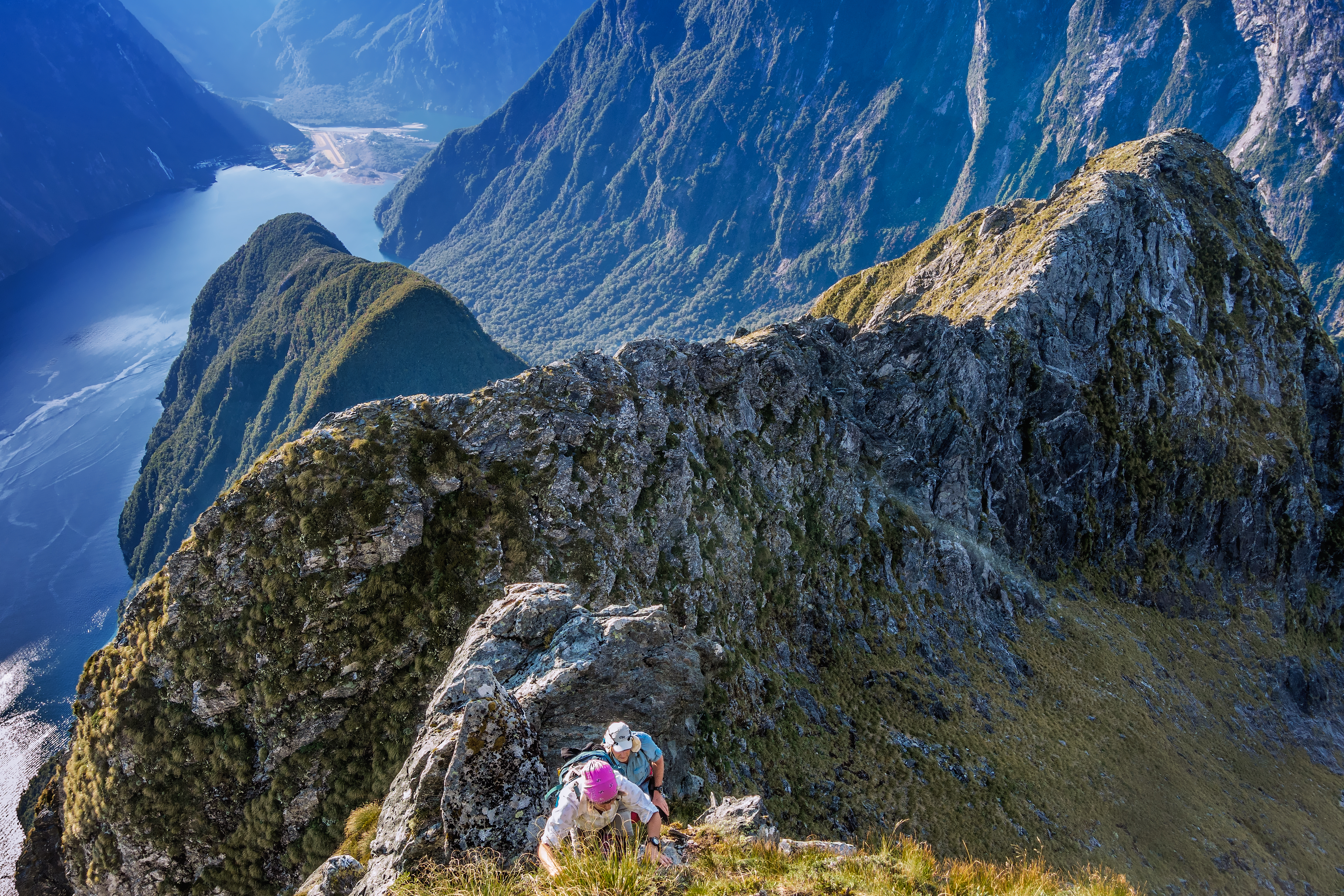
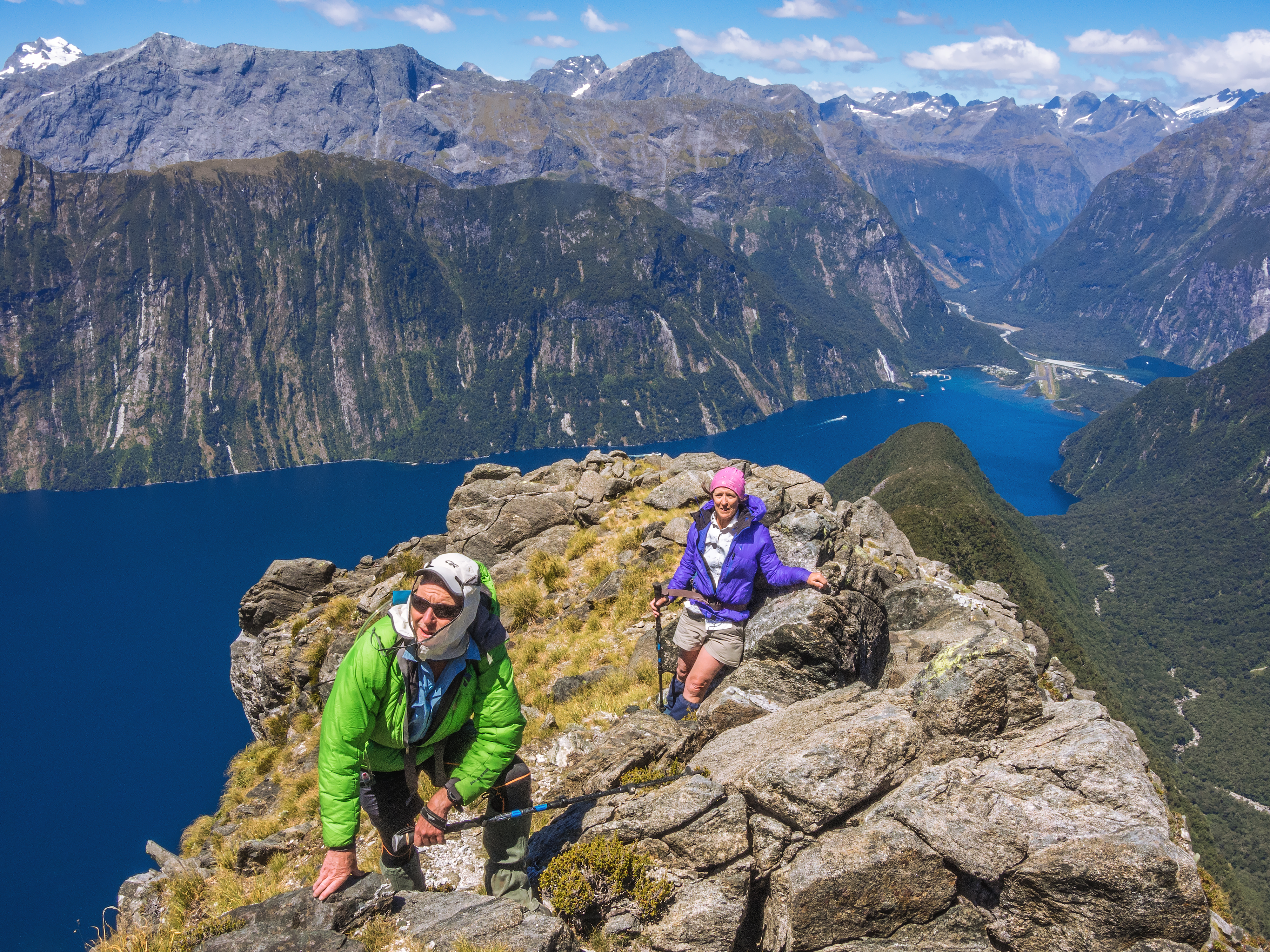
Climbing above the bush at about 950m our route unfolded, up and along a narrow rocky ridge. A sheer drop into an uninviting void confronted us on the north lip of a distinct notch at 1300m. On closer inspection, we could see a steep but reasonable trail dropping from the lip to this narrow notch. However, rising up on the other side was ground that looked somewhat more intimidating and I could see why this section was deemed the crux.
It required trial and error to find the safest route up from the notch. But in the calm, dry conditions we enjoyed, there was no need for a rope, just patience and concentration, particularly for the first 50m. After the crux, I expected that the gradient would relent more than it did, but the exposure was ever-present and steep staircases continued to present themselves.
By this stage, we were getting pressed for time. We were at 1430m and the summit was a further 250m above. We’d climbed the crux, but the highly exposed, relentlessly steep terrain didn’t make for fast travel.
We had arranged to meet our water taxi at 5pm and adding to the challenge we were running low on water and forecast rain was fast approaching. We knew that rushing a tough, exposed route in a dehydrated state, in wet conditions, was a recipe for trouble.
So, satisfied with the climbing and with the crux behind us, we realised we didn’t need to carry on. It was time to head back down.
It would have been great to have reached the summit, but we believed our retreat was the right call. I doubt I’ll have another crack at the peak, but if I do, I would swap climbing gear for more water, then go for the top on the first day, bivvying at the 730m camp.
We later learned from our water taxi skipper that only about a third of his clients reach the top.
He also told us that a local had once completed the climb, including a self-paddle to and from, in nine hours and in bare feet.


