Home / Trips / Northland

Kerikeri River Track, Kerikeri

Cascading river walk

For a relatively short walk, the Kerikeri River Track has a lot to offer, including waterfalls and historic sites. We started at the car park on Rainbow Falls Road on the outskirts of Kerikeri and began by taking in the spectacular Rainbow Falls. There are three viewing platforms within 10-minutes’ walk from the car park and from here we looked down the 27m drop from the top of the waterfall.  

Nearby are the remains of a weir that supplied water to an early hydro-electric station further down the river. Parts of the old water race could be seen beside the track in places. Although, only minutes from the road, we were already amongst the bush that flanked both sides of the river. This regenerating forest was mainly puriri, karaka, totara and manuka, with tree fern and flax. Fantails flitted around as we walked. 

The track winds down past some interesting rocky cliffs to the base of the falls. The Kerikeri River flows through a valley of basalt lava, formed by volcanic activity around 200 million years ago, and we passed more rocky outcrops along the trail. At the base of the waterfall, there is a swimming hole and some adventurous people were investigating a cave behind the cascades of water. 

We continued walking the River Track, which is part of the Te Araroa Trail, towards the Kerikeri Basin. This section of the track has a boardwalk but most of the walk is on a flat, well-surfaced path. Because the track follows the river, we found ourselves looping right around in almost a full circle before the walkway turned back towards Kerikeri. There are some more swimming spots here called the Fairy Pools.

Historic Kemp House. Photo: Heather Whelan

The modern world intruded a little further on, the concrete bridge of the Heritage Bypass loomed above.

At an open area along the track is the Wharepuke Falls; these are not as high as Rainbow Falls but are equally as pretty. Then it’s back amongst mossy rocks and gnarly puriri, before coming across a building besides the track. Informative signs inside tell the story of Kerikeri’s first hydro pumping station, built in 1930 to produce power for settlers arriving from England. The water ran to here, in races dug by Yugoslavian gum-diggers, all the way from the weir at Rainbow Falls.

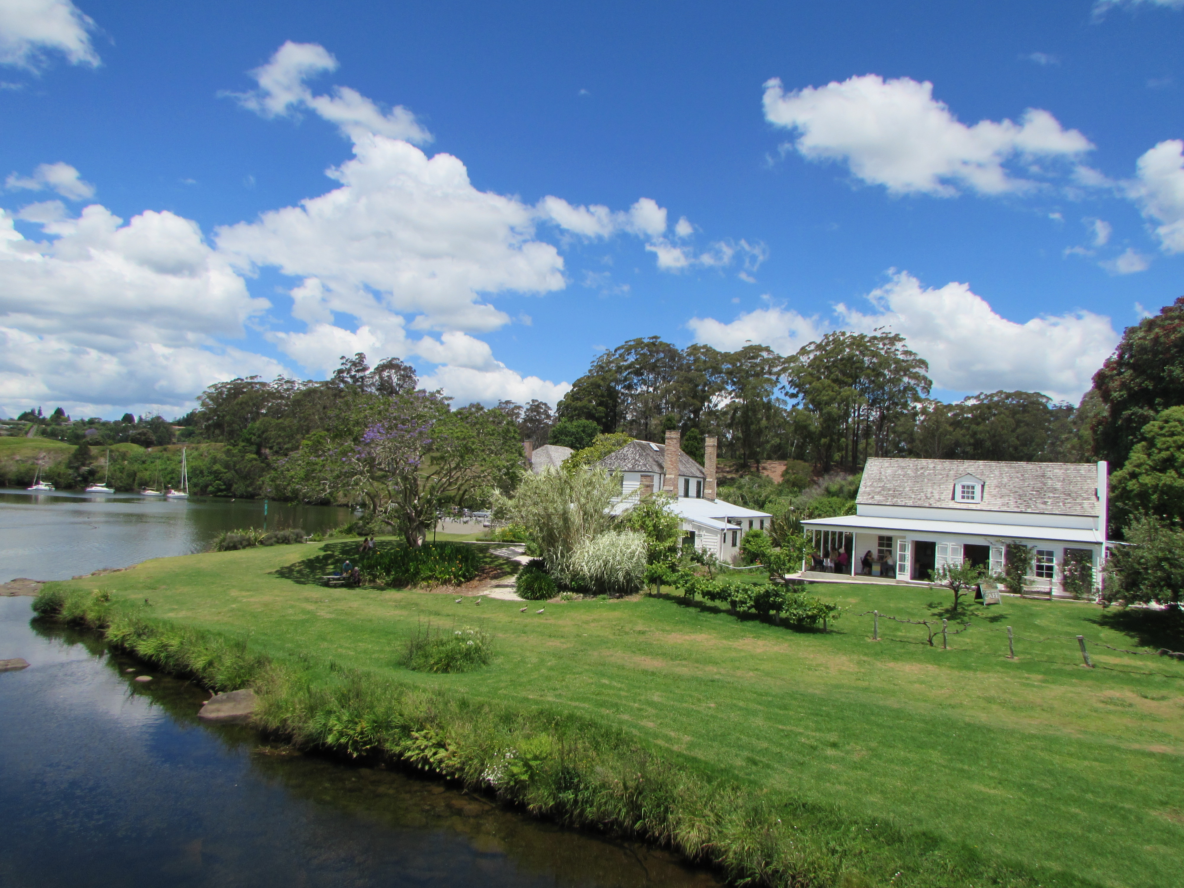
The final part of the walk goes beside some lily ponds before the bush is left and we arrived at the Kerikeri Basin Reserve. A modern curved footbridge links the two banks of the river and from here there are lovely views of the historic buildings, Kemp House and the Stone Store, and of the yachts moored in the basin.

The Kerikeri River Trail ends here but we decided to extend our walk by taking the short track to the summit of the hill overlooking the basin. This area, the Kororipo Heritage Park, was once Māori chief Hongi Hika’s headquarters. It was beneath this pa, and under Hongi Hika’s protection, that the Church Mission Society established its settlement.

Past the Stone Store, a carved entrance marks the start of the walk. To reach the summit of Kororio Pa, we walked up a slope beside gum trees planted in the 1800s. A palisaded viewing platform has information panels and stunning views of the Kerikeri Basin.

Distance
4.78km
Total Ascent
84m
Grade
Easy
Time
2hr one way
Access
From the Rainbow Falls car park on Rainbow Falls Road or at the Kerikeri Basin Reserve
Map
AV29

GPX File

Kerikeri River Walk (gpx, )

GPX File

Your device does not support GPX files. Please try a different device.