Journey up the broad Jollie River valley to a historic musterer’s hut.
Jollie River, flanked by the Burnett Mountains and the Gamack Range, flows into the north-east corner of Lake Pūkaki. The river valley has two ex-mustering huts – Jollie Hut and Green Point Hut – that were once part of Braemar Station before it became enveloped in the Gamack Conservation Area.
Access is from a clearly marked car park on Braemar Mount Cook Station Road. As this is a working station, ensure that gates and laneways are not blocked and keep to the marked 4WD track while crossing the easement.
You’ll reach the Gamack Conservation Area after 2.5km and some undulating terrain, after which it is a further 500m to Jollie Hut. The 4WD track is lined with exotic larch trees that turn golden in autumn.
Four-bunk Jollie Hut is spacious and has a separate bunkroom, a main area with a cooking bench, table and log burner, and ample space for camping outside. It received some deserved maintenance in 2021.Continuing on, the 4WD track drops to the Jollie River flats and eventually disappears at First Creek, which must be crossed. There are no markers beyond Jollie Hut, but travel is straightforward up the true left of Jollie River, and there is no need to cross it at any stage. However, the next large sidestream, Second Creek, also needs to be crossed.
Tussock terraces and occasional riverbed travel lead you further up the valley, with the mountains on both sides and Jollie Saddle coming into view as you progress. It is about 8km from Jollie Hut to Green Point Hut.
The valley begins to narrow about 1km before the hut, signifying its proximity. A worn ground trail leads up a tussock slope to an active slip, but it is easier to trace around the terrace below the slip than cross it.
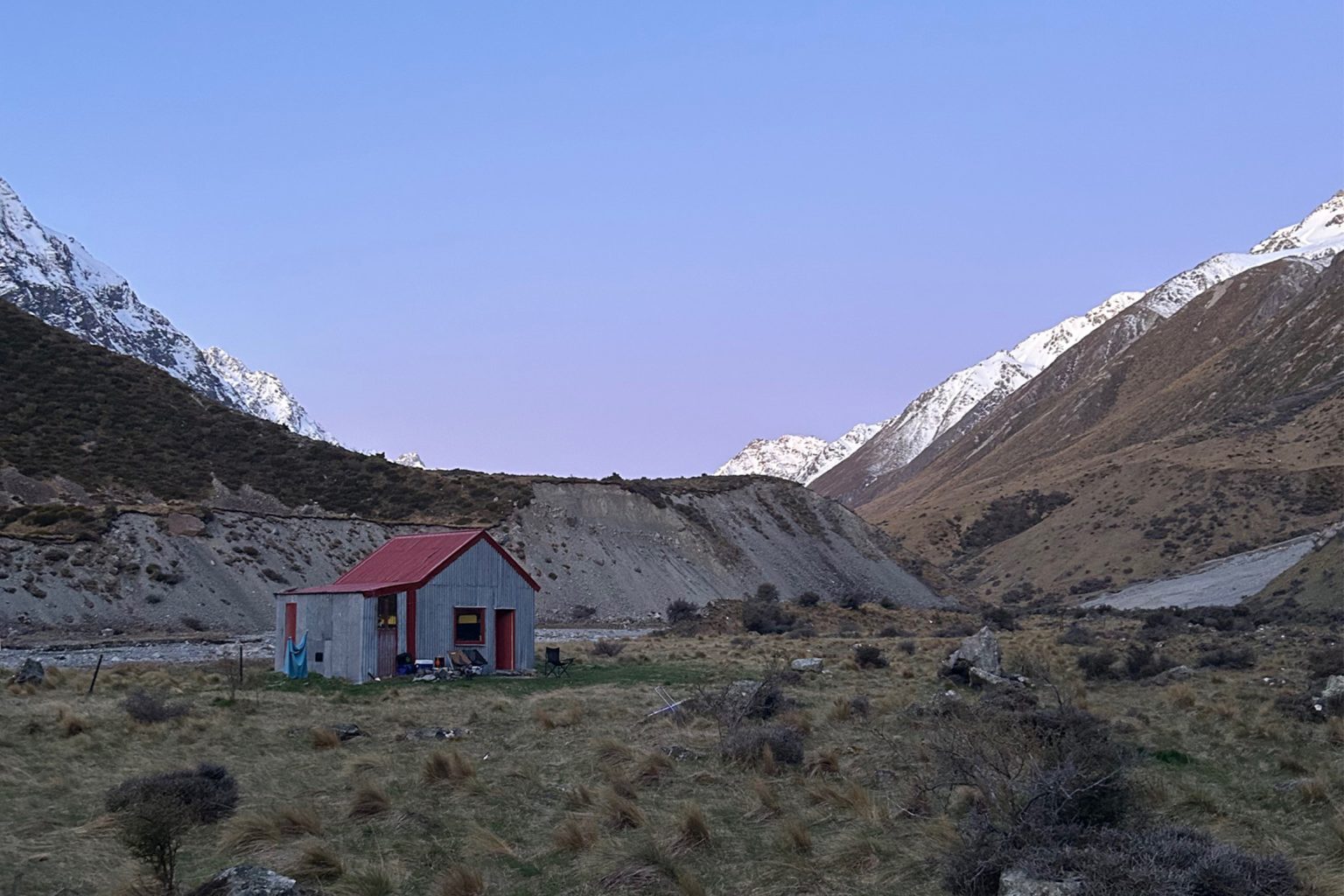
Rustic six-bunk Green Point Hut is perched on a terrace just above the river under Mt Burnett and Corbies Peak, and has a cooking bench (designed for tall people) and a table with benches. In 2021, lead screws in the roof were removed, Clearlite was installed and the window was replaced. It is popular with trampers, hunters and packrafters, so it pays to carry a tent even if there are not many cars in the car park. There is ample space for camping.
From the hut it is possible to travel further up the valley, crossing the Jollie River as required. The upper reaches provide views to the permanent snowfields on Jollie Saddle. It is breathtakingly wide and open with powerful waterfalls cascading from the mountain ranges that flank the valley floor. The Jollie can run high especially after heavy rain, so river-crossing ability is essential. As there is no marked or formed track, route finding and navigation skills are also important if you continue on. Otherwise return the way you came.