
Last year, when Lonely Planet lauded Taranaki as the second best region in the world to visit, it singled out the Pouakai Crossing as a ‘must-do’; as a magnificent trail that could challenge the Tongariro Alpine Crossing as the country’s finest day walk. The accolade had Taranaki tourism folk rubbing their hands with glee, immediately promoting ‘The Crossing’ to all comers. Then came a rainy summer; complaints about mud and calls for urgent track upgrades to meet the heightened expectations brought about by all the hype.
More focus on the walk now comes from the recently released Tapuae Roa, the Taranaki Regional Economic Development Strategy, which targets tourism as one of three sectors for ‘acceleration’. Developing a multi-day regional walk, encompassing the Pouakai Crossing, is a major initiative designed to ‘amp-up’ the sector. This proposed ‘Taranaki Crossing’ has, in fact, just been shortlisted by DOC as one of the potential new Great Walks.
Chair of the strategy ‘lead’ team and prominent local businessman, Peter Tennent, says the document is aspirational, aiming for everything to be world class and that tourism, featuring outstanding regional attractions such as the Pouakai Crossing, is key.
Last year government funding to the tune of several million dollars was announced for car parking, track upgrades and interpretation for the Crossing.
With two easy-access huts great for families and ‘first-timers’ in the hills, and fragile wetlands and slip-prone mountain slopes, is there a risk that this gem of a place will become overcrowded and overdeveloped?
Darryn Ratana, DOC Taranaki partnerships manager, doesn’t want that to happen but says the people are coming and the department has to manage the situation. He says licence for development also comes from a 2014 DOC user study, which highlighted the demand for a ‘premier one day walk in the region’.
“This doesn’t mean we are neglecting other tracks in the park; we are simply responding to demand.”
However, Ratana promises careful environmental assessment and iwi consultation before any major work begins on the ground.
“There is also a risk of promoting it extensively before any upgrade is completed. I’d rather do the work before we do the promoting, then people will have the experience they are expecting.
“Until recently, we didn’t even have a Pouakai Crossing day walk, it was just part of the park’s network of tracks. It may frustrate our [tourism marketing] friends at Venture Taranaki, but from an ecological and iwi point of view, it is critical that we take the time to do this properly.”
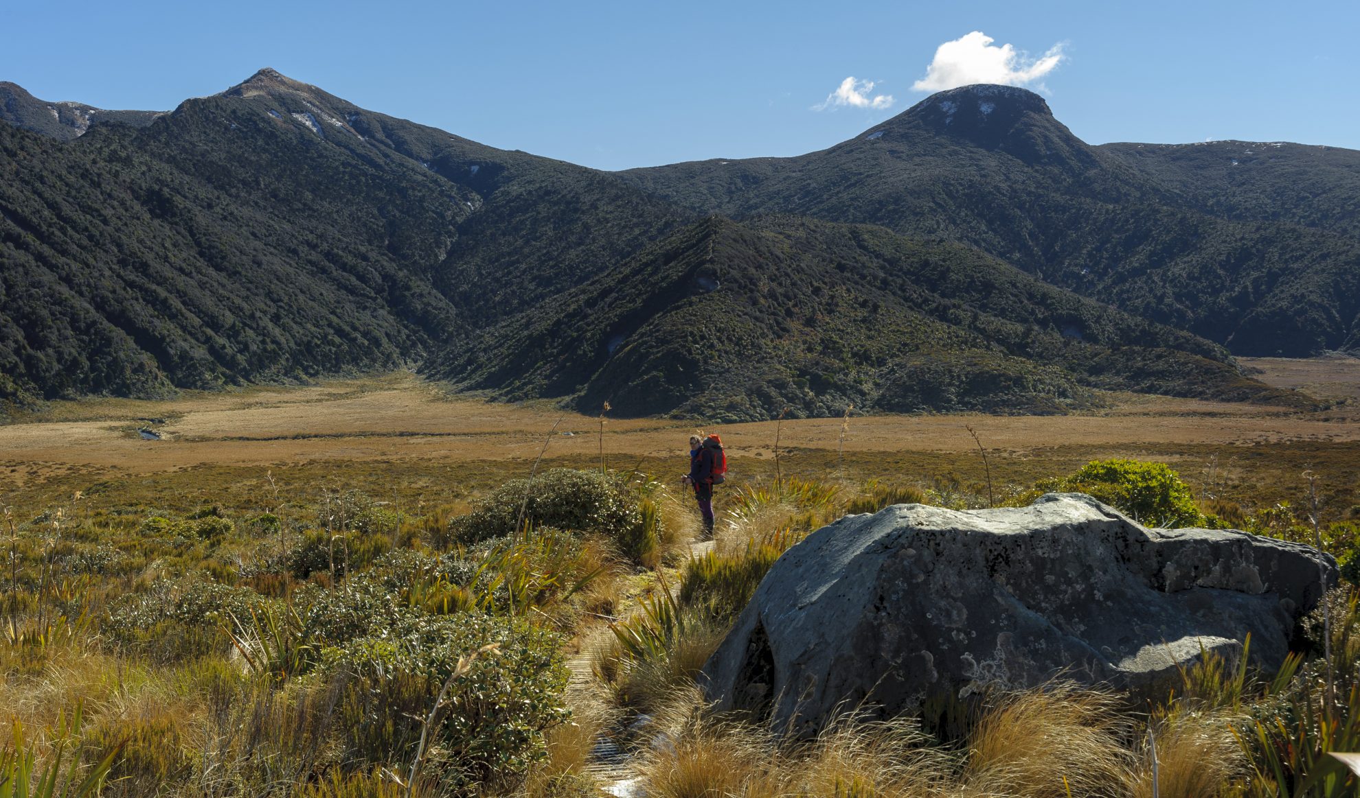
To clarify, the 18.4km route crosses from North Egmont Visitor Centre to Mangorei Road end, which are 30km apart by road. It traverses Mt Taranaki’s north-eastern slopes, Ahukawakawa Swamp and the Pouakai Range; cherry-picking along the way some of the park’s finest features; lava bluffs, goblin forests, wetlands and tarns and tussock tops.
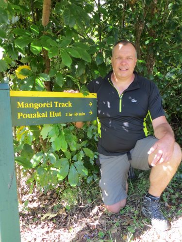
It’s difficult to determine the exact increase of Pouakai Crossing day-trippers, as people also use this track network to explore the Pouakai Circuit (an overnight Pouakai/North Egmont loop), the Round the Mountain Track, and to stay in either Holly or Pouakai Hut. However, DOC figures show 108,722 people visited the North Egmont Visitor Centre in 2017, up 13,775 on 2016. And in 2017, the number of people walking the Mangorei Track, at the eastern end of the Pouakai Crossing, increased by a third, from 13,000 people to 17,300.

Of the latter, Ratana says many are now just walking up to Pouakai and back to get ‘the tarn shot’, showing Mt Taranaki reflected in a tarn, near Pouakai Hut. Browse Instagram, you’ll understand.
Rob Needs, director of Top Guides, also runs a Pouakai Crossing shuttle service. He doesn’t yet have this season’s figures but confirms that numbers have increased. Interestingly, he says his main clients are European women, with a noticeable upswing this season of Kiwi walkers.
Ratana says that during the summer of 2016/17 for the first time, traffic management was required at North Egmont. He attributes this in part to the wet weather, which meant more people crowded into the park on the few fine days. The rainfall also led to complaints about muddy conditions on the Crossing, from those reading the promotional hype and expecting a higher quality track. This summer’s good weather helped spread the load.
So, what is to be done?
First up will be a new car park and toilet facilities at the Mangorei Road end (at the national park entrance). This is a New Plymouth District Council (NPDC) development, helped by a $700,000 boost from the government’s Tourism Infrastructure Fund. NPDC Manager Transportation, Carl Whittleson, says a 1.15ha road end section has been purchased and resource consent approved for toilets and a car and bus park for around 66 vehicles. It is expected that design and construction work of the tree-lined site will be completed ready for next summer. Whittleson said this would alleviate issues arising from increased use; parking overflows, road safety, and the obvious need for toilets.
Rob Needs is not a fan of the development. “This will make Mangorei Track even busier – passing lanes next! – with visitors misguided by blogs thinking they can just take a quick walk to the ‘mirror lake’ and get ‘the shot’ therefore completely missing the amazing Ahukawakawa wetlands, goblin forest and the flanks of Mounga Taranaki. North Egmont has the greater need for infrastructure.” (Mounga is the Taranaki dialect for maunga or mountain.)
However, Peter Tennent says whether we like it or not, people are coming and they drive cars, so they need car parks and toilets. “We’re currently under-delivering on the promise; we need to protect our mountain for future generations.”
Meanwhile, DOC has been allocated around $3.4 million, over a four year period, for track upgrades and interpretation. Ratana says this will involve several stages, with the first year focussing on environmental planning, iwi consultation and consents.
Consultation with iwi is critical, he says. “This will hinge on us satisfying iwi around cultural and safety elements. We should also talk with iwi about the name. It’s currently known as the Pouakai Crossing, but the walk also crosses Mt Taranaki.” Long-term, Ratana would love to see opportunities for cultural guiding on the Crossing, to give a richer experience and understanding.
He points out that Treaty talks over Mt Taranaki have just begun, now that a ‘Record of Understanding’ has been signed between all eight Taranaki iwi and the Crown. Ratana believes the Crossing consultation can continue alongside these negotiations.
He also anticipates that essential upgrade work could begin this year, in particular around boggy sections between Ahukawakawa Swamp and the Pouakai Range, and hazardous slip sites on Mt Taranaki. The most notorious of these, Boomerang Slip, has been stable for the past few years but the reality of the mountain is that it’s continually eroding, says Ratana.
The major proposal on the upgrade wish list is re-routing the track that climbs from Ahukawakawa to the Pouakai Range.
“The current route is steep and prone to excessive mud, especially after rain. Increased use adds to this, and people walk further off the track to avoid the mud, causing more damage. The idea is to bring the track up a more gentle ridge directly to the tarn on the Pouakai Range. The walk will be easier and it will shorten the overall distance of the Crossing by 2.5km,” says Ratana.
He expects the new section will be boardwalked, to avoid long-term maintenance issues. “The soil type there means any other option, for example wooden ‘rafts’ or shingle, will just sink.”
The re-aligned route would certainly enhance the experience and make the hike easier for many, says Needs. However, he worries about over capitalising on the track before it is required. “I feel it needs to be fixed up as an existing track and once it develops and is successful, then the realignment could be a reason for a return visit.”
Measures to protect the tarn area will be critical, adds DOC senior ranger Dave Rogers. He is talking of the place increasingly besieged by photographers, many of whom already trample off the current boardwalk built to safeguard this fragile area of wetland sedges, sphagnum moss and tussock, in their Instagram quest. Rogers also recalls coming across a whole class of school kids swimming in the tarn one day.
Whether an upgraded Pouakai will relieve pressure on, or even rival, the Tongariro Alpine Crossing is a moot point. It’s perhaps unlikely, given Tongariro’s volcanic landscape (arguably more dramatic than Taranaki, striking though it is), Lord of the Rings hype (for better or worse) and location, bang slap in the centre of a major tourist route.
Ratana shudders and says no one wants Pouakai to become another Tongariro, with all its inherent crowding issues. He says Pouakai is quite simply a beautiful walk, in its own right. Needs doubts it will rival Tongariro, but does say Pouakai provides an excellent alternative while clients wait for a weather window on Tongariro, plus it gives people a reason to revisit New Zealand. “I’ve had many clients say they’re glad there is another hike to do.”
There’s another plus, he adds. “The Pouakai Crossing certainly appears to have taken some numbers away from the (Mt Taranaki) summit climb, which can only be positive from a cultural and safety perspective.” It’s a good point, though not forgetting that conditions even on the Crossing can quickly change, to the point of being dangerous for inexperienced walkers.
Perhaps the last word should go to that doyen of informed opinion; Tripadvisor, and an entry written on January 13 this year. “Wow! Did the Pouakai Crossing to try to get the mirror lake photo. That is just one element of a feature-filled day hike. Start on a majestic mountain, wander thru [sic] goblin forest, visit an amazing wetland, NO CROWDS!!!”
Bringing back the birds
A record number of blue duck/whio ducklings have been counted in Egmont National Park this summer, following intensive predator control in the north of the park.
Mt Taranaki whio were designated “functionally extinct” in 1945, because of stoat and rat predation. They were re-introduced following the predator control programme, now spearheaded by the Taranaki Mounga community conservation project. DOC ranger surveys this summer found 64 ducklings in eight rivers throughout the park, the previous record was 53.
Also back and breeding are toutouwai (North Island robin), which hadn’t been seen on the Mounga for 112 years. Last April, 50 toutouwai were released into a 1000ha area where Taranaki Mounga has installed more than 2000 A24 rat traps, the largest area in which these traps have ever been deployed. At least three pairs are now breeding and more toutouwai will be released onto the mountain next year.
Taranaki Mounga; a collaboration between DOC, Taranaki iwi, NEXT Foundation and community partners, plans to continue expansion of its predator control programme in the park, and establish a ‘Mounga to Moana (Mountain to Sea) ecological corridor.


