Contours, compass bearings and grid references can all make navigation seem a little bit complicated. But it doesn’t need to be – by using a technique known as simplification you can make navigation an easy task.
The key behind simplification is to break the route up into manageable chunks and at key points on the way reaffirm your position. This will reduce the time you spend reading the map.
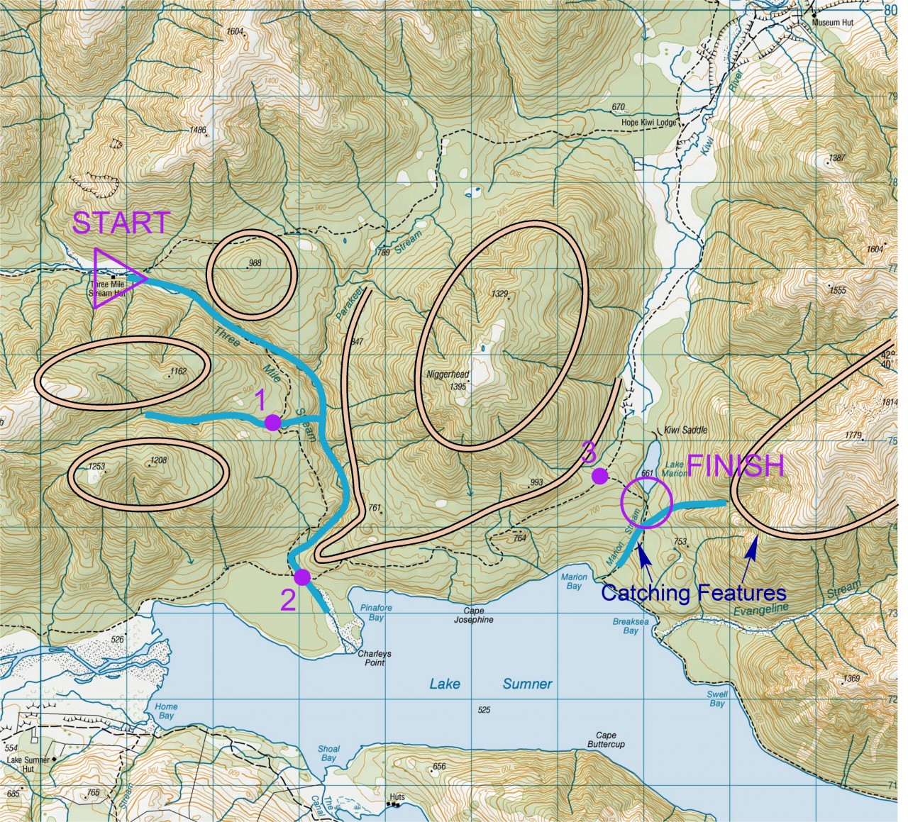
Besides your destination, you should identify key features which will act as ‘catching features’ and are used as a back-up should you overshoot the ‘control’ or ‘checkpoint’.
In the example pictured above, travel from Three Mile Stream Hut to Lake Marion can be simplified into four distinct hills and one major stream system which the track crosses twice. Points 1, 2 and 3 identify key decision points along the way where the map needs to be rechecked. Beyond the destination there is a hill slope and a second stream junction. If you have reached either of these two points then you know you have gone too far.
Orienteer’s call this method ‘collecting features’. The choice of features will depend largely on the map you’re using and your planned route, but may involve major ridges, sudden changes in vegetation and lines of rocky outcrops.
Simplification is a way of making things easier and for best effect should be used in conjunction with other techniques like compass bearings, fine navigation and the use of attackpoints.


34 years of inspiring New Zealanders to explore the outdoors. Don’t miss out — subscribe today.

Questions? Contact us