Image of the May 2013 Wilderness Magazine Cover Read more from the
May 2013 Issue
Home / Articles / Wild Trips

Rolling along the Rakaia

View of the Upper Rakaia Gorge with the Mt Hutt Range in the background. Photo: Andrew Lowton
Distance
10km
Time
3-4hr
Grade
Easy
Access
There is a small parking area at the northern end of the Rakaia Gorge Bridge and a larger car park farther back along SH72
Map
BX20

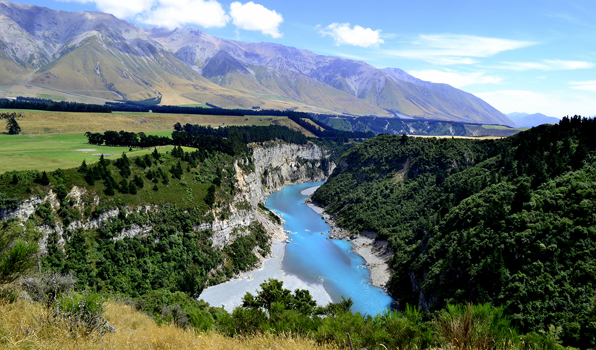
Rakaia Gorge Walkway, Canterbury

A sunny summer’s day saw us heading along the Inland Scenic Highway to the Rakaia River. After an hour’s drive we parked up beside the historic Rakaia Gorge Bridge. A plaque informs us that the bridge was completed in 1882 and was built in wrought iron in an unconventional form of trussed beam that is unique in New Zealand.

The walkway starts across the road from the parking area. For the first 10 minutes you can’t see the river but then its turquoise waters appear between the trees. The winding path offers tantalising glimpses at first and then a full-on view of the sweeping bend the river takes before flowing under the bridge. We zigzagged through stands of trees and up onto a glacial and river-cut terrace bordering a field, hopped a stile and headed down to a viewpoint that provided fine views of the lower gorge, with the Mt Hutt Range towering above.

From here the walkway follows the rim of the gorge. A weathered information board provides the geological story behind the making of the gorge and identifies layers of rock that are visible in the cliffs, including coal seams. We continued through more regenerating forest and emerged into burning sunshine alongside a fenced field. A short way along, a large sign inside the fence reads ‘Welcome to Terrace Downs’, an upmarket resort with a world-class golf course.

In the middle of the field stands a single large tree and beneath it two weathered canvas chairs and a picnic table make an inviting place to shelter from the heat. As we ate our lunch we could hear golfers cursing atop the ridge behind.

We continued, dropping down into a gully of montane forest and shrub. Here, a short side track leads to the site of the old Snowdon Coal Mine. We explored the entrances to several mine shafts that looked bleak and forbidding.

We then boulder-hopped across a creek, climbed steeply out of the gully and arrived at a signposted junction. The walkway forms a loop from here and we chose the right turn, the shortest to the viewpoint. After a few steep zigzags we emerged onto a tussock-covered terrace that rose steadily to Upper Gorge Viewpoint. Far below, a jet boat whooshed around a bend in the river. The turquoise river flowing between steep cliffs and forested slopes with a backdrop of mountains and blue sky was picture-perfect – a fitting destination for a day’s walk.

Beyond the viewpoint, the path drops steeply down and back into the forest. A short track leads to the river and, if pre-arranged, Discovery Jet can pick you up here and zoom you back along the river. Alternatively, they can drop you here for a one-way hike back along the walkway.

We returned the way we came, with a different perspective of the gorge and the river, pleased to have finally explored one of Canterbury’s rivers beyond its road-crossing and resolved to search out more.

– Andrew Lowton