When headed for the high country, Avalanche Joe might not be the sort of name you’re drawn to for a companion.
But it’s certainly easier to pronounce than Jozef Nawalaniec.
Although a New Zealander born and bred, Joe has Polish ancestry. A tramper, climber and teacher, he lives in the Wairarapa, where in recent years he’s revived the defunct Rathkeale College Tramping Club.
As with many nicknames, there are various versions about how Joe earned his moniker. The most prosaic is that the proper pronunciation of his Polish surname sounds a bit like ‘avalanche’. A more interesting story goes that he was first on the scene when, a few winters back, some avalanches occurred on Mt Holdsworth. Joe took photographs of the avalanches, which are an unusual event for the Tararuas, and they ended up on the front page of the Wairarapa Times-Age.
Joe has certainly spent plenty of time in avalanche country, and over the last year celebrated his 50th birthday by a series of adventures both here and abroad. He made the first ascent of a 6000m peak, Suku Kangri, in the Himalayas (solo), ran a marathon in the USA’s Death Valley, abseiled down the Tararua’s Chamberlain Creek and completed a nine-hour Southern Crossing from Walls Whare to Otaki Forks.
While Joe now calls Carterton home, he lived for almost a decade in Marlborough, and that’s where the Raglan Range comes in. He’s undertaken more than 40 trips to the area, climbed a number of its peaks, and continues to sing the praises of this underrated range to anyone willing to listen.
Having listened, I’d been threatening to accompany him on a Raglan Range roam for a few years, and finally the stars aligned. For me, it was virgin country, as it was for our other two companions, Andy Dennis and John Rhodes.
The Raglan Range rises near the headwaters of the Wairau, forming a barrier of high mountains adjacent to Nelson Lakes National Park. It’s a place of great scree slopes, craggy summits, curious plants that can withstand both summer droughts and severely cold winters. Beech drapes the lower slopes, but instead of the mossy majesty of those forests further west, here it’s largely the densely packed pole variety of mountain beech.
Our gateway into this large chunk of backcountry was the Lees Valley. After crossing a swingbridge over the Wairau River, which is substantial even this close to its headwaters, we swung into the Lee – a tributary. It was easy going, meandering through beech forest, over grassy flats, with the warm Marlborough sun beating down. We stopped at one flat to brew up, as required on a regular basis by John’s addiction to tea. Rumour has it that the man can be located in the hills simply by following a trail of used teabags, hence his nickname: ‘Teabag’. He was reading The autobiography of a super-tramp by William Davies, a Welsh poet who in the 1890s swagged around the UK and North America. Brew in hand, John read us a quote: ‘What is this life if, full of care, we have no time to stand and stare.’
That’s the beauty of tramping. We have time to stand and stare. So we did: at the burbling creek, the tightly knit pole forest, and the bluffy summits ahead.
After reaching the nicely situated Lees Creek Hut, we each did our own thing. Having not drunk any for at least an hour, John brewed more tea, while Andy read in the shade of the hut. Joe went exploring up a side-creek, and managed to slip into a deep pool and douse his camera. I decided to sleep out and found a leaf-littered hollow on which to spread my sleeping bag.
While the Raglan Range bears some resemblance to the mountains of Nelson Lakes, they are slightly lower, mostly hovering around 1800-2100m. Most of the range’s summits remain unnamed. Lying in the rain shadow of the Nelson Lakes mountains means it’s drier country. This, together with a greater number of scree slopes, lends the mountains a distinctly ‘Marlborough’ appearance, which Joe says increases the further east you tramp. ‘More curmudgeonly’ is how he put it.
Speaking of curmudgeons, John is happy now that he’s downed another litre of tea. This was his first big tramp since a surgeon installed a stainless steel knee into his leg 18 months ago. So far, he had tramped well, moving fast and fluently on the flatter terrain. Rougher country ahead would fully test it.
I woke to a curious sensation. Something tap-tap-tapping, ever so lightly, on my sleeping bag. It’s odd, and I slowly open one cautious eye to see a chubby South Island robin bouncing along my chest. Robins are naturally curious and friendly, but this one is off the scale. He can’t resist having a pull at my hair, and then gives it a good yank. I get a fright, yell, the bird retreated, but then, later, he approached my telephoto lens so closely that I can barely focus. In the resulting image, the bird’s head almost fills the frame and I can see my reflection in its eye.
The night before, we’d had a vigorous debate about ‘dirty politics’. I have a habit of bringing strangers together for a tramp, which some have called a dangerous social experiment. Now I’m worried that the heat of the argument might frazzle the harmony of our small community of individuals.
After we leave Lees Creek Hut to head up-valley in the welcome shade of early morning, Joe and I warm up to a discussion about nuclear energy, which is promising to get explosive. Andy, ever the wise sage, reminded us to shut up and enjoy our surroundings.
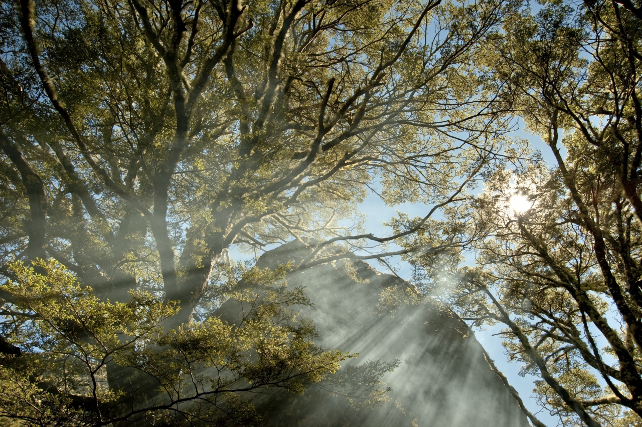
Talk stifled, we revelled in the scenery. The sun filtered through the forest, illuminating the delicate beech leaves, and casting even more delicate shadows on the moss. Joe told me we are experiencing ‘komorebe’, the term used by a Japanese friend of his to describe just such scenes. It translates to something like ‘sun dappled light coming through the trees to fall on the ground.’ That could almost be a haiku, I thought.
Past the last of the trees, we slogged in the heat beside the rapidly dwindling stream. John and I were distracted by filling water bottles, and failed to notice that Joe and Andy had branched up a scree slope opposite us. Their calls alerted us and we start a traversing trudge across the loose rocks to join them. It’s two steps up, one down, somewhat compensated by the observation of hardy scree plants that eke out an uncertain existence in such habitats.
After lunch in a high basin, we crested the range between two unnamed peaks, known simply as Pt1965m and Pt1938m. Expansive views unfolded, but there was a lot of tramping still ahead. The Raglan Range sports lines of bluffs, and we had to negotiate a way through one such barrier if we were to reach the headwaters of our next valley, the Branch.
Much as it cuts against your natural inclination, it’s always worth dropping your pack and scouting ahead. I did this and quickly ran down a likely looking rocky gut to see if it would go. It did, and soon we were all clambering down it, trying not to knock rocks onto each other. This sort of travel is slow with a steel knee, but John handled it steadily and surely.
He needed refreshment of the tannin-stained variety though, so we made a small fire and brewed tea, content that we were almost at Branch Biv. We hadn’t counted on a small gorge, however, which proved slow going, involving some tight travel through pole beech on a high sidle.
Debate for the day centres around use, or misuse, of the English language. When I used the phrase ‘not uncommon’ to describe a scree plant, John bemoaned the double negative as a waste of syllables. ‘Why not just say common?’ he asked.
I disagreed and argued that ‘not uncommon’ has a distinct meaning, somewhere between ‘common’ and ‘uncommon’. Andy and Joe backed me up, and John conceded. For the rest of the trip he used the phrase to describe just about everything we saw. ‘Gorges,’ he quipped, ‘seem not uncommon in this country.’
Branch Biv, like many in the area, lies on the edge of a pleasant grassy flat. Someone had left a dozen eggs, which we eagerly devour in addition to dinner. The following day, we followed a track through the forest that led to Bottom Misery Hut. It was another roasting hot Marlborough day, with the temperature well into the 30s. We stripped off for a swim and then more English language abuse followed, with Joe writing in the hut book: ‘Well-named hut: lots of pasty white bottoms down in the swimming hole, providing misery for on-lookers.’
This far down the Branch Valley, the country’s character abruptly changed. Instead of beech, wilding pines dominated, their alien green ranks marching up the hillsides, threatening to take over the tops. It’s a depressing sight. They’re the result of ill-conceived forestry projects begun last century, and now Douglas fir and radiata pine have all but overtaken the native vegetation in the lower valleys of the Leatham Conservation Area.
Happily, our route into the head of the Misery took us past these unsightly conifers and to one of the most scenic parts of the range. Although it has the unlikely name of Top Misery, Joe had been raving about this spot and it’s as good as he’s promised. An ex-Forest Service hut occupied a terrace set in a fine basin, edged by tongues of beech forest and surrounded by substantial peaks.
I slept outside for the third night in a row, happy to avoid the heat of the hut.
Early morning sees us tramping past a mossy waterfall into the head basins of the Misery. This is tramping paradise. We boiled a brew beneath a huge boulder set in a tiny copse of beech and watched the sunlight streak through the smoke. More climbing followed, hauling up a steep slope using tussocks. I noticed a large patch of mountain daisy, Celmisia traversii, which I thought was restricted to Fiordland and Kahurangi. Not quite that uncommon perhaps.
At a large tarn in the valley head, more swimming beckoned and it’s gloriously refreshing. Around the edge grew a red pondweed, which Andy told us is the same as that which gives the Red Tarns of Aoraki/Mt Cook National Park their name.
We neared the range crest again, heading for a pass that would take us into Hellfire Valley. We had a choice of routes. Andy took the sensible option of sidling tussock terraces and then climbing directly to the pass, but Joe was keen for the rest of us to clamber over some Raglan Range peaks. We did, crossing a few of 1900m height, with some scrambling in places. I gave myself a fright when a handhold pulled off and I plunged back to be stopped by a ledge. I have a sore back, but it was a timely reminder not to rely on just one hold. Moving more cautiously, with at least three points of contact, we finally reached Pt1988, and the remains of a battered old trig beacon. The peaks of Nelson Lakes protruded to the west, and below an exquisite turquoise tarn beckoned in the very head of the Hellfire.
Before we could dive into its inviting waters, however, there was some more navigation through bluffs and we each managed a different route. After we reached it, the tarn proved so deliciously sun-warmed that it was tempting just to set up camp and stay swimming until dusk, but Andy reminded us we had to be out tomorrow. The map showed no track in the Hellfire. Given gorges are not uncommon in this country, he noted it might be slow going. As long shadows fell over the valley, we tramped to the bush-edge and set up camp.
At first we found much easier travel in the Hellfire than expected – there was a rudimentary track which we later discovered has been maintained by the Nelson Tramping Club. But Andy was right, there were two stings in the route’s tail. One, literally, was a sting or three from wasps, which infest the area during summer. And two, a huge mess of windfall, which had obliterated the track below the gorge. For John, clambering over trunks massed in precarious heaps proved torturous, but eventually we were out of it and down by the flats of the Wairau once again. Joe, who had forged ahead, handed out long stewed tea.
‘The Bounds of Hades’ is one early name for the Raglan Range, and we certainly found it hot travel in the drought-afflicted Marlborough summer. But there had been far more heaven than hell. High, dry mountains. Resilient plants that live on shifting rock. Lovely, tidy, seldom-visited huts. And moments of camaraderie and of komorebe.
Thanks Joe.
Access: From Rainbow Road, the hydro electricity road that runs between St Arnaud and Hanmer. A permit from Rainbow Station ($20 per vehicle) is required if travelling past a locked gate
Grade: Difficult. Off-track travel and route finding
Time: Rainbow Road to Lees Creek Hut (4 bunks), 3.5-4hr; To Branch Biv (2 bunks) via Lees Creek headwaters and Raglan Range, 7-9hr; To Bottom Misery Hut (6 bunks), 3-4hr; To Top Misery Hut (4 bunks) 3-4hr; To Hellfire Stream tarn, 3-4hr; To Rainbow Road via Hellfire Stream, 4-6hr
Map: BS25

34 years of inspiring New Zealanders to explore the outdoors. Don’t miss out — subscribe today.

Questions? Contact us


