Short walks on Otago’s Peninsula promise unique wildlife encounters and scenery, writes David Barnes
Otago Peninsula has had high praise from some eco-knights. Sir David Bellamy said it was “one of the finest examples of eco-tourism in the world ”, while his compatriot Sir Richard Attenborough said it “is a unique and very special place. It is a place that every visitor to Dunedin should see”.
I’ve lived at the Peninsula’s urban end for more than half my life, so its many walking opportunities feel like an extension of my back yard. There are over 20 tracks on its 20km length. Many are short, but several times I’ve strung half a dozen together to lead a trip for the Otago Tramping and Mountaineering Club that I’ve called All Day on the Peninsula.
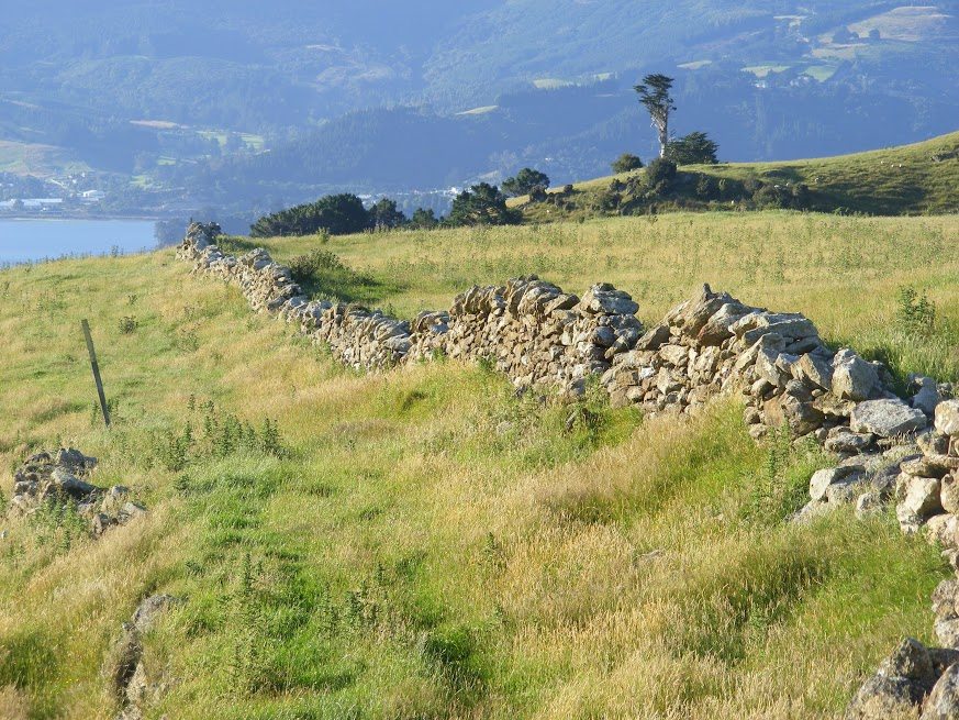
The peninsula’s north-western side encloses Otago Harbour. First Portobello Road and then Harington Point Road skirt the harbour’s shores, leading to Taiaroa Head at the harbour entrance. A variety of roads branch off from the harbourside, or from Highcliff Road, which runs along the peninsula’s spine, providing access to the rugged cliffs and spectacular beaches that are strongholds for much of the area’s acclaimed wildlife.
Taiaroa Head was an important site of Maori occupation in pre-European times, its commanding location making an excellent military stronghold. It was also used for harbour defence from the late nineteenth century till the Second World War. Today, it’s the site of the acclaimed albatross colony, as well as a blue penguin viewing operation. These and several other commercial operators provide the chance for those with short time frames to see much of the wildlife, although plenty of other opportunities exist elsewhere on the peninsula for a more self-contained approach for those with time.
Most of the tracks on the seaward side will take you to either a beach with the chance to encounter penguins, seals or sea lions, or cliff tops where a variety of seabirds, including several types of shags, can be seen.
Harbour Cone
Ask Dunedinites what the highest point on the Peninsula is and many will say it’s Harbour Cone. It’s not, but its classic volcanic shape makes it one of the most prominent, and also makes it attractive for walkers. The purchase of a 328ha farm surrounding it a few years back by the Dunedin City Council has given a boost to walking opportunities.
Leaving from a sign on Highcliff Road, 3km past the Pukehiki church, descend into Smith Creek, following marker poles. When the route splits, take the right fork down Smith Creek. As the stream approaches sea level, the track joins another which is an unformed extension of Turnbull Bay’s Bacon Street. It’s unformed because it’s far too steep to be a road, and some would argue it’s a bit steep for a walking track too. It gains 160m to rejoin Highcliff Road. Crossing the road, a marked route leads directly to the summit of Harbour Cone. If Bacon Street Track has exhausted you, it’s possible to walk along the road for around 1km to the car. If you make the climb to the top of the cone, you’re rewarded with panoramic views. A sharp descent brings you to a saddle, from where a 10-minute meander returns you to your car.
Wild file
Access Signposted on Highcliff Rd, which runs along the spine of Otago Peninsula. Closed for lambing September 1-November 1.
Grade Easy
Time 2hr
Map CE17
PIX: Harbour cone
The Pyramids and Victory Beach
This largely flat walk visits an important yellow-eyed penguin breeding area and the geological oddity known as the Pyramids. The latter are evidence of the volcanic activity that shaped the whole peninsula.
From the car park, a vehicle track leads, in 20-minutes, to the Pyramids. It’s a short scramble up the smaller of the two, where there’s a panoramic view of the beach and surrounds. Back on level ground, carry on past the Pyramids and take the left fork for a longer loop. Look out for sea lions in the vegetation as you make your way to the beach.
Depending on the weather, the 3km-long beach can be a place of benign beauty or a reminder that you’re on the fringes of the Southern Ocean. Turning right, a stroll towards the beach’s southern end takes you past the flywheel from the ship Victory, wrecked here in 1861 amidst allegations of drunkenness and incompetence on the bridge. From the end of the beach, follow the edge of Papanui Inlet, picking up a vehicle track for some of the distance, to Dick Road, from where it’s 15-minutes back to the car.
Wild file
Access 2km from Portobello, turn off Harington Point Road into Weir Road and follow signs for another 4km to the carpark at the end of Dick Road.
Grade Easy
Time 2 ½ hours
Map CE17 Dunedin