Thick mist hovers in the trees at The Divide car park on the Milford Highway
as I pull up for a pre-dawn walk to Key Summit, a modest bump on the ridge above the Routeburn Track and one of the places for easily accessible views from anywhere along the highway.
It’s early and there’s no one about – just me and the slightly spooky forest filled with hanging mosses, giant trees, and the all pervading mist. Craning my head to peer through a gap in the trees I try to imagine that the cloud is thinner above the treeline where I am headed.
The climb drags on and I just want to get there and see if it’s clear. But I have a solid 300m ascent to reach the bush edge where I may have good news.
The bush edge duly arrives, but there is no good news: the cloud seems just as thick, though there is a trace of light beginning to spill over the ranges from the east. I head up the zigzaging trail to Key Summit viewpoint, hoping my trip here and the lost sleep and relaxation of a morning at the riverside has not been in vain.
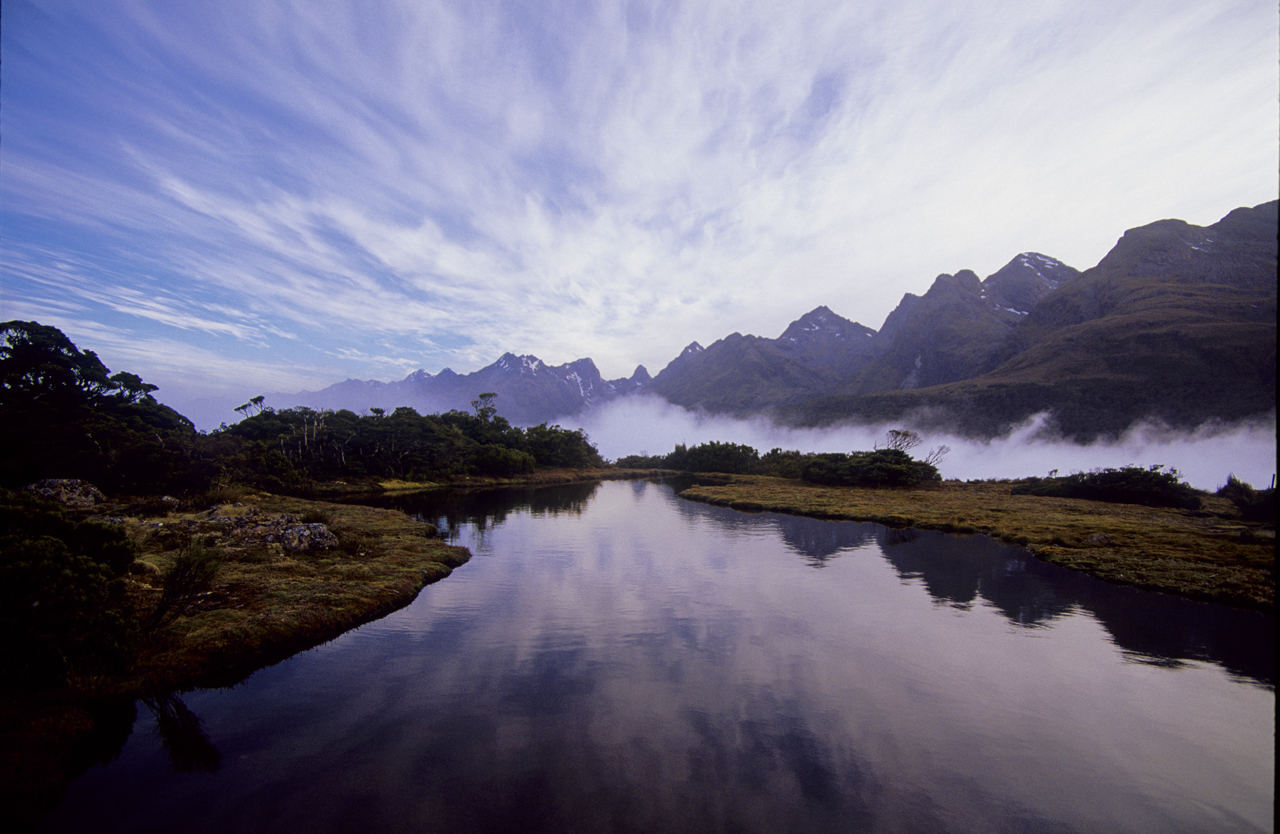
Another 100m climb and I am at the lookout, shrouded in cloud. It’s much colder here, so I pull out an extra layer and a hat, plus my camera gear just in case, grab a snack bar and as I survey the misty tarn in front of me a window opens in the cloud, revealing the Darran Mountains in all their glory.
The cloud disperse even more and the Darrans and Ailsa mountains are now fully revealed, jutting proudly from above the massive trench of the Hollyford Valley. Gazing at their snow-flecked summits raking the sky, I manage to get a hauntingly beautiful picture of the Ailsas, hanging like a crumpled parchment above the indigo surface of the tarn at my feet.
The Wilderness 40 Best Huts: 12 Top North Island Huts
Takorika, Havelock Water Supply Reserve
Subscribe!
Each issue of Wilderness celebrates Aotearoa’s great outdoors — written and photographed with care, not algorithms.Subscribe and help keep our wild stories alive.