Arthur Range traverse, Kahurangi National Park
You probably won’t read of this trip in a guidebook, or find it on a website. It’s a local jaunt in our backyard bush, only known by die-hard locals and lovers of the Red Hills.
Every three years or so, our tramping club tackles the Arthur Range, walking from Mt Campbell to the Lodestone in a single day. This 17km pilgrimage traverses five peaks over 1300m and lasts more than 10 hours, requiring a high level of fitness and aptitude in negotiating a route along beech-clad ridges and up steep rock faces – all off-track.
After all the scratches, bumps and bruises, the trade-off, on a good day, is unsurpassed views in all directions, and the pure joy of spending time in the mountains.
It’s 6am when I join my friends at the Badminton Hall in Richmond, our usual rallying point. Six of us cram into a Hilux ute and drive into the pre-dawn murk towards Motueka. A steep 4WD road meanders up Rocky River Road onto the forested flanks of Mt Campbell, with its trademark television tower guiding us to the summit. By 8am we have our boots on and our fleece jackets off. The low-angled sun is illuminating the landscape from the north-east, heating up the rocks beneath our feet. It promises to be a perfect day.
We splash suncream over our skin before heading south toward a subsidiary peak. At this altitude any vegetation is scarce so we make excellent progress down the hill. We crash through open beech forest onto some sunny saddles. The entire route is along a series of disjointed ridge tops and there is no water supply.
After several hours we top out onto the exposed expanse of Hoary Head, a monolithic table-top of shattered marble, 1473m above the Riwaka River. From this high vantage, we gaze across the vast wilderness of Kahurangi. To our north is Hailes Knob, the tower on Takaka Hill; beyond that is Golden Bay, glistening under the punishing summer glare; then, squinting into the midday sun, I gasp – is that really Mt Egmont? My companion confirms this sighting, and we rave about how blessed we are. A pair of kea arrive to inspect us, and we see a chamois wandering the lonely tops of Hoary Head.
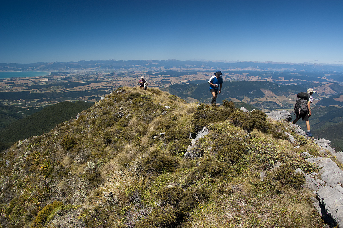
From the summit cairn, where I sip tea from a flask, we spot our support crew on our next objective: the serrated top of Crusader. Two tiny dots are moving as one, along the razorback summit ridge – Brian and Kurt had volunteered to park their van at Flora car park, and do our journey in reverse.
Dropping off a broad ridge we pass a cosy campsite, large enough for a couple of tents. Pressing on, the scrubby ridgeline narrows into a torturous knife-edge, forcing us to sidle beneath rock outcrops and do tricky manoeuvres. Under a canopy of dracophyllum we rendezvous with Brian and his mate. We swap route information and car keys.
Here I am, staring up the north face of Mt Crusader; 60-degrees of sheer terror. Three years earlier the club had climbed this truncated pyramid in a directissimo from the Graham Valley – nine hours of wild scrub-bashing and mild rock climbing. From the top, I had peered over the edge in disbelief at how any human would willingly choose to climb the north face. Now here I was, standing at the base, pondering the exact same question. Make no mistake, it wasn’t the angle of the climb which had my nerves on edge, no, it was more sinister than that. As Brian had warned us, the entire face was guarded with an army of wild Spaniards, ready to draw blood from even the most cunning and careful bushman. It wasn’t long before our limbs had blood mixed into the sweat and sunblock.
By 2pm we’re atop Crusader, the crux of the route at 1428m, and lunch is long overdue. I sit down with the others and lick my wounds. Somebody spots stick figures moving along Hoary Head; it must be our support party. We photograph the panorama from Tappy to Taranaki, naming the peaks we know and dreaming of future trips.
I get my second wind, and lead off down through stands of dracophyllum onto a saddle with our next waypoint, the gentle slopes of Mt McMahon (1342m). The neinei provide much-needed shade as we push on along open clay pans. A bellbird delights us during a rest stop, and we hear kaka. The afternoon sun has swung over our right shoulders when we make for our final objective, the lofty subalpine heights of Lodestone, still 5km distant. The open silver beech forest provides easy travel, and some kind soul has conscientiously marked a route with pink tape.
Two bushy knobs are traversed before the final summit push, clambering up tussock to a radio mast at 1462m. I am ecstatic to be here. My ancestors were the first to climb Lodestone in 1863 before exploring the Tablelands, starting the gold rush, and later grazing sheep there. John Salisbury and his brothers had cut a track over this mountain, down into Flora Stream. According to the surveyors who followed in later years, it was fit for neither man nor beast.
A 30-minute knee-jarring descent brings us down to Flora car park, our journey’s end. It’s taken us over 10 hours of walking. We arrive home in Nelson as dusk cloaks the hills.
Note: There is no water on the entire route. A small, flat campsite is located under the southern shoulder of Hoary Head.