Located between Christchurch and Greymouth, Arthur’s Pass National Park has a huge variety of hikes and climbs. The Mt Bealey Track offers spectacular views of Arthur’s Pass Village, the National Park and 2275m Mt Rolleston.
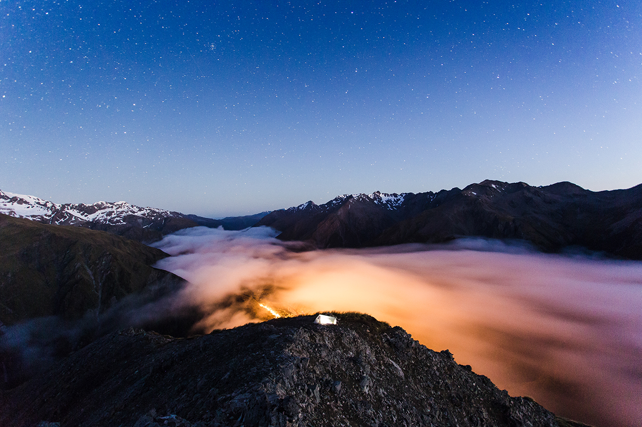
Because the summit can be reached within 4-5hr, most people do a return climb of Bealey as a day trip. But once past the bushline and above 1300m, various flat campsites can be found along the unmarked route leading to the summit, inviting trampers to spend the night surrounded by the park’s rugged peaks.
With most people in the area heading up the Avalanche Peak Track to the north, you’ll likely find a quiet spot to pitch your tent.
– Felix Hohagen


34 years of inspiring New Zealanders to explore the outdoors. Don’t miss out — subscribe today.

Questions? Contact us


