
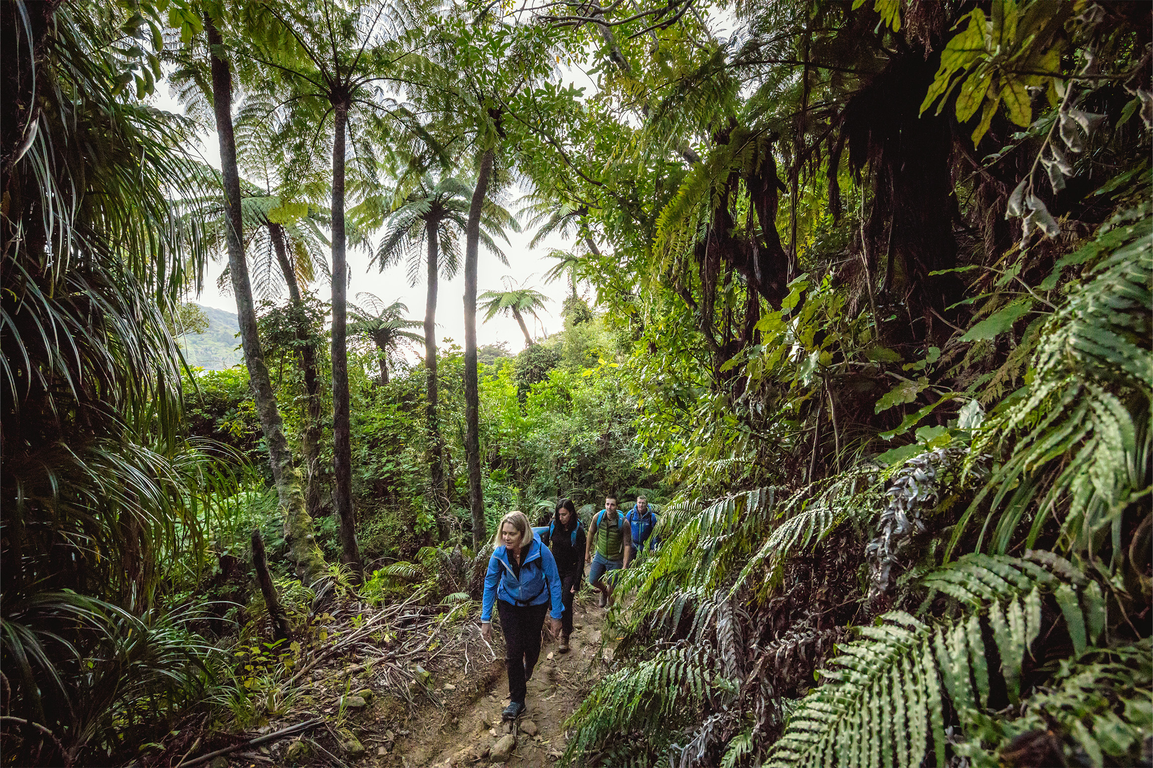
On the first day, Mum, Ginny, Sam and I walked four hours from Anakiwa to Mistletoe Bay Eco Village, a holiday park-style accommodation complex, where we’d booked a cabin. We cooked dinner in the well-appointed kitchen and went out at night to see that phosphorescence. The next day Sam and I farewelled Mum and Ginny and walked four hours along the ridge to Portage Resort where we installed ourselves on the deck with magazines, hot chips and prosecco. We went for a late swim off the jetty and floated around in the chilly sea, alone apart from several old salts mucking about with boats and calling to each other across the still bay. It was the resort’s last open weekend, the water temperature was still bearable, the evening cosy, and the morning had a pleasant autumnal mist off the sea.
The next day we walked 22km to Punga Cove Resort. Sam and I were splashing out a little on these lodges, the beer and the French fries.
Sam had outdone herself and brought a feijoa and ginger shortcake, batches of Anzac and oat and sultana biscuits, Rice Bubble slice and a dense loaf of nutty seed bread. On the ridgeline she broke out a bag of licorice allsorts she’d carried for three days. I had come off nearly 12 days straight of tramping from St Arnaud, and she forever lodged herself in my heart. These sunny days with friendship and stellar views were turning out to be a pretty good holiday.
The track is based on a network of settler bridle paths that date back to early farming days. The benign and seafood-rich area is also rich with the history of some of Aotearoa’s earliest inhabitants, as well as important cultural meeting points. Māori have lived and sheltered in Tōtaranui for at least 800 years, and the Sounds was an important trading site, close to much-valued lenses of pakohe argillite on Rangitoto D’Urville Island and in inland northwest Nelson. As strong as iron, the stone made essential and valuable toki (adzes) and other tools and was traded all over the motu.
and was traded all over the motu.
Captain James Cook visited Meretoto Ship Cove in 1770 and returned twice more during that decade on different voyages. Living there, when he arrived in the Endeavour, were the Kurahaupō iwi of Ngāti Kuia, Rangitāne o Wairau and Ngāti Apa Ki te Rā Tō, who met with Cook’s on-board Tahitian arioi (priest), Tupaia. They also traded with Russian sailors in 1820, when two ships anchored near Motuara Island. It had been more than 40 years since Cook had visited, but the iwi occupying those lands were the same peoples who had encountered Cook and his men. Māori artefacts gathered at this time are still held in Russian museums today.
A little bit of reading about this long and complex history helps to bring the track alive as you walk, and especially when you reach Meretoto Ship Cove. There, a pouwhenua depicts the legend of famed navigator Kupe and his battle with a giant wheke (octopus), and it is easy to imagine ships sailing into the pretty bay and taking water from the stream.
From Punga Cove it’s an easy 12km to Furneaux Lodge, where I overnighted and Sam took a water taxi home. The penultimate section to Resolution Bay – 10.3km – was in sheeting rain and I spent a rainy afternoon at Resolution Bay Cabins, the only guest there. I slept badly, overcome with the idea of traversing the entire North Island.
The next day I jogged 5.6km to Meretoto Ship Cove. I touched the monuments and shed a few tears, then stripped off, inched over the shells and stones and dunked myself in the water. A few minutes later my water taxi arrived to take me to Picton, from where I’d head to Wellington and the northern leg of Te Araroa. A pod of tiny Hector’s dolphins cavorted alongside the boat as we motored to the port town, and I sat back contentedly as we pulled into bays on the way to drop off mail, groceries, people and gear.
The QCT sometimes feels like a bougie getaway for city folk on a big family catchup, but there’s nothing wrong with that. We’ve all done plenty of muddy slogs and gorse-bashing. The journey can be as up-market as you want it to be and you can have a great time with non-tramping family and friends. And of course, you don’t have to stay at those fancy places to drop down to the shore for a coffee, a beer or a swim to ease away the sweat and dust of a pleasant day’s walk by the sea.
If you want to avoid the cost of staying at the resorts and lodges, a four-day trip going northbound could look like this.
Start at Anakiwa and walk eight hours or 20.5km to camp at Cowshed Bay campsite in Torea Bay; there’s also a non-DOC campsite at Te Mahia Saddle after four hours. The next day, walk six or so hours and stop at Bay of Many Coves campsite, or eight hours, 23km, to stop at Camp Bay campsite. Seven hours on the third day will see you to Schoolhouse Bay campsite, and then you can walk a couple more hours out the next morning, taking a pre-booked water taxi back to Picton from Ship Cove. There are at least 20 places to stay on the track as well, should you tire of tenting.


