How are wind and seashells connected? We can only speculate why ancient Maori put them together in the name of a mountain system rising to the west of Lake Taupo and trending from the Waimarino Plains northwards to Mangakino. They called it Hauhungaroa. This was obviously once a place where the wind blew and seashells were in view, if only we knew. Nowadays, it’s possible to walk the entire length of this range, which has gained added importance as part of the Te Araroa Trail.
The end of Mangakahu Road seems a long way from civilization. The old Mangakahu Mill workings are barely visible now as we embark on the 6.5km tramp to Hauhungaroa Hut. The first part climbs steeply. Here on the western side of the range, furthest from the source of eruptions, podocarps occur less frequently, and tawa is dominant.
Once the crest of the range is reached, the going gets easier. We follow the track north past Motere Trig, keeping an eye out for occasional vistas through the trees. Halls totara and miro become more noticeable with an increasing presence of kamahi, quintinia, broadleaf and toro.
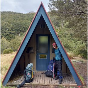
The six bunk Hauhungaroa Hut is sited at 950m, offering good views over the King Country to the north-west. The hut would have greater practical value if the large deck was roofed, but it’s a welcome haven after a relatively demanding work-out.
From Hauhungaroa Hut, the track continues along the ridgeline before descending a long but obvious spur to meet the Waihaha River just south of Te Awaiti Stream. On a sunny day this is a great spot to enjoy a refreshing paddle or dip.
Keeping on the true left of the river, we enter the valley of the giants – the enormous trees of the Waihaha Ecological Area. We are now in the heart of the original mixed podocarp forest which has thrived in the thickest pumice deposits on the eastern side of the range. A tight canopy of rimu, matai, miro, totara, and occasional kahikatea, reaching 40-50m in height tower above.
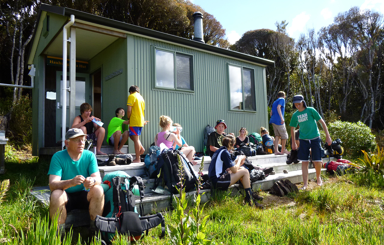
Within a couple of hours we burst out of the forest onto a pocket-sized clearing graced by the 10-bunk Waihaha Hut, complete with wood-stove and covered verandah. This is a wonderful place to while away the hours while appreciating the primeval surroundings.
It is just 9.5km on a benched, all-weather track to the Western Bay Road. Waihaha means ‘noisy water’ and it certainly is in places, but it’s the diversity of plant communities that are the outstanding feature of this final section. Large wheki-ponga dot the understorey. Soon thereafter, the river plunges through a gorge, notable for large holes carved in the rock. We pause in the fire-induced shrublands of the Pokiara Clearing to listen to secretive fernbirds. Here, frosts have prevented the invasion of forest species. Rust-coloured monoao dominates the multitude of species, including ferns, lichens and mosses, most spectacular in summer flower.
Twin viewpoints offer glimpses of Lake Taupo and the central volcanoes to the east before we descend a gradual terrace to the footbridge over the Mangatu Stream. The Taupo eruption (233AD) destroyed much of the silver beech in Pureora, but isolated remnants survive along this tributary. After a brief and picturesque chasm, the river meanders over mossy ledges before becoming sluggish and slow-moving, with photogenic outcrops of ignimbrite volcanic rock on the far bank.
Pureora’s giants are not as exquisitely dense as those in Whirinaki Forest Park, but they are impressive nonetheless and a little more accessible to most. It is well worth the walk to meander in their midst.
– Phillip Donnell


34 years of inspiring New Zealanders to explore the outdoors. Don’t miss out — subscribe today.

Questions? Contact us