Travers Peak, Hanmer Conservation Park

Read more from

Google Earth view of the route to Travers Peak

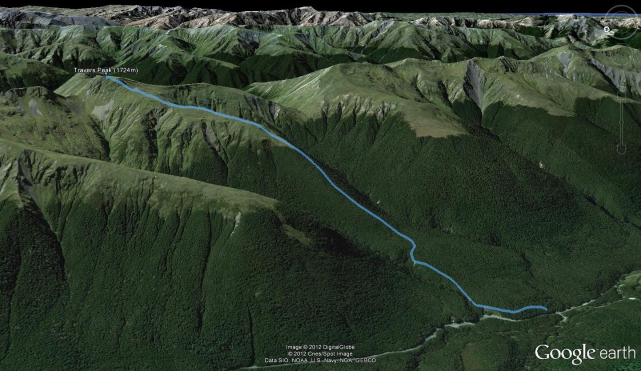
A well-marked trail that climbs onto the terrace above the road and slowly turns to the east to gain the spur between Goings and Foleys creeks which ascends to the bush edge on Travers Peak (1724m).

Distance
3.63km
Grade
Moderate
Area
Hanmer Conservation Park
Time
3-4hr
Access
Signposted opposite the Deer Valley car park on SH7 just south of the Lewis Pass Rd summit
Map
BT23

GPX File

Travers Peak (gpx, 4 KB)

GPX File

Your device does not support GPX files. Please try a different device.
Alistair Hall

About the author

Alistair Hall

More From Trips

More From Trips

Related Topics

Similar Articles

Dirt bike trial on Tongariro Northern Circuit gets approval

2026-27 Great Walk hut and campsite booking dates revealed

Cause of November’s Tongariro National Park fire discovered

Otamatapaio Hut, Oteake Conservation Park

Sudden Valley Bivouac, Arthur’s Pass National Park

Mt Technical tarns, Lewis Pass Scenic Reserve

Trending Now

Dirt bike trial on Tongariro Northern Circuit gets approval

Knockin’ on heaven’s door

The 2026 Wilderness Outdoor Photographer of the Year competition

Getting Technical

Getting fit for a multi-day hike

Subscribe!
Each issue of Wilderness celebrates Aotearoa’s great outdoors — written and photographed with care, not algorithms.Subscribe and help keep our wild stories alive.

Join Wilderness. You'll see more, do more and live more.

Already a subscriber?  to keep reading. Or…

34 years of inspiring New Zealanders to explore the outdoors. Don’t miss out — subscribe today.

Your subscriber-only benefits:

All this for as little as $6.75/month.

1

free articles left this month.

Already a subscriber? Login Now