Home / Trips / Taupo

Tongariro Alpine Crossing, Tongariro National Park

Image of the July 2020 Wilderness Magazine Cover Read more from the
July 2020 Issue

Crossing off an icon

Renamed the Tongariro Alpine Crossing in 2007, the iconic day walk is responsible for more rescues than any other in New Zealand. In good weather, however, it’s hard to beat.

At 1120m, Mangatepopo car park sits 360m higher than Ketetahi car park at the opposite end, making it the obvious starting point.

Ngauruhoe is the star of the show for the first hour and a half of the track, which eases its way along the true left of the Mangatepopo River on an easy path with some boardwalk sections.

The Devil’s Staircase is the first – and probably the toughest – sustained climb of the track, and it offers hard-earned views west all the way to Taranaki, which seems to grow in stature the higher you climb.

Preparedness checkpoints stagger the ascent, warning walkers of weather dangers and urging they turn back if cloud cover matches the pictures. It’s a smart – and hopefully effective – deterrent from DOC.

The climb offers no respite for half an hour, but the pancake-flat South Crater provides an opportunity to catch your breath and recover before the push to the Red Crater ridgeline.

The ascent isn’t as intense as Devil’s Staircase, and it soon levels out on a small plateau, with brilliant views over the vibrant crater and the Kaimanawa Ranges beyond.

After a short climb up and over the humpy Red Crater summit, a new world awaits.

The iconic scree descent to Emerald Lakes is postcard tramping, and the startling saturation of the lakes never ceases to amaze – they really are as vibrant as the photos.

Mangatepopo boardwalk

The feet of thousands of walkers have dulled what may have once been a razor ridge, and most people descend without too much trouble. Steep drop-offs on either side of the scree ridge remind how ugly this section could be in foul weather.

The track continues past the stunning lakes to flat ground at Central Crater, which is crossed easily before the last decent climb of the tramp to the ridge overlooking Blue Lake.

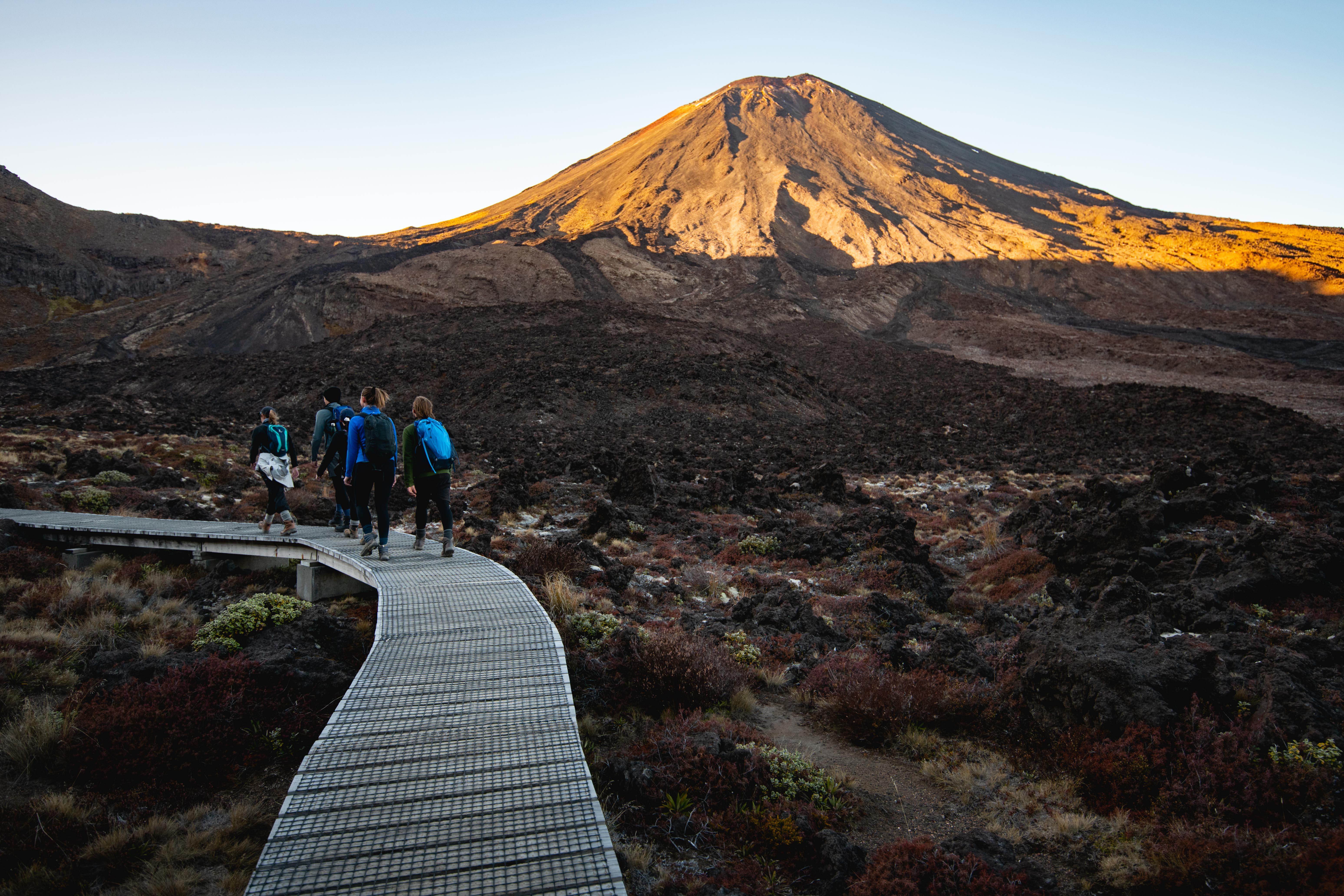
From here, Mts Tongariro, Ngauruhoe and Ruapehu align for one of the best views of the crossing.

The first hour of the descent to Ketetahi is a seldom-mentioned highlight and would be a popular walk in its own right if not overshadowed by the crater crossing. Sweeping switchbacks wind in an easy gradient down the northern slope, overlooking Lake Rotoaira, Taupō and the car park which never seems to get closer.

Tussock and subalpine plants contribute an earthy palette of ochre, gold and green, reminiscent of the South Island, and completely unlike the barren scrubs on the colder southern slopes.

Toilets, and the accompanying queues, can be found at the site of the old Ketetahi Hut, demolished after suffering damage in the 2012 eruption of Te Maari Crater.

From here, the track descends below the bushline, which is stunted at first, but grows in height and variety as the altitude drops.

With tree cover comes the welcoming calls of tui and pīwakawaka, offering a comforting contrast to the deathly quiet of the alpine zone.

The final stretch of intermittent stairs is tough on aching legs, but the gradient eases as the track crosses a lahar zone, and onto the last leg before the car park.

Distance
19.4km
Total Ascent
1024m
Grade
Moderate
Time
7-8hr
Access
Mangatepopo car park
Map
BH34

GPX File

Tongariro Alpine Crossing (gpx, 15 KB)

GPX File

Your device does not support GPX files. Please try a different device.