Walk in Sir Edmund Hillary’s footsteps on a circuit that offers views to rival those on the popular Ōmanawanui and Te Henga Tracks.
By Diana Ward
Several tracks – Marawhara, White, Rose and Laird Thomson – combine to create a memorable circuit at North Piha.
The first two tracks form part of the Hillary Trail, which currently is open only in sections in an effort to reduce the spread of kauri dieback.
Marawhara Track, a 10min, wide gravelled path, starts from North Piha Road and runs through a lush grove of mainly nīkau, pūriri, ponga and kawakawa and ends at Marawhara Stream. In the early 1900s, when timber milling was at its height in the Waitākere Ranges, logs were hauled from the stream and transported via a tramway to the Piha Mill at the junction of the Piha and Glen Esk streams.
Cross the stream to White Track. Your feet will likely remain dry, though signage warns of flash floods following serious rainfall.
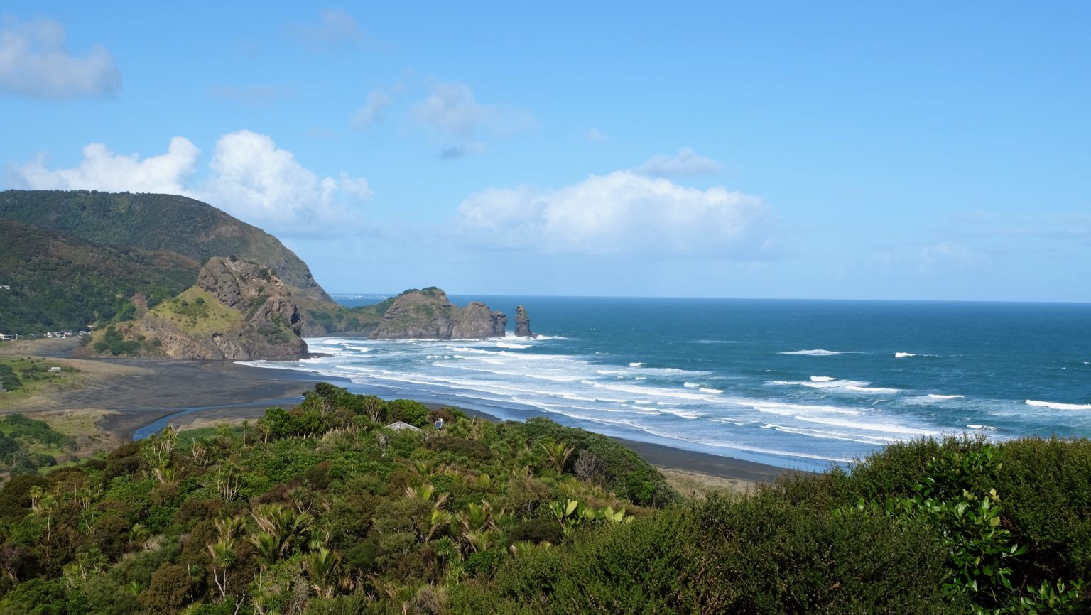
White Track climbs for about 35min through regenerating bush. There are several viewpoints. The first, 820m from the start of the walk, reveals Piha Beach and Lion Rock. The track has been upgraded as part of remedial work to protect kauri. It is stepped and gravelled and there’s a cleaning station at the next track junction, where White Track ends and a short access track to Anawhata Road begins.
Take the left path through the cleaning station then veer right along the private road to the highest point (207m) where there is a seat and views of Te Waha Point and the Tasman Sea.
Continue along this road for several minutes to a low padlocked gate that can be stepped over. Turn left onto Anawhata Road and go through another gate at No. 234 (there’s a pedestrian gap to the left) that leads to the start of Rose Track. Again there are panoramic views, and on the descent a cluster of baches above Whites Beach comes into view.
Rose Track is on the right at the bottom of the driveway. It is named after the Rose family, who bought property here in the 1920s. Jim Rose became Sir Edmund Hillary’s father-in-law. Apparently, Hillary chose this place to escape to after his 1953 climb of Everest, and in the 1970s built his own bach overlooking Whites Beach. Laird Thomson Track on the left is named after William Laird Thomson, who bought land here in the 1930s. All three men were keen trampers, and they and their families actively protected the area. Over the years they gifted land to ensure public access to the tracks and beach.
It is a 10min walk on Rose Track to Whites Beach. Swimming is not advised due to rips and the beach is not patrolled by lifeguards. At the southern end a steep route leads up the cliff to Te Waha Point. This is inaccessible at higher tides and carries warnings of falling rocks and slippery surfaces.
The better option is to return up Rose Track and take the Laird Thomson Track (35min) to North Piha Beach as there are stunning views you’ll not want to miss. Dogs aren’t allowed as the area is a refuge for grey-faced petrels that nest in burrows.
The 5min sidetrack to Te Waha Point is a must. With sheer cliffs on three sides, it is easy to see why the Te Kawerau ā Maki people chose this for a pā site.
Continue down Laird Thomson Track to North Piha Beach. The track is shaded nearly all day and can be slippery after rain. It’s then a short walk across black sand to a path leading through the dunes and eventually to North Piha Road, from where it’s 10min to your car.


34 years of inspiring New Zealanders to explore the outdoors. Don’t miss out — subscribe today.

Questions? Contact us


