Home / Trips / Hawkes Bay

Maungamahue, Ruahine Forest Park

Image of the June 2022 Wilderness Magazine Cover Read more from the
June 2022 Issue

When the weather’s no good on the main Ruahine Range, this trip on the western side is a good alternative and offers beautiful tops, tarn-side camping and highpoint views.

The trail begins on the gradually inclined Deadman’s Track, up a spur leading to the rounded tops of the Whanahuia Range.

Shortly after starting, a junction is reached, left leads to Rangiwahia Hut. The right-branching trail continues to climb steeply at first through the forest and then eases off from about 1050m. At 1200m the trail deviates, heading directly east up towards Mangahuia, about 4km distant. Once the tree line is cleared views back down the ridge open up and tussock indicates arrival on the tops. DOC’s orange triangles are replaced by poles from here. 

After about two hours, the 1500m contour is reached and a short 50m descent is required before the final ascent to the Whanahuia Range and the summit of Mangahuia (1583m). In winter, these tops can be covered in rime ice so dense it’s like light snow cover. It’s beautiful, although in good weather the afternoon sun may melt much of it and turn the trail into a trickling stream.

North of Mangahuia, the poled route undulates over open tussock, soon reaching a westward turn that leads back to Rangiwahia Hut. Continuing past the junction, the trail drops gradually north-east to a small picturesque tarn-scape suitable for camping. Soon after, the trail turns east and descends steeply to Triangle Hut.

Campsite north of Mangahuia. Photo: Peter Laurenson

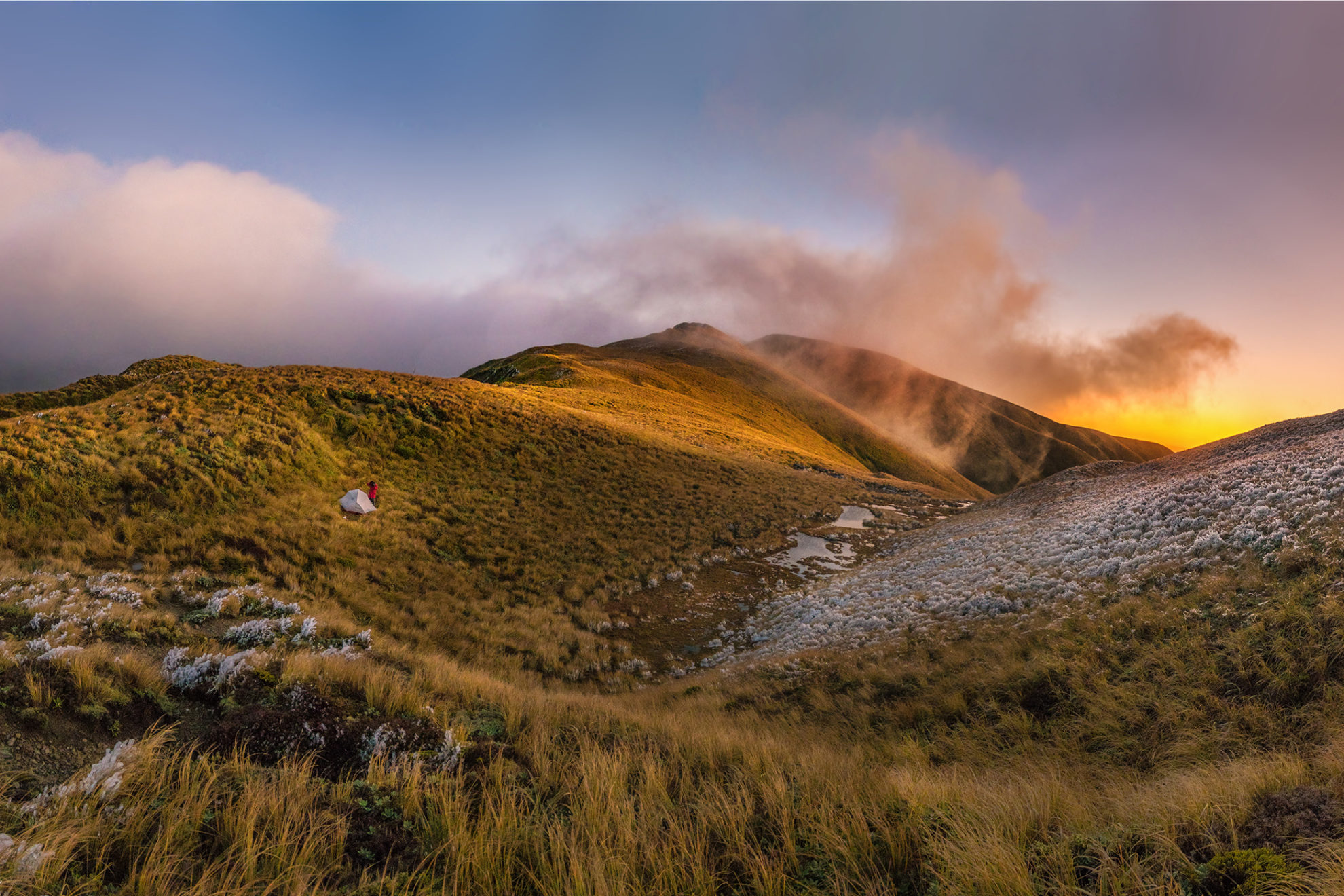
About 120m above the camping area beside the tarns, to the north-west, is Pt1635. This is easily climbed and offers excellent panoramic views in every direction.

To reach Maungamahue, leave the poled route and climb towards Pt1635 until reaching the 1600m contour. From here, drop to the next saddle where there’s another larger tarn and a trail leading to the 1661m summit. It may seem more direct to sidle along the 1500m contour beneath the eastern slopes of Pt1635, but this is a more challenging approach.

Reaching the top takes an hour from camp and the view is worth the effort: east to Te Hekenga and Sawtooth Ridge, north to Mangaweka, while Ruapehu and Ngauruhoe lie to the north-west. In fine conditions, Taranaki Maunga is visible in the distant west.

Retrace steps along the tops to the Rangiwahia Track junction. This wide easy trail gradually descends west along a long broad ridge with a couple of minor undulations, taking about an hour to reach the hut. To the north, on the far side of the Mangawharariki River, rounded hillsides form the southern flanks of Pt1635.

A night at Rangiwahia Hut offers the chance to enjoy sunset silhouetting, and sunrise lighting up, Ruapehu and Ngauruhoe.

From the hut, an easy descent on a good track through native forest leads to the road end. The highlight of this section is a grace-fully-arched bridge above a deeply cut river that loops its way to join the Mangawharariki further down.

Distance
18.5km
Total Ascent
1553m
Time
2-3 days. Car park to Whanahuia Range tarns, 3-4hr; To Maungamahue, 60min; To Rangiwahia Hut, 4hr; To car park, 2hr
Accom.
Rangiwahia Hut ($15, 13 bunks)
Access
From the Renfrew Road end car park
Map
BL36

GPX File

Maungamahue (gpx, 15 KB)

GPX File

Your device does not support GPX files. Please try a different device.