Watch the sunset on this overnight loop with stunning views, an optional summit and swimming holes.
The track starts on the true left of Geologist Creek. Follow it upstream then south and into the bush. Around 1km you will cross an unmarked stream. The track then climbs steeply up the south-west spur of Mt Brown. The forest is mossy and the tree roots are useful to pull yourself up on. At times the track branches off around trees or boggy sections before returning.
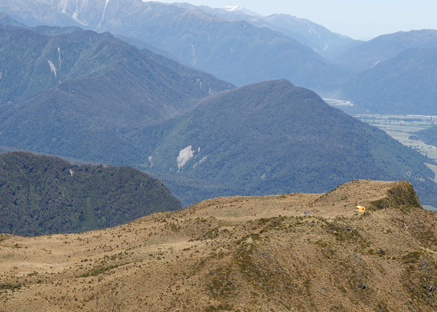
After about 2.5km you will reach the alpine zone, where the vegetation changes from native bush to tussock. Keep an ear out for mātātā fernbirds. There are waratahs from here to the hut, 400m away on a plateau. If the hut is fully booked, there are camping options here.
Leave your gear at the hut (1125m) and head up to the summit of Mt Brown (1270m) via a worn track along the ridgeline behind the hut (about 1hr each way).
The route is less obvious on the descent from the plateau to Styx River. Intermittent track markers along the top section become consistent further down. Take care through a windswept section (around 1080m) that diverts you up a steeper bank, involving a bit of a scramble.
From here, descend approximately 900m along the southern spur of Mt Brown through the bush and down to Styx River. In some boggy sections the track is not easily identifiable, so route-finding care is required.
The route meets Mount Brown Creek around the 500m contour. Follow the creek until you reach the Styx River.
Cross the creek and stay on the true right of the Styx along a section of wide, flat track – a welcome respite after the descent. After about 150m you’ll come to some bluffs. In low flows you can sidle or wade around this section, but in high flows it may be impassable. In good conditions there are a couple of great swimming holes here.
Follow an old farm track for about 1.5km to the Styx River car park on Dorothy Falls Road, then follow the road towards Lake Kaniere for 3km, back to your vehicle.
Distance
13.3km
Total Ascent
1096m
Grade
Moderate / Difficult
Time
Car park to hut 3–4hr; to car park via Styx River, 4–5hr
Accom.
Mt Brown Hut (standard, 4 bunks)
Access
From the Geologist Creek car park on Dorothy Falls Road
The 2026 Wilderness Outdoor Photographer of the Year competition
Dirt bike trial on Tongariro Northern Circuit gets approval
A majestic coastal walk
Knockin’ on heaven’s door
Subscribe!
Each issue of Wilderness celebrates Aotearoa’s great outdoors — written and photographed with care, not algorithms.Subscribe and help keep our wild stories alive.