There are several easily accessible walks along the Whangarei Heads and Ocean Beach roads, which run along the north side of the Whangarei Harbour. Mt Manaia and Mt Lion are two of the best known, whereas Mt Aubrey is often overlooked. It ticked all the boxes for us though: bush, beach, amazing views and two walkways that can be joined to create a loop.
The steep-sided volcanic remnant takes its name from the area’s first resident magistrate and collector of customs, Harcourt Aubrey, who settled in the area in 1848. We saw a scattering of homes dating back to that era and a pretty, historic church on the corner where we turned into Reotahi Road. There is a small car park (Tiller Park) on the left and the track led straight into the bush from there.
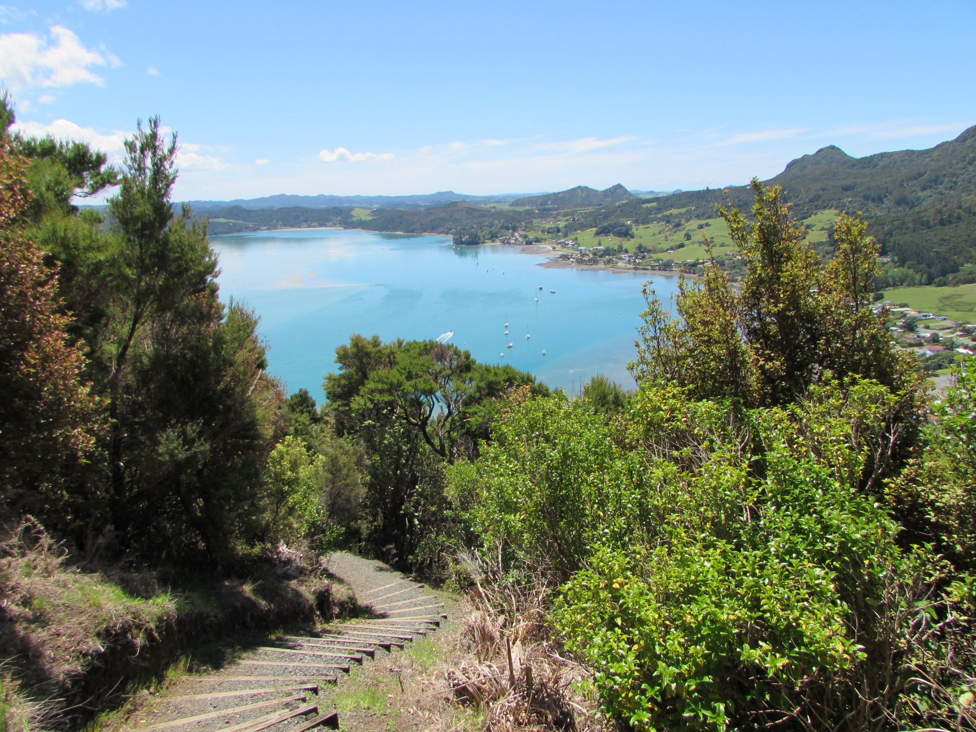
We passed an area littered with large rocks before arriving at a series of steep wooden steps. The views to McLeod Bay had already provided us with a reason to pause, but the most dramatic part of the walk could have been easily missed. As the track wound close beside the cliff, we spotted a faint path leading upward. This track was a scramble, involving a bit of climbing, and we had to use various plants for handholds in places, but once on the rocky summit we were rewarded by panoramic views of Whangarei Harbour and coastline. The neighbouring volcanic peaks of Mt Manaia and Whangarei Heads reared above the green farmland and coastal settlements.
Back on the main track, it was an easy walk around the side of the mountain before heading steeply downhill, through native bush thick with totara and puriri, towards Little Munroe Bay and the end of the Mount Aubrey Walkway. However, our loop walk continued from the bay and along Reotahi Coastal Walkway, which led us along the side of the harbour to McLeod Bay.

Along the way, we came upon some interesting ruins – the remains of the Whangarei Freezing Works. Established in 1912, the works provided meat for England until a fire in 1921 destroyed the buildings. The scene was quiet as we wandered past and it was hard to imagine what a bustling place it was in its heyday.
The coastal views we enjoyed here encompassed Motukaroro Marine Reserve to Beach Road. The Marine Reserve was applied for and established by students from Kamo High School over a period of years between 1990 and 2006. The reserve is home to 50 species of fish and snorkelers admire its kelp forests and sponge gardens.
A little further along, we passed the bottom of Reotahi Road, where it would have been possible to return to the car park, but we opted to continue along the track through a section of bush that led to Norfolk Avenue, Matuku Street and into a DOC reserve at McLeod Bay.
The final part of the walk followed the road uphill, past a popular cafe, and back to Tiller Park.
– Heather Whelan


34 years of inspiring New Zealanders to explore the outdoors. Don’t miss out — subscribe today.

Questions? Contact us


