A physically challenging overnighter with humble hospitality above the snowline.
Mt Fishtail (1641m) stands between Mt Royal to the east and Mt Richmond to the west. Fishtail Hut, a humble four-bunker, is perched above the bushline under the nose of the summit in a true alpine environment. It’s just 8km to the hut but it takes about five hours – an indication of the steepness and difficulty of the trail.
A parking area with a toilet indicates where trampers can begin the walk, though those with a 4WD can ford Pine Valley Stream and continue to Mill Flat Campsite.
It is an easy, scenic ramble to Mill Flat from the first car park, with swimming holes below and a possible short detour to a waterfall. Mt Fishtail can be seen early on, looking imposing. Cross the swingbridge to Mill Flat. The next 3km is rough underfoot but straightforward, winding north alongside the stream through mixed beech and podocarp forest.
An unbridged stream crossing at the base of the spur leading to Fishtail Hut is easily navigated in summer. Then the more than 1000m climb to Fishtail Hut begins. Note there is no access to water from here.
It’s continuously steep to Pt831, after which the gradient eases as the track follows a prominent ridgeline through beech forest with occasional views back towards the valley.
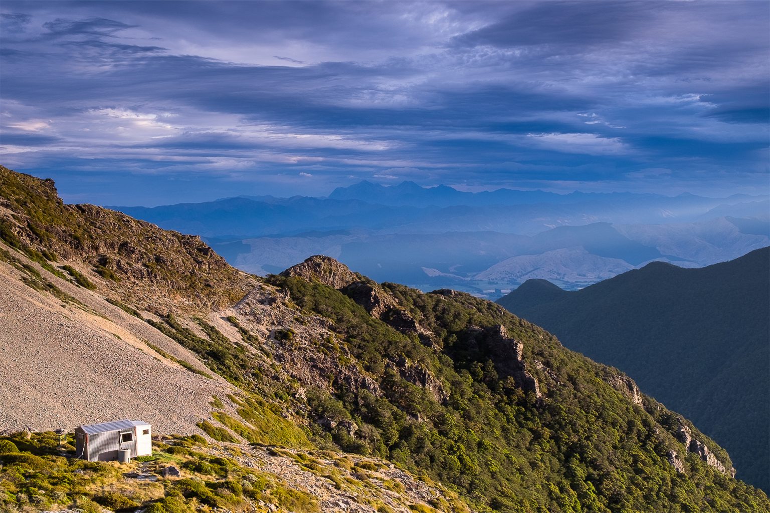
Toutouwai and korimako fly curiously close and the track is well marked. As the bushline nears, the stunted beech gives way to an exposed rocky stretch to the hut. Take care to stay on the route, which is marked with poles and cairns. Ice and snow can make this section slippery in winter and snow tools may be required.
In good weather there are stunning views over the Wairau River Valley and Kaikōura Ranges. In fair conditions the summit can be gained with an off-track push to the saddle north of the hut, then south-east along the high ground.
After a night at Fishtail Hut, return the same way.
Distance
7.85km
Total Ascent
At least 1161m
Grade
Moderate / Difficult
Time
4–6hr to hut
Accom.
Fishtail Hut (standard, four bunks)
Access
From Pine Valley Road end. Turn off SH6 just north of the Wairau River Bridge and follow Northbank Road for 25km to Pine Valley Road
Each issue of Wilderness celebrates Aotearoa’s great outdoors — written and photographed with care, not algorithms.Subscribe and help keep our wild stories alive.