Coopers Knob, Banks Peninsula

Read more from

Photo: Pat Barrett

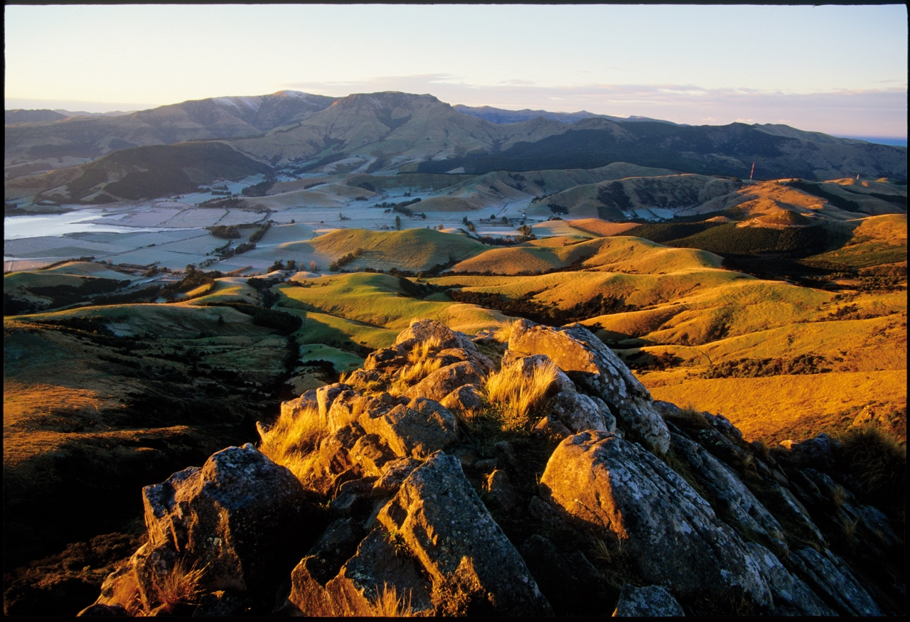
Coopers Knob is the highest of the tors on the crest of what was once a large volcano. It stands above Head of the Bay, overlooking Lyttelton Harbour.

The harbour side is sheer whereas the Canterbury Plains side is much gentler and this is where the trail to the summit makes its way.

The trail is part of a network of marked walkways along the Port Hills from near Gebbies Pass to Godley Head.

Distance
1.1km
Grade
Easy
Area
Banks Peninsula
Time
1hr
Access
From Sign of the Kiwi on Dyers Pass head south on Summit Road, past the Sign of the Bellbird about 8km to Gibraltar Rock, where a series of tracks head onto Coopers Knob on the eastern side of the road

GPX File

Coopers Knob (gpx, 1 KB)

GPX File

Your device does not support GPX files. Please try a different device.
Alistair Hall

About the author

Alistair Hall

More From Trips

More From Trips

Similar Articles

Trampers say decision to remove beloved hut failed to follow process

Kiwi hiker’s brush with grizzly bear caught on video

New less toxic stoat sausage bait results impress DOC

Mt Wakefield, Aoraki Mt Cook National Park

Edwards Hut, Arthur’s Pass National Park

Lagoon Saddle huts, Craigieburn Forest Park

Trending Now

Lowry from Days Bay, East Harbour Regional Park

Trampers say decision to remove beloved hut failed to follow process

Foggy Peak, Korowai-Torlesse Tussockland Park

Roaming the red rocks

2026’s guide to outdoor socks

Subscribe!
Each issue of Wilderness celebrates Aotearoa’s great outdoors — written and photographed with care, not algorithms.Subscribe and help keep our wild stories alive.

Join Wilderness. You'll see more, do more and live more.

Already a subscriber?  to keep reading. Or…

34 years of inspiring New Zealanders to explore the outdoors. Don’t miss out — subscribe today.

Your subscriber-only benefits:

All this for as little as $6.75/month.

1

free articles left this month.

Already a subscriber? Login Now