The track provides incredible views. Photo: George Driver

Cairnmuir Hill Track, Central Otago

April 2020

Read more from

April 2020

Take the high road

Traversing a mountain range between the historic Central Otago gold mining towns of Clyde and Cromwell, the Cairnmuir Hill Track provides an excellent vantage point to soak in ‘big sky country’.

The track follows the spine of the Cairnmuir Mountains (1130m) and is surrounded by impressives ranges in all directions. The Dunstan (1667m) and Old Woman (1749m) ranges stand either side while the peaks of The Remarkables, Pisa Range and Southern Alps are also clearly in view.

I walked from Clyde, but you can also start from Cornish Point Road near Bannockburn. The route is also suitable for mountain bikes.

At first, it’s a 4WD track through private farmland dotted with schist outcrops, but soon the climbing begins. It’s a gruelling 400m ascent to reach the ridgetop, where the gradient finally flattens. The effort is rewarded with views of the rolling hills of the Old Man Range extending down to Clyde and Alexandra and the terraces of orchards, vineyards and farmland to the south. To the west stands Double Cone on The Remarkables. Across the valley and to the east, the Dunstan Mountains rise 1450m from Lake Dunstan to the pinnacle of Leaning Rock.

April 2020

Read more from

April 2020

The stone musterer’s hut sits nestled in a valley high up the Cairnmuir Range. Photo: George Driver

The track continues through a rolling landscape of tussock, speargrass and wild thyme, winding past schist tors and the occasional herd of merino sheep. The route is marked with snow poles, but there are multiple farm tracks so a map is helpful.

After about three hours, the track descends steeply again before rising and traversing beneath the peaks of Cairnmuir Hill (1114mm) and Mt Jackson (1130m). Here, views of Lake Dunstan, Cromwell and the Pisa Range come into view to the north, and there are also views down the Kawarau Gorge to the west, heading through to Queenstown.

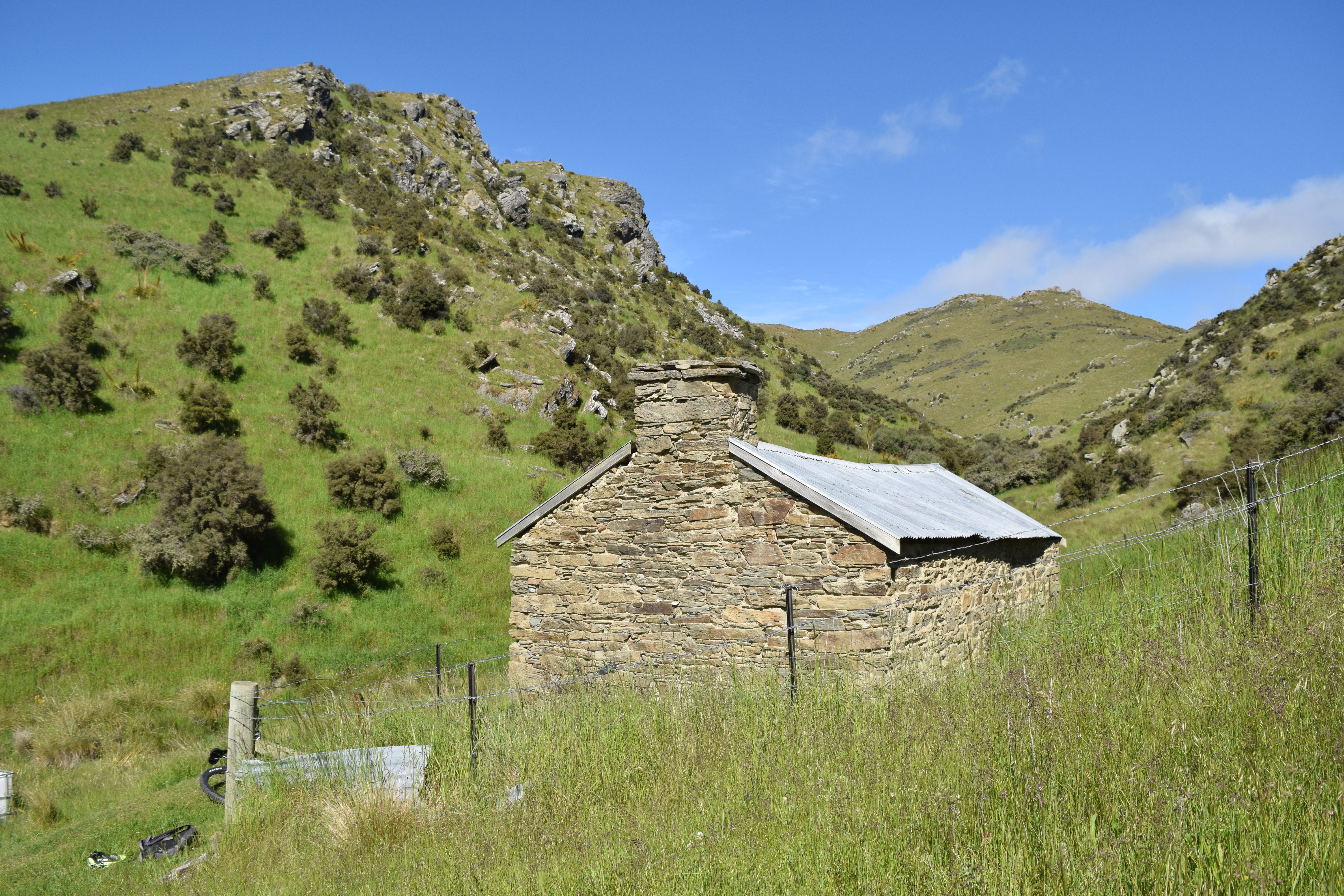
After passing Mt Jackson, the track descends a ridge into the Cairnmuir Gully and comes to a small schist musterers hut, beside a stream. The private hut has a spartan interior, with a dirt floor and a wooden table and bench seats. When we visited, sacking was hanging from the ceiling and it looked like it hadn’t been used for years.

From the hut, there is a short climb to regain the ridge of the Cairnmuirs, before the track descends to Bannockburn and down to Lake Dunstan with incredible views of the lake, where the waters of the Kawarau and Clutha rivers meet.

Distance
20.7km
Total Ascent
1017m
Grade
Moderate
Time
6-8hr (3-5hr to mountain bike)
Access
From Clyde, the track starts about 2km beyond the Clyde Lookout on Hawksburn Road

GPX File

Cairnmuir Hill Track (gpx, )

GPX File

Your device does not support GPX files. Please try a different device.

More From April 2020

Related Topics

Similar Articles

$35m scam: Everest guides accused of poisoning climbers to force fake rescues

2026-27 Great Walk hut and campsite booking dates revealed

Dirt bike trial on Tongariro Northern Circuit gets approval

Leaning Lodge, Rock and Pillar Conservation Area

Harris Saddle and Routeburn Falls Hut, Mount Aspiring National Park

Kãnuka Loop Track, Bendigo Historic Reserve

Join Wilderness. You'll see more, do more and live more.

Already a subscriber?  to keep reading. Or…

34 years of inspiring New Zealanders to explore the outdoors. Don’t miss out — subscribe today.

Your subscriber-only benefits:

All this for as little as $6.75/month.

1

free articles left this month.

Already a subscriber? Login Now