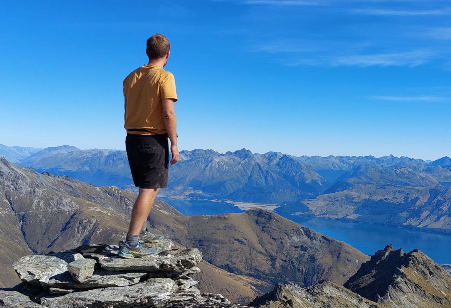
Black Peak is a stunning spot. Nestled in the Richardson Mountains in scheelite mining country, the summit boasts 360-degree views.
This walk is easily accessible for a long day or overnight trip, and there are a number of huts nearby.
The Mt Judah Road track starts at the Whakaari Conservation Area car park and passes through farmland following the old Mt Judah Road. The 4WD track is straightforward, but make sure the markers are followed to avoid straying onto private land.
The trail passes the Glenorchy Scheelite Battery and the State Mine. Views to the west begin to open up, with the Humboldt Range towering over Lake Whakatipu.
After around 45 minutes, at a junction, the Mt Judah Track to the right leads to several historic mining huts and Heather Jock Hut. The way to Black Peak is to the left via the McIntosh Loop Track. It’s a sharp descent to Buckler Burn, where there’s an unbridged river crossing. On the other side, a steep zig-zag commences on an old mining trail. This becomes more gradual and, after several switchbacks, the junction to McIntyre Hut is reached. The hut is a couple of minutes away and is of a high standard.
The track now follows a 4WD trail over Long Gully Stream to reach Long Gully Saddle after a 90min winding traverse. Follow the right-hand track towards McIntosh Hut.
If your plan is to stay overnight, it’s a good idea to leave any heavy equipment here to lighten the load for the ascent to Black Peak.
The hike is now unmarked and requires good navigation skills. Return on the track towards Long Gully Saddle, then, where the track bends slightly to the left, take the worn path to the right. Follow this as it sidles to the north of Mt McIntosh towards Black Peak; it’s straightforward.
Above Temple Creek are the remains of an old storm-damaged musterers’ hut, and about here the ascent to Black Peak’s false summit begins. There are several rough routes and the terrain leaves the schist temporarily for a strange marshy slog to the summit. Eventually, the south peak is reached. A daunting-looking ridge must be crossed to gain the true summit. It is essential to take the correct route to avoid exposure, loose rock and steep drops. Going to the right of the ridge is easiest, despite a visually less-inviting sheer drop. The path is straightforward and manoeuvres around several large rocks on the ridge.
The final jaunt to the summit – of about three minutes – is still exposed and isn’t for the faint-hearted, but careful footing with plenty of strong rocks to balance against makes for a good route.
From the summit there are excellent views of the Richardson Mountains, the jagged peaks behind the Black Hill ridgeline and more.
Retrace your steps for a night in McIntosh Hut before continuing on to the car park. It is also possible to make the trip a loop by descending the Mt McIntosh Loop Track.