You’ll get your feet wet before a rocky climb and the reward of picture-postcard views in all directions.
The Dry Acheron Track is the first walkway established by the New Zealand Walking Access Commission under the Walking Access Act 2008. The route crosses both Big Ben and Dry Acheron stations which, combined, cover around 4600ha.
From the small car park on Coleridge Road, follow the DOC markers and cross a stile into farmland. This section is just under 1.4km long and includes two gates. Stick to the marked route at all times to stay within the boundary of covenant areas.
Cross a second stile, follow the markers along a hedge and veer left with the fenceline to cross a third stile at around 2km. Here you drop down and enter the Dry Acheron Stream. Depending on the water level, you’re likely to get wet feet. DOC markers are intermittent along the stream, but just follow it upstream, crossing back and forth where necessary.
After about 1.5km a sign indicates a side trip to the Clay Covenant (10min) on the terrace just above the stream. Continue in the stream bed through a small gorge.
Around the 5km mark, outlets from two lakes form Dry Acheron Stream. Where a fence crosses the stream, hop onto the true left bank of the northernmost branch and you will see another fence. Cross it at the stile then follow the line of willow trees on the left along a faint 4WD track.
When the track ends it is again wet feet territory, and you will stay in the stream bed until the start of the climb. There are DOC markers, although they’re not always easy to spot. The terrain is dotted with tussock and matagouri.
Cross yet another stile and head right around the base of the hill. Soon a small, marked track heads up to the left. This is where the real fun begins. Follow the markers up the rocky outcrop. The first climb is reasonably steep, but the views on a clear day are worth it and it does level out for a bit.
Head for Pt962. From here there is another good heart-pumping climb – not as steep as the first, but you’ll still earn your peanut butter sandwich.
Around 1200m the marker poles become more difficult to find. Follow an old fence line to the next marker.
The route turns slightly right below the 1300m contour and keeps climbing. The final push is over a scree field with a couple of guiding markers.
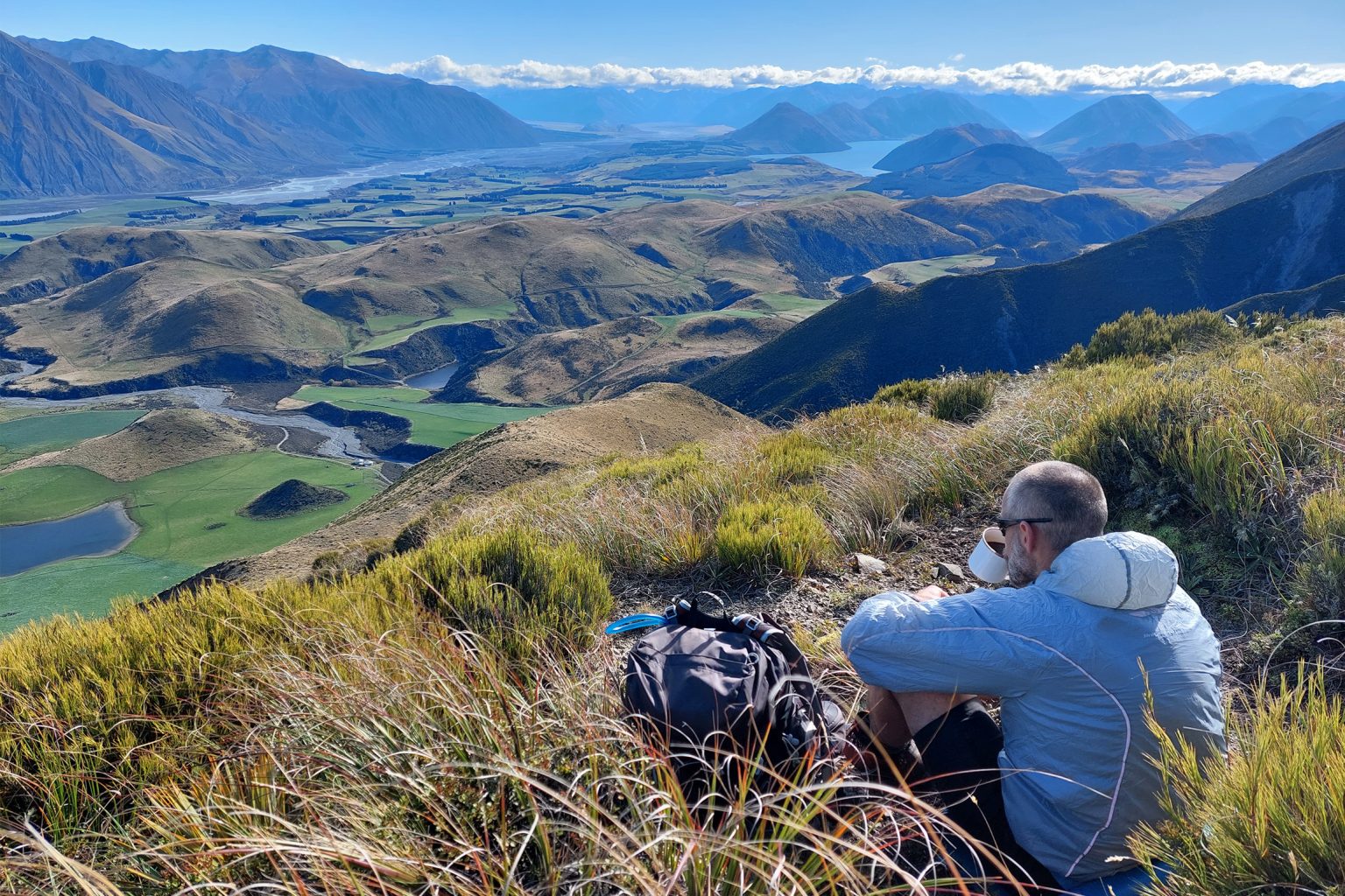
The views – a patchwork that includes the Rakaia River, Lake Coleridge and the Big Ben and Mt Hutt ranges – are worth all the effort. Barring a howling nor’wester, this is a great spot to have a well-earned lunch break before heading back the way you came.